Bridgend, Islay
Bridgend
| |
|---|---|
 The River Sorn at Bridgend | |
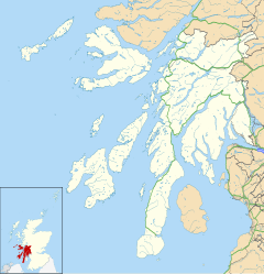 Bridgend Location within Argyll and Bute | |
| OS grid reference | NR336624 |
| Civil parish |
|
| Council area | |
| Lieutenancy area | |
| Country | Scotland |
| Sovereign state | United Kingdom |
| Post town | ISLE OF ISLAY |
| Postcode district | PA44 |
| Dialling code | 01496 |
| Police | Scotland |
| Fire | Scottish |
| Ambulance | Scottish |
| UK Parliament | |
| Scottish Parliament | |

Bridgend (Scottish Gaelic: Beul an Àtha) is a village on the Inner Hebrides island of Islay off the western coast of Scotland at the tip of Loch Indaal. The village is within the parish of Killarow and Kilmeny.[1]
The island's two main roads, the A846 and A847, meet in the village just north of the bridge over the River Sorn that gives the village its name. The A846 passes through the village on its route between Port Askaig and Ardbeg.[2] The A847 begins in Bridgend and continues to Portnahaven.[3]
References[]
- ^ "Details of Bridgend". Gazetteer for Scotland. Retrieved 2 January 2015.
- ^ "A846". Sabre. Retrieved 2 January 2015.
- ^ "A847". Sabre. Retrieved 2 January 2015.
External links[]
| Wikimedia Commons has media related to Bridgend, Islay. |
| hide | ||
|---|---|---|
| Villages |  | |
| Geographical features | ||
| History and architecture |
| |
| Islay whisky | ||
| Other Islay related articles | ||
This Argyll and Bute location article is a stub. You can help Wikipedia by . |
Categories:
- Villages in Islay
- Argyll and Bute geography stubs