Brievengat
Brievengat | |
|---|---|
Neighbourhood | |
 Ronde Klip estate in Brievengat | |
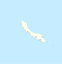
 Brievengat Location in Curaçao | |
| Coordinates: 12°09′N 68°54′W / 12.15°N 68.90°WCoordinates: 12°09′N 68°54′W / 12.15°N 68.90°W | |
| State | Kingdom of the Netherlands |
| Country | Curaçao |
| City | Willemstad |
| Population (2011)[1] | |
| • Total | 4,695 |
Brievengat (Dutch pronunciation: [ˈbrivə(ŋ)ˌɣɑt]) is a neighbourhood of Willemstad in northeast Curaçao.[2] It is located to the north of the capital, Willemstad, and to the east of the Hato International Airport.
The origin of the name Brievengat (English: Letter hole) is unclear. It was first mentioned in 1708 in a will as the name of a plantation.[3] The ground was very fertile, and the plantation flourished until 1877 when a hurricane destroyed the buildings, and killed about 75% of the animals. In 1924, the terrain was sold to Royal Dutch Shell who in turn sold it in 1954 to the monument trust who restored the buildings. In the 1950s and 1960s, a residential neighbourhood was constructed on the plantation grounds.[4] The plantation estate is nowadays in use as an entertainment centre.[5]
References[]
- ^ "Census 2011". Central Bureau of Statistics. Retrieved 17 April 2021.
- ^ Buurtprofiel Brievengat 2011, p. 3.
- ^ Buurtprofiel Brievengat 2011, p. 8.
- ^ Buurtprofiel Brievengat 2011, p. 10.
- ^ "Landhuis Brievengat Entertainment Center". Brievengat. Retrieved 20 April 2021.
Bibliography[]
- Buurtprofiel Brievengat (2011). "Buurtprofiel Brievengat" (PDF). Government of Curaçao (in Dutch).
- Populated places in Curaçao
- Willemstad
- Caribbean geography stubs
- Curaçao stubs
