Buba
Buba | |
|---|---|
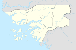 Buba Location in Guinea-Bissau | |
| Coordinates: 11°35′24″N 14°59′24″W / 11.59000°N 14.99000°W | |
| Country | |
| Region | Quinara Region |
| Elevation | 3 m (10 ft) |
| Population (2012) | |
| • Total | 8,556 |

Buba is the largest city in southern Guinea-Bissau, lying on the Rio Grande de Buba, near the . It has a population 6,815 (2008 est).[1]
During his presidency, former President of Guinea-Bissau Kumba Yala planned to move the capital city to Buba.[2] Those plans have been dropped since he was deposed in a coup d'état. Construction is under way for a deepwater port that could host three 70-tonne vessels at any given time. It is being built by in order to export bauxite.[3]
The Portuguese constructed an army camp in Buba, which, shortly after independence, was used as the headquarters for a Dutch Foreign Aid Project aimed at providing the villages of Quinara and Tombali with safe drinking water. The construction of a plywood factory through Swedish Foreign Aid in 1982 boosted the economy and growth of Buba, as it installed a steam engine which produced enough electricity to supply the whole town.[citation needed]
References[]
- ^ http://world-gazetteer.com/wg.php?x%3D%26men%3Dgcis%26lng%3Den%26des%3Dwg%26srt%3Dnpan%26col%3Dabcdefghinoq%26msz%3D1500%26geo%3D-95. Retrieved 2008-06-16. Missing or empty
|title=(help)[dead link] - ^ "BBC NEWS | Africa | Capital change for Guinea-Bissau". news.bbc.co.uk. Retrieved 2017-07-13.
- ^ "Archived copy". Archived from the original on 2015-09-24. Retrieved 2017-06-30.CS1 maint: archived copy as title (link)
Coordinates: 11°35′N 15°00′W / 11.583°N 15.000°W
| Authority control |
|
|---|
- Quinara Region
- Populated places in Guinea-Bissau
- Sectors of Guinea-Bissau