Bullaun, County Galway
This article needs additional citations for verification. (May 2009) |
Bullaun
Bollán | |
|---|---|
Village | |
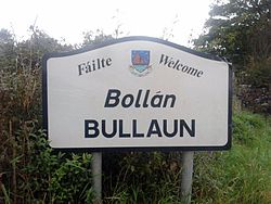 Bullaun road signage, on the R350 road | |
 Bullaun Location in Ireland | |
| Coordinates (Village square): 53°14′53″N 8°33′18″W / 53.248°N 8.555°WCoordinates: 53°14′53″N 8°33′18″W / 53.248°N 8.555°W | |
| Country | Ireland |
| Province | Connacht |
| County | Galway |
| Constituency | Galway East |
| Area | |
| • Total | 0.58 km2 (0.22 sq mi) |
| Elevation [2][better source needed] | 69 m (226 ft) |
| Time zone | UTC0 (GMT) |
| • Summer (DST) | UTC+1 (BST) |

Bullaun (Irish: An Bollán) is a village in east County Galway, Ireland. It lies 6 km northeast of Loughrea on the R350 regional road. It shares its parish with a village called New Inn.
The townland of Lakafinna, to the south of Bullaun, contains an old castle and the local water scheme. It is local folklore that an unused tunnel exists between this castle and close to a house in Ballyara formerly belonging to Paddy Finnerty.[citation needed] There is also a river which flows through Bullaun which used to have quantities of fresh water salmon of high quality.[citation needed] There are no salmon there nowadays as over-fishing and pollution has caused them to be virtually extinct in east Galway.[citation needed]
The village also contains St Patrick's church, a pub called the Harbour Bar and is home to the Corcoran's Turoe stone. The home ground for the Sarsfields GAA team is in Bullaun.[citation needed]
See also[]
- List of towns and villages in Ireland
References[]
- ^ "Map of Bullaun, Galway".
- ^ "EarthTools - Find places, latitude/longitude, sunrise/sunset, elevation, local time and time zones". web.archive.org. 29 January 2013.

- Towns and villages in County Galway