Burnaby
Burnaby | |
|---|---|
| City of Burnaby | |
From top to bottom, left to right: Metrotown skyline, Brentwood Town Centre station on the Millennium Line, Metropolis at Metrotown mall, Deer Lake Park, Burnaby Mountain and the Burrard Inlet, Cherry blossom bloom on a residential street, Brentwood, Metrotown, and Edmonds skylines | |
 Flag | |
| Motto(s): By River and Sea Rise Burnaby | |
 | |
 Burnaby | |
| Coordinates: 49°16′N 122°58′W / 49.267°N 122.967°WCoordinates: 49°16′N 122°58′W / 49.267°N 122.967°W | |
| Country | |
| Province | |
| Regional district | Metro Vancouver |
| Established | 1892 (municipality status) |
| Incorporated | 1992 (city status) |
| Government | |
| • Mayor | Mike Hurley |
| • MP | show
List of MPs |
| • MLA | show
List of MLAs |
| • Governing body | Burnaby City Council |
| Area | |
| • Total | 98.6 km2 (38.1 sq mi) |
| Elevation | Sea level to 370 m (0–1,214 ft) |
| Population (2016)[1] | |
| • Total | 232,755 (ranked 22nd) |
| • Density | 2,568.7/km2 (6,653/sq mi) |
| Time zone | UTC-8 (Pacific Standard (PST)) |
| • Summer (DST) | UTC-7 (Pacific Daylight (PDT)) |
| Forward sortation area | V3N, V5A - V5J |
| Area code(s) | 604, 778, 236 |
| Website | burnaby |


Burnaby is a city in the Lower Mainland region of British Columbia, Canada. Located in the center of the Burrard Peninsula, it neighbours the City of Vancouver to the west, the District of North Vancouver across the confluence of the Burrard Inlet with its Indian Arm to the north, Port Moody and Coquitlam to the east, New Westminster and Surrey across the Fraser River to the southeast, and Richmond on the Lulu Island to the southwest.
Burnaby was incorporated in 1892 and achieved its city status in 1992. A member municipality of Metro Vancouver, it is British Columbia's third-largest city by population (after Vancouver and Surrey), and is the seat of Metro Vancouver's regional district government.
The main campuses of Simon Fraser University and the British Columbia Institute of Technology are located in Burnaby. It is home to high-tech companies such as Ballard Power (fuel cell), Clio (legal software), D-Wave (quantum computing), General Fusion (fusion power), EA Vancouver and Capcom Canada. Burnaby's Metropolis at Metrotown is the largest mall in British Columbia, and the fifth largest in Canada.
The city is served by Skytrain's Expo Line and Millennium Line. Metrotown station in downtown Metrotown is the second-busiest station in regional Vancouver's urban transit system as of 2018.[2]
History[]
Pre-colonial (before 1850)[]
Burnaby is the original home to Halkomelem- and Squamish-speaking Central Coast Salish Nations. Local landmarks such as Burnaby Mountain, Deer Lake, and Brunette River feature prominently in Indigenous history passed down through oral traditions.[3] The northern shorelines of Burnaby, along the second narrows of Burrard Inlet was site of an ancient battle between the attacking Lekwiltok and the defending Musquem according to Chief Charlie Qiyəplenəxw.[4]
The Coast Salish people living in BC and Washington state numbered more than 100,000 people, a level of population density only supported by agriculture in other geographies.[5] Techniques to preserve and store surplus food sustained a hierarchical society. Burnaby's marshlands along its rivers and lakes were cranberry harvesting areas for numerous villages, some numbering over 1,000 residents.[6] Indigenous people travelled through Burnaby to reach the mouth of Brunette and Fraser River for the bountiful fishing seasons, eulachon in the spring and sockeye salmon in the late summer. Early European explorers and fur traders introduced diseases that decimated the Indigenous population. This false appearance of Burnaby as a vast open space, along with traditional Indigenous farming techniques which did not permanently alter the landscape, meant Indigenous land in Burnaby was mislabelled as Terra Nullius.[7]
Incorporation (1850–1990)[]
The Fraser Canyon Gold Rush of 1858, the first of many gold rushes in British Columbia, brought over 30,000 fortune seekers, including many American miners. The fear of an impending annexation by the United States led to the creation of the Colony of British Columbia in 1858 and the establishment of New Westminster as its capital.[8]
Settlers in Burnaby acquired land through a process called pre-emption which allowed people to claim a piece of land by clearing forests and building houses. Pre-emption was excluded from Indigenous people. Royal Engineers dispossessed land from Indigenous people with the assistance of military force including the original routes of North Road, Kingsway, Canada Way, and Marine Drive. Logging permits given to settlers destroyed the forests of southern Burnaby which had provided vital sustenance for Indigenous people.[9]
The City of Burnaby is named after Robert Burnaby, who was a Freemason, explorer, and legislator. He was previously private secretary to Colonel Richard Moody, the first land commissioner for the Colony of British of Columbia.[10][11] In 1859, Burnaby surveyed a freshwater lake in the city's geographic centre. Moody named it Burnaby Lake.
Burnaby was established in 1891 and incorporated a year later in 1892. In the same year, the interurban tram between Vancouver and New Westminster began construction.[12]
Recent[]
The expanding urban centres of Vancouver and New Westminster influenced the growth of Burnaby. It developed as an agricultural area supplying nearby markets. Later, it evolved into an important transportation corridor between Vancouver, the Fraser Valley and the Interior. The introduction of the Skytrain's Expo Line cemented this trend into the 21st century.
As Vancouver expanded and became a metropolis, Burnaby was one of the first-tier suburbs of Vancouver, along with North Vancouver and Richmond. During the suburbanization of Burnaby, "Mid-Century Vernacular" homes were built by the hundreds to satisfy demand by new residents. The establishment of British Columbia Institute of Technology (BCIT) in 1960 and Simon Fraser University (SFU) in 1965 helped Burnaby gradually become more urban in character. In 1992, one hundred years after its incorporation, Burnaby officially became a city.[13]
Since the 1970s, Burnaby has seen a decline in resource sectors and a subsequent rise of high value-added services and technology sectors. The presence of BCIT and SFU promoted research & development in the area. For example, manufacturing plants near Still Creek closed in the late 1970s, only to reopen few years later as film production studios.[14] The continued expansion of media production in Burnaby contributed to Hollywood North.
Geography and land use[]

Burnaby occupies 98.6 square kilometres (38.1 sq mi) and is located at the geographic centre of the Metro Vancouver area and home to the Metro Vancouver regional government in Metrotown. Situated between the city of Vancouver on the west and Port Moody, Coquitlam, and New Westminster on the east, Burnaby is bounded by Burrard Inlet and the Fraser River on the north and south, respectively. Burnaby, Vancouver and New Westminster collectively occupy the major portion of the Burrard Peninsula. The elevation of Burnaby ranges from sea level to a maximum of 370 metres (1,210 ft) atop Burnaby Mountain. Due to its elevation, the city of Burnaby typically has quite a bit more snowfall during the winter months than nearby Vancouver or Richmond. Overall, the physical landscape of Burnaby is one of hills, ridges, valleys and an alluvial plain. The land features and their relative locations have had an influence on the location, type and form of development in the city.
Burnaby is home to many industrial and commercial firms. British Columbia's largest (and Canada's second largest) commercial mall, the Metropolis at Metrotown, is located in Burnaby. Still, Burnaby's ratio of park land to residents is one of the highest in North America. It also maintains some agricultural land, particularly along the Fraser foreshore flats in the Big Bend neighbourhood along its southern perimeter.
Burnaby parks, rivers, and lakes[]
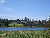
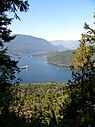
Major parklands and waterways in Burnaby include Central Park, Robert Burnaby Park, Kensington Park, Burnaby Mountain, Still Creek, the Brunette River, Burnaby Lake, Deer Lake, and Squint Lake.
Climate[]
Burnaby's Simon Fraser University weather station is located 365 metres (1,198 ft) above sea level on Burnaby Mountain. Therefore, climate records are cooler and wetter, with more snowfall, as compared to the rest of the city.
Burnaby has an oceanic climate (Cfb) with mild, dry summers and cool, rainy winters.
| hideClimate data for Burnaby (Simon Fraser University) 1981−2010 at 365 metres | |||||||||||||
|---|---|---|---|---|---|---|---|---|---|---|---|---|---|
| Month | Jan | Feb | Mar | Apr | May | Jun | Jul | Aug | Sep | Oct | Nov | Dec | Year |
| Record high °C (°F) | 16.5 (61.7) |
18.5 (65.3) |
23.0 (73.4) |
28.0 (82.4) |
33.0 (91.4) |
31.1 (88.0) |
34.0 (93.2) |
33.9 (93.0) |
34.5 (94.1) |
26.5 (79.7) |
19.4 (66.9) |
16.1 (61.0) |
34.5 (94.1) |
| Average high °C (°F) | 5.8 (42.4) |
6.8 (44.2) |
9.3 (48.7) |
12.4 (54.3) |
15.6 (60.1) |
18.2 (64.8) |
21.2 (70.2) |
21.2 (70.2) |
18.0 (64.4) |
12.0 (53.6) |
7.5 (45.5) |
5.1 (41.2) |
12.7 (54.9) |
| Daily mean °C (°F) | 3.6 (38.5) |
4.3 (39.7) |
6.2 (43.2) |
8.7 (47.7) |
11.8 (53.2) |
14.4 (57.9) |
17.0 (62.6) |
17.2 (63.0) |
14.6 (58.3) |
9.5 (49.1) |
5.3 (41.5) |
2.9 (37.2) |
9.6 (49.3) |
| Average low °C (°F) | 1.4 (34.5) |
1.7 (35.1) |
3.1 (37.6) |
4.9 (40.8) |
7.9 (46.2) |
10.5 (50.9) |
12.7 (54.9) |
13.2 (55.8) |
11.1 (52.0) |
7.0 (44.6) |
3.0 (37.4) |
0.8 (33.4) |
6.5 (43.7) |
| Record low °C (°F) | −13.9 (7.0) |
−14 (7) |
−8 (18) |
−3.3 (26.1) |
−0.5 (31.1) |
3.9 (39.0) |
5.0 (41.0) |
3.3 (37.9) |
2.0 (35.6) |
−7 (19) |
−14 (7) |
−19.4 (−2.9) |
−19.4 (−2.9) |
| Average precipitation mm (inches) | 280.9 (11.06) |
178.4 (7.02) |
182.1 (7.17) |
154.4 (6.08) |
120.0 (4.72) |
101.4 (3.99) |
64.7 (2.55) |
64.5 (2.54) |
92.2 (3.63) |
210.1 (8.27) |
311.6 (12.27) |
249.8 (9.83) |
2,009.9 (79.13) |
| Average rainfall mm (inches) | 256.5 (10.10) |
163.2 (6.43) |
171.2 (6.74) |
152.7 (6.01) |
119.9 (4.72) |
101.4 (3.99) |
64.7 (2.55) |
64.5 (2.54) |
92.2 (3.63) |
209.8 (8.26) |
303.6 (11.95) |
220.8 (8.69) |
1,920.7 (75.62) |
| Average snowfall cm (inches) | 24.3 (9.6) |
15.1 (5.9) |
10.9 (4.3) |
1.7 (0.7) |
0.1 (0.0) |
0.0 (0.0) |
0.0 (0.0) |
0.0 (0.0) |
0.0 (0.0) |
0.2 (0.1) |
8.0 (3.1) |
29.0 (11.4) |
89.3 (35.2) |
| Average precipitation days (≥ 0.2 mm) | 20.5 | 16.2 | 18.9 | 16.1 | 14.9 | 13.5 | 7.4 | 6.8 | 10.3 | 17.1 | 21.6 | 19.8 | 183.1 |
| Average rainy days (≥ 0.2 mm) | 18.1 | 14.7 | 18.3 | 16.0 | 14.9 | 13.5 | 7.4 | 6.8 | 10.3 | 17.0 | 21.0 | 17.3 | 175.4 |
| Average snowy days (≥ 0.2 cm) | 4.0 | 2.5 | 2.0 | 0.54 | 0.04 | 0.0 | 0.0 | 0.0 | 0.0 | 0.09 | 1.8 | 4.5 | 15.5 |
| Source: Environment Canada[15] | |||||||||||||
Transportation[]

The SkyTrain rapid transit system, based in Burnaby, crosses the city from east to west in two places: the Expo Line (completed in 1986) crosses the south along Kingsway and the Millennium Line (completed in 2002) follows Lougheed Highway. The SkyTrain has encouraged closer connections to New Westminster, Vancouver, and Surrey, as well as dense urban development at Lougheed Town Centre on the city's eastern border, at Brentwood Town Centre in the centre-west, Edmonds-Highgate in the southeast, and most notably, at Metrotown in the south. Burnaby is also served by RapidBus line R5, and several other bus routes operated by TransLink.[16]
Major north–south streets crossing the City include Boundary Road, Willingdon Avenue, Royal Oak Avenue, Kensington Avenue, Sperling Avenue, Gaglardi Way, Cariboo Road, and North Road. East–west routes linking Burnaby's neighbouring cities to each other include Hastings Street, Barnet Highway, the Lougheed Highway, Kingsway (which follows the old horse trail between Vancouver and New Westminster), Canada Way and Marine Drive/Marine Way. Douglas Road, which used to cross the city from northwest to southeast, has largely been absorbed by the Trans-Canada Highway and Canada Way. Since the 1990s, Burnaby has developed a network of cycling trails. It is also well served by Metro Vancouver's bus system, run by the Coast Mountain Bus Company, a division of TransLink.
Demographics[]
| Year | Pop. | ±% |
|---|---|---|
| 1921 | 12,883 | — |
| 1931 | 25,564 | +98.4% |
| 1941 | 30,328 | +18.6% |
| 1951 | 58,376 | +92.5% |
| 1956 | 83,745 | +43.5% |
| 1961 | 100,157 | +19.6% |
| 1966 | 112,036 | +11.9% |
| 1971 | 125,660 | +12.2% |
| 1976 | 131,599 | +4.7% |
| 1981 | 136,494 | +3.7% |
| 1986 | 145,161 | +6.3% |
| 1991 | 158,858 | +9.4% |
| 1996 | 179,209 | +12.8% |
| 2001 | 193,954 | +8.2% |
| 2006 | 202,799 | +4.6% |
| 2011 | 223,218 | +10.1% |
| 2016 | 232,755 | +4.3% |
| Source: Statistics Canada [17] | ||
According to the 2016 Census, Statistics Canada reported that Burnaby had a population of 232,755 who resided in 92,201 of its 98,030 total dwellings, a 4.3 percent change from the 2011 census.[19] With a land area of 98.6 km2 (38.1 sq mi), it had a population density of 2,360.6/km2 (6,113.9/sq mi) in 2016. The median age is 40.3 years old, slightly younger than the British Columbia median of 43.0 years old.
| Canada 2016 Census | Population | % of Total Population | |
|---|---|---|---|
| Visible minority group Source:[20] | |||
| South Asian | 18,735 | 8.1% | |
| Chinese | 78,025 | 33.9% | |
| Black | 3,670 | 1.6% | |
| Filipino | 13,000 | 5.7% | |
| Latin American | 4,630 | 2% | |
| Arab | 1,700 | 0.7% | |
| Southeast Asian | 4,620 | 2% | |
| West Asian | 4,960 | 2.2% | |
| Korean | 7,790 | 3.4% | |
| Japanese | 3,655 | 1.6% | |
| Other visible minority | 690 | 0.3% | |
| Mixed visible minority | 4,840 | 2.1% | |
| Total visible minority population | 146,310 | 63.6% | |
| Aboriginal group Source:[21] | |||
| First Nations | 2,615 | 1.1% | |
| Métis | 1,365 | 0.6% | |
| Other Aboriginal groups | 225 | 0.1% | |
| Total Aboriginal population | 4,195 | 1.8% | |
| European Canadian | 79,575 | 34.6% | |
| Total population | 230,080 | 100% | |
Language[]
The 2016 census found that English was spoken as the mother tongue of 41.33 percent of the population. The three next most common languages were Mandarin (14.53 percent), Cantonese (12.32 percent) and Tagalog (3.35 percent).[22]
| Mother tongue | Population | Percentage |
|---|---|---|
| English | 91,850 | 41.33% |
| Mandarin | 32,295 | 14.53% |
| Cantonese | 27,375 | 12.32% |
| Tagalog | 7,435 | 3.35% |
| Korean | 7,010 | 3.15% |
| Punjabi | 5,000 | 2.25% |
| Spanish | 4,165 | 1.87% |
| Persian | 4,080 | 1.84% |
| Italian | 3,975 | 1.79% |
| Russian | 2,650 | 1.19% |
People and politics[]

While Burnaby occupies about 4 percent of the land area of the Greater Vancouver Regional District, it accounted for about 10 percent of the region's population in 2016. It is the third most populated urban centre in British Columbia (after Vancouver and Surrey) with an estimated population of 249,197 (2017).
Similar to Greater Vancouver, Burnaby has always had diverse ethnic and immigrant communities. For example, North Burnaby near Hastings Street has long been home to many Italian restaurants and recreational bocce games. Metrotown's high-rise condominium towers in the south have been fuelled in part by recent arrivals from China (Hong Kong and Macau), Taiwan, and South Korea. According to the 2006 Census, 54% of Burnaby residents have a mother tongue that is neither English nor French.
Politically, Burnaby has maintained a left-wing city council closely affiliated with the provincial NDP and school board for many years, while sometimes electing more conservative legislators provincially (for the Social Credit and BC Liberal parties) and federally (for the Reform, Alliance, and Conservative parties). Its longest-serving politician had been Svend Robinson of the New Democratic Party (NDP), Canada's first openly gay member of Parliament, but after 25 years and seven elections he resigned his post in early 2004 after stealing and then returning an expensive ring. Burnaby voters endorsed his assistant, Bill Siksay, as his replacement in the spring 2004 Canadian federal election. In the May 2013 provincial election, residents of the city sent 3 NDP MLAs and one Liberal MLA to the British Columbia legislature. The NDP MLA for Burnaby-Lougheed, Jane Shin, faced controversy after the election for misrepresenting herself as a physician while not having completed a medical residency nor holding a licence to practise medicine.[23]
According to a 2009 survey by Maclean's magazine, Burnaby is Canada's best run city. The survey looks at a city's efficiency, the cost of producing results, and the effectiveness of its city services.[24] However, Maclean's does note that Burnaby has one of the worst municipal voter turnouts in the country, 26 percent. In 2015, the Canadian Federation of Independent Business (CFIB) included Burnaby as a Vancouver periphery to rank eighth for entrepreneurial communities.[25]
Industry and economy[]


The city features major commercial town centres, high-density residential areas, two rapid transit lines, high technology research, business parks, film studios such as The Bridge Studios, and TV stations such as Global TV.
Major technology firms such as Ballard Power Systems (fuel cell), D-Wave Systems (quantum computing), Clio (software company) (legal tech), Creo (imaging), and EA Canada (studio) (Electronic Arts) have their headquarters in Burnaby. Telus have relocated their headquarter from Burnaby to Telus Garden in Vancouver.
Metropolis mall located in Metrotown neighbourhood, the Downtown of Burnaby,[26] is the largest mall in British Columbia with West Vancouver's Park Royal in the second place. It is the fifth largest in Canada behind the first place West Edmonton Mall located in Edmonton, Alberta. Despite its size, Metropolis mall was the second most visited mall in Canada in 2017 and third most visited in 2018.[27]
Heavy industry companies including Chevron Corporation and Petro-Canada petroleum refineries oil on the shores of Burrard Inlet.
Best Buy, Ritchie Bros. Auctioneers, Pacific Blue Cross and Nokia have significant facilities in Burnaby.
Other firms with operations based in Burnaby include Canada Wide Media, , Telus, Teradici, AFCC, Mercedes-Benz Fuel Cell, HSBC Group Systems Development Center, and TransLink. eBay ceased local operations in 2009.[28]
Sports[]
The city's main stadium, Swangard Stadium, is located in Central Park (Burnaby). It was completed in 1969. The stadium was home to Vancouver 86ers (now Vancouver Whitecaps) in the Canadian Soccer League from 1986 to 2010, when the team relocated to BC Place to play in the Major League Soccer.
Burnaby Velodrome hosted the National Junior and U17 Track Championship in 2014.
Education[]

Public education[]
The city has over 24,000 students across the 41 elementary schools and 8 secondary schools managed by School District 41. It also has a Community and Adult Education Department and an International Students Programme.
Higher education[]
Simon Fraser University's main campus, with more than 30,000 students and 950 staff, is located atop Burnaby Mountain (elevation 370 metres (1,210 ft)). In Maclean's 2020 rankings, the university placed first in their comprehensive university category, and ninth in their reputation ranking for Canadian universities.[29] Burnaby gondola, operating between the main campus and Production Way–University station has been included in TransLink (British Columbia)'s 10-Year Investment Plan in 2018.
British Columbia Institute of Technology's main campus in Burnaby, home to more than 49,000 full-time and part-time students, was established in 1964. A new $78 million, net-zero emission Health Science Centre expected to open in late 2021, will accommodate 7,000 students.[30]
Arts and culture[]
Burnaby is home to multiple museums highlighting the diverse history and culture of the city. Burnaby Village Museum is a 10-acre (4.0 ha) open-air museum preserving a 1920s Canadian village. The Nikkei National Museum & Cultural Centre which includes a Japanese garden opened in 2000 to promote awareness and understanding of Japanese Canadian culture. The Museum of Archaeology and Ethnology is located within the Simon Fraser University campus at the top of Burnaby Mountain.
Burnaby Public Library was first established in 1954. It currently has four locations throughout the city, including the central Bobbie Prittie Metrotown branch in downtown Burnaby. The library system holds over three million items in circulation, with more than 5,000 visitors per day.
Many cultural facilities are located in or around Deer Lake Park, including the Burnaby Art Gallery, Shadbolt Centre for the Arts, and the Burnaby Village Museum.
Michael J. Fox Theatre, a community theatre that seats 613, with 11 wheelchair spaces, is situated within Burnaby South Secondary School.
Notable people[]


- Karl Alzner, NHL hockey player
- Glenn Anderson, former NHL hockey player
- Andrea Bang, actor best known for Kim's Convenience
- Michael Bublé, singer
- Christy Clark, former Premier of British Columbia
- Eleanor Collins, jazz singer, TV host and civic leader
- Kris Chucko, NHL hockey player
- Ian James Corlett, voice actor, writer, and TV producer
- Robin Esrock, South-African-born Canadian travel writer, TV host and author
- Michael J. Fox, Canadian-American actor
- Kaleigh Fratkin (born 1992), professional ice hockey player
- Jacob Hoggard, lead singer of Hedley
- Joe Keithley, musician and Burnaby politician
- Braam Jordaan, South-African-born entrepreneur, filmmaker, animator, and activist
- Eagle Keys, American-born CFL football player and head coach
- Jason LaBarbera, NHL hockey player
- Brad Loree, movie stuntman
- Kenndal McArdle, former NHL hockey player and investment banker
- John H. McArthur, Harvard Business School dean
- Darren McCarty, NHL hockey player
- Carrie-Anne Moss, movie, television and voice actress
- Dave Nonis, former Senior Vice President and Director of Hockey Operations of the Toronto Maple Leafs
- Ryan Nugent-Hopkins, NHL hockey player
- Mark Olver, NHL and KHL hockey player
- Tyler O'Neill, MLB player for the St. Louis Cardinals
- Buzz Parsons, NASL soccer player and later CSL coach
- Dugald Campbell Patterson, Scottish-born Burnaby pioneer
- Colin Percival, computer scientist
- Dick Phillips, American-born MLB baseball player and PCL team manager
- Roy Radu, Rugby union player
- Svend Robinson, former federal MP, arbitrator/advocate and parliamentary relations consultant
- Cliff Ronning, former NHL hockey player
- Joe Sakic, former NHL hockey player
- Mike Santorelli, NHL hockey player
- Murray SawChuck, Canadian-born Las Vegas-based magician
- Gurv and Harv Sihra, Indian-Canadian professional wrestlers known as Sunil and Samir Singh
- Josh Simpson, USL soccer player
- Christine Sinclair, NWSL soccer player and captain of the Canadian Women's National Soccer Team.
- Don Taylor, Vancouver-area television sportscaster
- Patrick Wiercioch, NHL hockey player
- Greg Zanon, AHL and NHL hockey player
Sister cities[]
Burnaby has four sister cities:[31]
- Kushiro, Hokkaido, Japan (1965)
- Mesa, Arizona, United States (1998)
- Hwaseong, Gyeonggi, Korea (2010)
- Zhongshan, Guangdong, China (2011)
Surrounding municipalities[]
| show Places adjacent to Burnaby |
|---|
See also[]
- Burnaby Public Library
References[]
- ^ Government of Canada, Statistics Canada (February 8, 2017). "Census Profile, 2016 Census - Burnaby, City [Census subdivision], British Columbia and British Columbia [Province]". www12.statcan.gc.ca.
- ^ Shepert, Elana. "New pedestrian bridge will connect Metrotown Skytrain Station with mall". Vancouver Courier.
- ^ "History of Burnaby: Resource Guide" (PDF). Burnaby Village Museum. Burnaby Village Museum. Retrieved June 24, 2020.
- ^ "History of Burnaby: Resource Guide" (PDF). Burnaby Village Museum. Burnaby Village Museum. Retrieved June 24, 2020.
- ^ "History of Burnaby: Resource Guide" (PDF). Burnaby Village Museum. Burnaby Village Museum. Retrieved June 24, 2020.
- ^ "History of Burnaby: Resource Guide" (PDF). Burnaby Village Museum. Burnaby Village Museum. Retrieved June 24, 2020.
- ^ "History of Burnaby: Resource Guide" (PDF). Burnaby Village Museum. Burnaby Village Museum. Retrieved June 24, 2020.
- ^ Marshall, Daniel. "Fraser River Gold Rush". The Canadian Encyclopedia. Historica Canada. Retrieved June 24, 2020.
- ^ "History of Burnaby: Resource Guide" (PDF). Burnaby Village Museum. Burnaby Village Museum. Retrieved June 24, 2020.
- ^ "Burnaby (city)". BC Geographical Names.
- ^ Akrigg, G.P.V.; Akrigg, Helen B. (1986), British Columbia Place Names (3rd, 1997 ed.), Vancouver: UBC Press, ISBN 0-7748-0636-2
- ^ "History of Burnaby: Resource Guide" (PDF). Burnaby Village Museum. Burnaby Village Museum. Retrieved June 24, 2020.
- ^ Ireland, Tom. "The History of Burnaby, BC". 604 Now. Retrieved June 24, 2020.
- ^ "History of Burnaby: Resource Guide" (PDF). Burnaby Village Museum. Burnaby Village Museum. Retrieved June 24, 2020.
- ^ "Burnaby, British Columbia". Canadian Climate Normals 1981–2010. Retrieved February 17, 2015.
- ^ "Transit Maps". www.translink.ca. Retrieved November 19, 2020.
- ^ Services, Ministry of Citizens. "Census of Canada - Province of British Columbia". www2.gov.bc.ca.
- ^ "Burnaby Religions, 2011 Census". Statistics Canada. September 11, 2013. Retrieved August 25, 2016.
- ^ "Census Profile, 2016 Census Burnaby, City [Census subdivision]". Statistics Canada. Retrieved April 15, 2019.
- ^ "Census Profile, 2016 Census - Burnaby, City, British Columbia". Statistics Canada. January 25, 2018. Retrieved January 25, 2018.
- ^ "Burnaby Aboriginal Peoples, 2011 Census". Statistics Canada. September 11, 2013. Retrieved August 25, 2016.
- ^ "Burnaby, CY". Burnaby, City [Census subdivision], British Columbia and British Columbia [Province]. Statistics Canada. April 3, 2019. Retrieved April 15, 2019.
- ^ Moreau, Jennifer. "Newsmaker of the year: Jane Shin". Burnaby Now. Glacier Media. Retrieved February 24, 2016.
- ^ MacQueen, Ken. "The best-run city in Canada: Lean, debt-free, and offering great public services, Burnaby is a model for the country". Retrieved August 4, 2009.
- ^ Ted Mallett, Vice-President & Chief Economist, Simon Gaudreault, Senior Economist, Andreea Bourgeois, Senior Analyst. "Entrepreneurial Communities, Canada's top places to start and grow businesses in 2015" (PDF).CS1 maint: multiple names: authors list (link)
- ^ "Metrotown Downtown Plan". City of Burnaby. Retrieved September 25, 2019.
- ^ Van Santvoort, Albert. "This Burnaby mall is now the third-busiest in Canada - despite its size". BurnabyNow. Retrieved September 25, 2019.
- ^ Penner, Derrick (May 5, 2009). "eBay to close Burnaby facility; about 700 jobs lost". Vancouversun.com. Retrieved July 27, 2010.
- ^ Maclean's (October 3, 2019). "Canada's best universities by reputation: Rankings 2020". Maclean's. Retrieved February 19, 2020.
- ^ Chan, Kenneth. "Construction begins on BCIT's new $78-million Health Sciences Centre". DailyHive. Retrieved January 6, 2020.
- ^ "Sister & Friendship Cities". www.burnaby.ca.
- Adapted from Home
External links[]
| Wikimedia Commons has media related to Burnaby. |
| Wikivoyage has a travel guide for Burnaby. |
| show Subdivisions of British Columbia |
|---|

| show Municipalities of Metro Vancouver |
|---|
| show Authority control |
|---|
- Burnaby
- Cities in British Columbia
- Populated places in Greater Vancouver
- Populated places established in 1892
- 1892 establishments in British Columbia