Bushmanland (South West Africa)
This article relies largely or entirely on a single source. (June 2019) |
Bushmanland Boesmanland Buschmannland | |||||||||
|---|---|---|---|---|---|---|---|---|---|
| 1976–1989 | |||||||||
 Flag | |||||||||
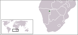 Location of Bushmanland (green) within South West Africa (grey). | |||||||||
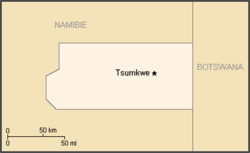 Map of the bantustan. | |||||||||
| Status | Bantustan | ||||||||
| Capital | Tsumkwe (Tjumǃkui) | ||||||||
| Common languages | Khoisan English Afrikaans German | ||||||||
| History | |||||||||
• Establishment | 1976 | ||||||||
• Re-integrated into Namibia | May 1989 | ||||||||
| Currency | South African rand | ||||||||
| |||||||||

Allocation of Land to bantustans according to the Odendaal Plan. Bushmanland is in the north-east.
Bushmanland (Afrikaans: Boesmanland) was a bantustan in South West Africa (present-day Namibia), intended by the apartheid government to be a self-governing homeland for the San people (the Bushmen). Despite this, a government was not established in the region. The bantustan, then called 'homelands' by the South African authorities, was established with the issue of Proclamation 208 in 1976. [1]
Bushmanland, like other homelands in South West Africa, was abolished in May 1989 at the start of the transition to independence.
See also[]
- Bushmanland (South Africa)
- Apartheid
References[]
- ^ Welch, Cameron (2018). The San and the N‡a Jaqna Conservancy, Tsumkwe District West, Namibia: The San and the N‡a Jaqna Conservancy, Tsumkwe District West, Namibia. African Books Collective. p. 28. ISBN 978-3906927039.
| |||||||||||||||||||||||||||||||||||||||||||||||||||||||||||||||||||||||||||||||||||||||||||||||||||||||||||
Coordinates: 19°35′S 20°31′E / 19.583°S 20.517°E

This Namibia location article is a stub. You can help Wikipedia by . |
Categories:
- History of Namibia
- Bantustans in South West Africa
- States and territories disestablished in 1989
- Former polities of the Cold War
- Namibia geography stubs