Byron Heights
| Byron Heights | |
|---|---|
 Byron Heights | |
| Highest point | |
| Elevation | 497 m (1,630 ft) |
| Prominence | 497 m (1,630 ft) |
| Coordinates | 51°25′29″S 60°33′53″W / 51.42472°S 60.56472°WCoordinates: 51°25′29″S 60°33′53″W / 51.42472°S 60.56472°W |
| Geography | |
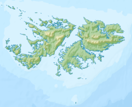
| Location | Falkland Islands, South Atlantic Ocean |

Byron Heights is a mountain rising to 497 m (1,630 ft)[1] at the northwest extremity of West Falkland, Falkland Islands in the South Atlantic. It is situated 11.65 km (7.24 mi) southeast of .
The mountain's top is occupied by RRH Byron Heights (Remote Radar Head Byron Heights) of the British Forces South Atlantic Islands (BFSAI),[2] part of an early warning and airspace control network including also RRH Mount Alice on West Falkland and RRH Mount Kent on East Falkland.
References[]
- ^ Byron Heights. Falkland Islands. GeoNames Geographical Database
- ^ Post Conflict and RAF Stanley. Think Defence Website, 2017
This Falkland Islands location article is a stub. You can help Wikipedia by . |
Categories:
- Mountains of West Falkland
- Military of the Falkland Islands
- Royal Air Force stations
- Falkland Islands geography stubs