Cabezas (Unión de Reyes)
Cabezas
San Antonio de Cabezas | |
|---|---|
Village | |
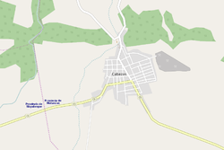 OSM map showing Cabezas | |
 Location of Cabezas in Cuba | |
| Coordinates: 22°50′26.5″N 81°40′40.2″W / 22.840694°N 81.677833°WCoordinates: 22°50′26.5″N 81°40′40.2″W / 22.840694°N 81.677833°W | |
| Country | |
| Province | Matanzas |
| Municipality | Unión de Reyes |
| Founded | 1822[1] |
| Area | |
| • Total | 28.70 km2 (11.08 sq mi) |
| Elevation | 120 m (390 ft) |
| Population | |
| • Total | 5,549 |
| Time zone | UTC-5 (EST) |
| Area code(s) | +53-52 |

Cabezas, also known as San Antonio de Cabezas, is a Cuban village and consejo popular ("people's council", i.e. hamlet) of the municipality of Unión de Reyes, in Matanzas Province. Sometimes referred to as Wajay,[2] it has a population of 5,549 and the council's administrative territory covers an area of 28.70 km².[1]
History[]
The village was founded in 1822 around the church of San Antonio, and its population increased from 1827.[1] Before the administrative reform of 1976, it was an autonomous municipality that included the villages of Bermeja, Bija, Lima and Magdalena.[3]
Geography[]
Located at the borders between the provinces of Matanzas and Mayabeque, Cabezas spans on a plain north of the Zapata Swamp.[4] It is 6 km far from Bermeja, 8 from Palos, 14 from Nueva Paz, 20 from Unión de Reyes, 37 from Matanzas and 88 from Havana.
Transport[]
The village is crossed in the middle by the Circuito Sur highway (CS) and nearest station, Palos (on the Havana-Güines-Cienfuegos railway), is 8 km southwest. Nearest motorway exit, "Nueva Paz" (on the A1 motorway), is 14 km southwest.
See also[]
References[]
- ^ a b c d e f (in Spanish) Cabezas on EcuRed
- ^ Wajay maps on maphill.com (map showing Cabezas)
- ^ Cabezas on guije.com
- ^ 1354873853 Cabezas on OpenStreetMap
External links[]
![]() Media related to Cabezas at Wikimedia Commons
Media related to Cabezas at Wikimedia Commons
- Populated places in Matanzas Province
- Populated places established in 1822
- 1822 establishments in Cuba