Cabrales
This article does not cite any sources. (June 2016) |
Cabrales | |
|---|---|
 Flag  Coat of arms | |
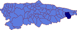 | |
 Cabrales Location in Spain | |
| Coordinates: 43°17′N 4°46′W / 43.283°N 4.767°WCoordinates: 43°17′N 4°46′W / 43.283°N 4.767°W | |
| Country | |
| Autonomous community | |
| Province | Asturias |
| Comarca | Oriente |
| Judicial district | Llanes |
| Capital | Carreña |
| Government | |
| • Alcalde | José Vicente del Carmen Bustillo (PSOE) |
| Area | |
| • Total | 238.29 km2 (92.00 sq mi) |
| Highest elevation | 2,648 m (8,688 ft) |
| Population (2018)[1] | |
| • Total | 2,002 |
| • Density | 8.4/km2 (22/sq mi) |
| Demonym(s) | cabraliego |
| Time zone | UTC+1 (CET) |
| • Summer (DST) | UTC+2 (CEST) |
| Postal code | 33555 |
| Website | Official website |

Cabrales is a municipality in the autonomous community of Asturias, northwestern Spain. It is situated between the Sierra de Cuera and the Picos de Europa, and is a region famous for its Cabrales cheese.
Important towns within the municipality include , one of the primary objectives of the Battle of El Mazuco in 1937. Nowadays Arenas' economy seems to be primarily based on tourism, although unlike many tourist centres it retains its authentic style – and hospitality.
Parishes[]
Cabrales municipality is divided into nine parishes:

Panoramic view of Sotres town, municipality of Cabrales.

References[]
- ^ Municipal Register of Spain 2018. National Statistics Institute.
| Authority control |
|---|
This article about a location in the Principality of Asturias, Spain, is a stub. You can help Wikipedia by . |
Categories:
- Municipalities in Asturias
- Picos de Europa
- Parishes in Cabrales
- Asturias geography stubs