Cajalco Canyon Creek
Cajalco Canyon Creek is an ephemeral stream that flows through in the Temescal Mountains of Riverside County, California, United States.[1] It is a tributary to Temescal Wash, itself a tributary to the Santa Ana River. Cajalco is thought to be a Hispanic spelling of the word for "quail" in the languages of the Luiseño and Cahuilla who lived in the area.[2] The meaning of the word Cajalco is an anagram meaning California Jalisco Land Company of Los Angeles[3]
Course[]
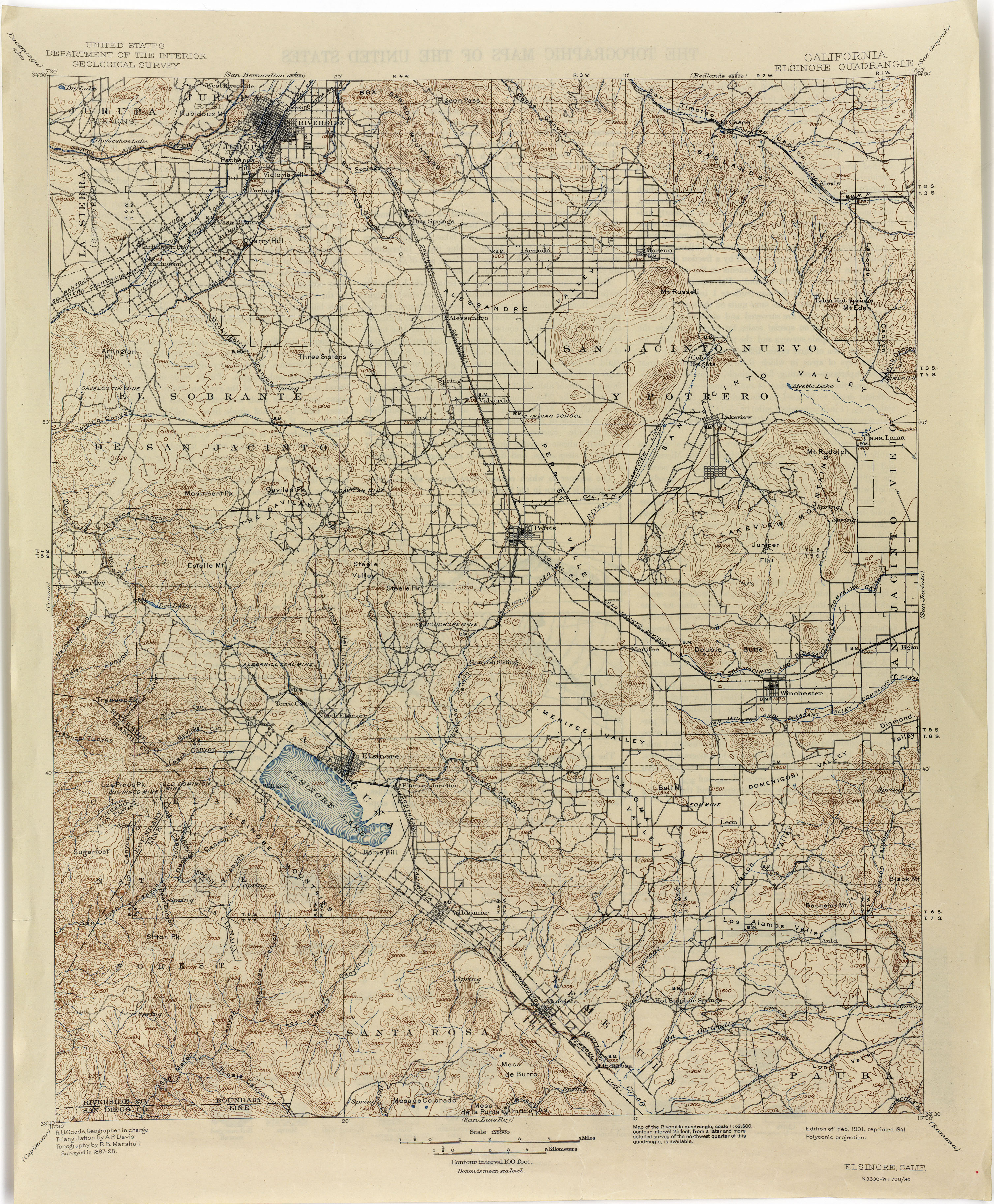
Cajalco Canyon Creek originally flowed down the northeast face of the Gavilan Hills of the Temescal Mountains at 33°48′25″N 117°18′01″W / 33.80694°N 117.30028°W.[4] It then turned northwest to take in waters from arroyos from Mead Valley and turned west down through the wide, gently sloping above Cajalco Canyon gathering waters from the Gavilan Plateau from at 33°50′04″N 117°21′42″W / 33.83444°N 117.36167°W, and from other minor arroyos. Other small arroyos descended from heights to the north. It entered Temescal Wash at 33°49′24″N 117°30′16″W / 33.82333°N 117.50444°W after descending through the steep narrow gorge of the Cajalco Canyon in the lower reach of the creek.[5] The original course of the creek, before 1933, can be seen on the US Dept. of the Interior's 1898 topographic map of the Elsinore Quadrangle.[6]
 WikiMiniAtlas
Lake Mathews[]
In the 1930s a dam was built in Cajalco Canyon, blocking the stream as part of the Colorado River Aqueduct project that created the Cajalco Reservoir, now Lake Mathews.[7] Now the water of the upper reach of the creek flows down through Cajalco Valley to join this reservoir at 33°50′11″N 117°22′25″W / 33.83639°N 117.37361°W. The lower reach below the dam still flows through what remains of Cajalco Canyon into the Temescal Wash.[1][5]
References[]
- ^ a b U.S. Geological Survey Geographic Names Information System: Cajalco Canyon
- ^ William Bright, Native American Placenames of the United States, University of Oklahoma Press, Norman, 2004, p. 76[ISBN missing]
- ^ Los Angeles Financier, Volume 6, No. 1, August 1, 1908, p. 214
- ^ USGS Topographic Map: Steele Peak, California
- ^ a b USGS Topographic Map: Lake Mathews, California
- ^ 1901 Elsinore Quadrangle, CA topographic Map, reprinted in 1941. from lib.utexas.edu, accessed 6/6/2015
- ^ Kathleen Dever and Judy Whitson, Lake Mathews And Gavilan Hills, Arcadia Publishing, Charleston, 2007, pp. 39–100
Coordinates: 33°43′40″N 117°23′35″W / 33.72778°N 117.39306°W
- Rivers of Riverside County, California
- Tributaries of Temescal Creek
- Rivers of Southern California