Calang
Calang | |
|---|---|
Town | |
 Indonesian Navy landing craft KRI Teluk Banten (516) and KRI Teluk Langsa (501) and a US Navy Seahawk helicopter in Calang | |
| Coordinates: 4°38′N 95°35′E / 4.633°N 95.583°E | |
| Country | |
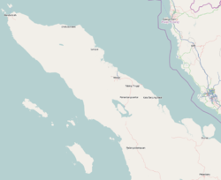
| Region | Sumatra |
| Province | Aceh |
| Regency | Aceh Jaya Regency |
| Time zone | UTC+7 (IWST) |
| Area code | (+62) 654 |


Calang, the capital of the Aceh Jaya Regency of the special territory (daerah istimewa) of Aceh was on the island of Sumatra, Indonesia. It had a population of about 12,000 though it was reported to have "vanished completely leaving only scattered shards of concrete" as a result of the tsunami produced by the 2004 Indian Ocean earthquake. Only about 30 per cent of the townspeople have survived.
The trail of destruction left by the tsunami extends two kilometers inland from the coast. Whole hills have been washed away.
The township, a former Indonesian Military (TNI, Tentara Nasional Indonesia) stronghold, will be relocated inland according to Indonesian Welfare Minister Alwi Shihab.
Climate[]
Calang has a tropical rainforest climate (Af) with heavy to very heavy rainfall year-round.
| hideClimate data for Calang | |||||||||||||
|---|---|---|---|---|---|---|---|---|---|---|---|---|---|
| Month | Jan | Feb | Mar | Apr | May | Jun | Jul | Aug | Sep | Oct | Nov | Dec | Year |
| Average high °C (°F) | 29.1 (84.4) |
30.0 (86.0) |
31.6 (88.9) |
32.3 (90.1) |
31.2 (88.2) |
31.4 (88.5) |
31.0 (87.8) |
31.6 (88.9) |
30.8 (87.4) |
30.9 (87.6) |
29.7 (85.5) |
29.0 (84.2) |
30.7 (87.3) |
| Daily mean °C (°F) | 26.3 (79.3) |
26.6 (79.9) |
27.5 (81.5) |
28.2 (82.8) |
27.8 (82.0) |
27.8 (82.0) |
27.3 (81.1) |
27.9 (82.2) |
27.3 (81.1) |
27.6 (81.7) |
26.8 (80.2) |
26.3 (79.3) |
27.3 (81.1) |
| Average low °C (°F) | 23.5 (74.3) |
23.3 (73.9) |
23.4 (74.1) |
24.1 (75.4) |
24.4 (75.9) |
24.3 (75.7) |
23.7 (74.7) |
24.2 (75.6) |
23.8 (74.8) |
24.4 (75.9) |
23.9 (75.0) |
23.7 (74.7) |
23.9 (75.0) |
| Average rainfall mm (inches) | 231 (9.1) |
170 (6.7) |
234 (9.2) |
287 (11.3) |
327 (12.9) |
266 (10.5) |
285 (11.2) |
312 (12.3) |
369 (14.5) |
384 (15.1) |
357 (14.1) |
250 (9.8) |
3,472 (136.7) |
| Source: Climate-Data.org[1] | |||||||||||||
See also[]
References[]
- ^ "Climate: Calang". Climate-Data.org. Retrieved 5 November 2020.
External links[]
 | This Aceh location article is a stub. You can help Wikipedia by . |
- Aceh geography stubs
- Populated places in Aceh
- Regency seats of Aceh