California County Routes in zone R
In the California Route Marker Program, which designates county routes in California, only two highways exist in the "R" zone: CR R2 and CR R3. Both of these routes are in Riverside County.
R1[]
 | |
|---|---|
| Route information | |
| Existed | 1966–1970 |
| Major junctions | |
| South end | |
| North end | near Banning |
| Location | |
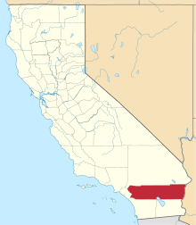
| Counties | Riverside |
| Highway system | |
This section needs expansion. You can help by . (November 2019) |
County Route R1 was converted into SR 243 in 1970. Its southern end was at SR 74 in Mountain Center and its north end was in Banning.[1]
R2[]
 | |
|---|---|
| Route information | |
| Length | 11.26 mi[2] (18.12 km) |
| Existed | 1964[2]–present |
| Major junctions | |
| South end | |
| North end | Eagle Mountain |
| Location | |
| Counties | Riverside |
| Highway system | |
This section needs expansion. You can help by . (February 2010) |
County Route R2 is also known as Kaiser Road. Its southern end is SR 177 and its north end is at Eagle Mountain, a modern day ghost town.
The route was defined in 1964, and has not been altered since then.
R3[]
 | |
|---|---|
| Route information | |
| Length | 23.45 mi[2] (37.74 km) |
| Existed | 1966 or 1973[2]–present |
| Major junctions | |
| South end | |
| North end | |
| Location | |
| Counties | Riverside |
| Highway system | |
This section needs expansion. You can help by . (February 2010) |
County Route R3 is also known by several other names along its route. Portions of the highway are called Sage Road, Cactus Valley Road, and State Street. Its southern end is SR 79 at Radec and its north end is SR 74.
At its north end in Hemet, it provides a major transportation route.
Historic information conflicts as to the date the route was defined. Some information indicates the highway was created in 1966, although other sources give a commissioning date of 1973. This is a former routing of SR 79. [2]
Major intersections[]
| Location | Distance | Destinations | Notes | References |
|---|---|---|---|---|
| Radec | 0.0mi | |||
| Sage | 5.1mi | Wilson Valley Road - Aguanga | ||
| Hemet | 20.0mi | Domenigoni Parkway - Menifee | ||
| Hemet | 23.1mi |
See also[]
 California Roads portal
References[]
- ^ "California Road Signs and Sights Gallery: Section of 1966 official highway map".
- ^ a b c d e Faigin, Daniel. "County Routes 'R'". California Highways. Retrieved 2010-02-18.

- County routes in California
- Roads in Riverside County, California