From Wikipedia, the free encyclopedia
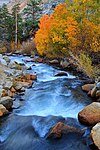
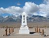
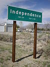
This list includes properties and districts listed on the California Historical Landmark listing in Inyo County, California . Click the "Map of all coordinates" link to the right to view a Google map of all properties and districts with latitude and longitude coordinates in the table below.
References [ ] See also [ ]
Protected areas of California
National Park System
National Parks
Channel Islands Death Valley Joshua Tree Kings Canyon Lassen Volcanic Pinnacles Redwood Sequoia Yosemite National Preserves Mojave
National Monuments
Cabrillo Castle Mountains César E. Chávez Devils Postpile Lava Beds Muir Woods Tule Lake National Seashores Point Reyes
National Historical Parks
Rosie the Riveter/World War II Home Front San Francisco Maritime National Historic Sites National Memorials
Port Chicago Naval Magazine National Recreation Areas
State Parks
State Parks State State State State Beaches State State Vehicular
Carnegie Oceano Dunes Ocotillo Wells Other
National Forests and Grasslands
National Forests
Angeles Butte Valley NG Cleveland Eldorado Humboldt-Toiyabe Inyo Klamath Lake Tahoe Basin Lassen Los Padres Mendocino Modoc Plumas Rogue River – Siskiyou San Bernardino Sequoia Shasta–Trinity Sierra Six Rivers Stanislaus Tahoe National Wilderness
Agua Tibia Ansel Adams Bucks Lake Caribou Carson-Iceberg Castle Crags Cucamonga Desolation Dick Smith Dinkey Lakes Emigrant Golden Trout Hoover Inyo Mountains Ishi Jennie Lakes John Muir Kaiser Marble Mountain Mokelumne Mount Shasta Wilderness Pine Creek San Gabriel San Rafael Sespe Siskiyou Snow Mountain South Fork Eel River South Sierra South Warner Thousand Lakes Trinity Alps Ventana Yolla Bolly–Middle Eel National Monuments
National Wildlife Refuges
Antioch Dunes Bitter Creek Blue Ridge Butte Sink Castle Rock Clear Lake Coachella Valley Colusa Delevan Don Edwards San Francisco Bay Ellicott Slough Farallon Guadalupe-Nipomo Dunes Hopper Mountain Humboldt Bay Kern Lower Klamath Marin Islands Merced Modoc Pixley Sacramento Sacramento River Salinas River San Diego Bay San Diego San Joaquin River San Luis San Pablo Bay Seal Beach Sonny Bono Salton Sea Stone Lakes Sutter Tijuana Slough Tule Lake
State Wildlife Areas
Wildlife Ecological Marine
Bureau of Land Management National Landscape Conservation System
National Monuments National Wilderness Areas
National Marine Sanctuaries
Channel Islands Cordell Bank Greater Farallones Monterey Bay
National Estuarine Research Reserves
University of California Natural Reserve System
Private Conservation Land Trusts
Heritage registers
National Natural Landmarks
Categories :
History of Inyo County, California Buildings and structures in Inyo County, California California Historical Landmarks History of the Mojave Desert region History of Southern California Protected areas of Inyo County, California Hidden categories:
Lists of coordinates Geographic coordinate lists Articles with Geo Commons category link is on Wikidata