California Historical Landmarks in San Joaquin County
This list includes properties and districts listed on the California Historical Landmark listing in San Joaquin County, California. Click the "Map of all coordinates" link to the right to view a Google map of all properties and districts with latitude and longitude coordinates in the table below.
| Image | [1] | Landmark name | Location | City or town | Summary |
|---|---|---|---|---|---|
| 214 | Confluence of San Joaquin and Stanislaus Rivers | ||||
| 149 | South bank of North Fork Mokelumne River, 100 ft west of County Rd J8 | Thornton | |||
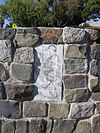 |
513 | 1100 E Weber St. 37°57′22″N 121°16′38″W / 37.956046°N 121.277213°W | Stockton | ||
| 935 | 1672 W. Bowman Rd. | French Camp | |||
 |
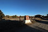
740 | Carnegie | Carnegie State Vehicular Recreation Area 37°37′59″N 121°32′37″W / 37.63305°N 121.5435°W | Tracy | |
 |
755 | Corral Hollow | Corral Hollow | Tracy | |
| 437 | First landing place of sailing launch Comet | Entrance to Mossdale Crossing Park and Ramp | Tracy | ||
| 668 | French Camp | Elm St at French Camp School | French Camp | ||
| 178 | Stockton City Hall | Stockton | |||
 |
365 | Lockeford | Historic district 38°09′27″N 121°09′05″W / 38.1575°N 121.151389°W | Lockeford | |
 |
931 | Lodi Arch | E. Pine & S. Sacramento Sts. 38°08′03″N 121°16′15″W / 38.134167°N 121.270833°W | Lodi | |
| 155 | 38°12′15″N 121°05′31″W / 38.204033°N 121.092°W | Clements | |||
| 162 | Mokelumne City | Cameron Rd. and Thornton Rd. 38°15′11″N 121°26′21″W / 38.253056°N 121.439167°W | Thornton | ||
| 436 | Ripon City Park, Fourth and Locust Sts. 37°44′09″N 121°07′37″W / 37.7359°N 121.126917°W | Ripon | |||
| 801 | Reuel Colt Gridley Monument | Stockton Rural Cemetery 37°58′39″N 121°17′11″W / 37.977467°N 121.286417°W | Stockton | ||
 |
777 | San Joaquin City | North of county line on County Hwy J3 37°40′12″N 121°15′58″W / 37.67°N 121.266111°W | Tracy | |
| 780-7 | At entrance to Mossdale Crossing Park and Ramp, just north of San Joaquin River (missing)[2] 37°47′14″N 121°18′18″W / 37.787361°N 121.305083°W | Lathrop | |||
| 520 | San Joaquin Valley College | 18500 N Lilac St. | Woodbridge | ||
| 934 | Stockton Assembly Center | 37°56′18″N 121°16′06″W / 37.9382°N 121.26845°W | Stockton | ||
| 1016 | 510 E. Magnolia St. 37°57′52″N 121°17′12″W / 37.964367°N 121.286667°W | Stockton | |||
| 1039 | 1930 S. Grant St. | Stockton | |||
| 765 | E. Acacia St, between N. Pilgrim & N. Union Sts. 37°57′54″N 121°16′44″W / 37.964867°N 121.278867°W | Stockton | |||
| 995 | Trail of the John C. Fremont 1844 Expedition | Hwy 88 & Calaveras River | |||
| 165 | Center St. between Channel and Miner Sts. 37°57′20″N 121°17′32″W / 37.955417°N 121.292217°W | Stockton | |||
| 163 | County Hwy Jl0 | Woodbridge | |||
| 358 | Woodbridge | Historic district | Woodbridge |

References[]
- ^ "California Historical Landmarks By County". Ohp.parks.ca.gov. Retrieved 2019-04-03.
- ^ "Site of Completion of Pacific Railroad - First Transcontinental Railroad". HMdb.org. Retrieved 6 December 2019.
See also[]
| Wikimedia Commons has media related to California Historical Landmarks in San Joaquin County, California. |
Categories:
- History of San Joaquin County, California
- Buildings and structures in San Joaquin County, California
- California Historical Landmarks
- San Joaquin County, California
- History of the San Joaquin Valley