Camopi Airport
Camopi Airport | |||||||||||
|---|---|---|---|---|---|---|---|---|---|---|---|
| Summary | |||||||||||
| Airport type | Public | ||||||||||
| Serves | Camopi, French Guiana | ||||||||||
| Elevation AMSL | 237 ft / 72 m | ||||||||||
| Coordinates | 3°10′20″N 52°20′10″W / 3.17222°N 52.33611°WCoordinates: 3°10′20″N 52°20′10″W / 3.17222°N 52.33611°W | ||||||||||
| Map | |||||||||||
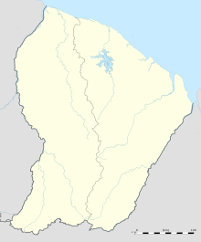
 Camopi Location of the airport in French Guiana | |||||||||||
| Runways | |||||||||||
| |||||||||||
Camopi Airport (sometimes called Vila Brasil Airport) is an airport serving the Oyapock River village of Camopi, French Guiana near the border with Brazil.
The airport is at the confluence of the Camopi River into the Oyapock, adjacent to the Camopi encampment of the 3rd Foreign Infantry Regiment of the French Foreign Legion.[3]
The Camopi non-directional beacon (Ident: CP) is located just south of the runway.[4]
In October 2020, the airport was upgraded for regular passenger transport.[5]
See also[]
References[]
- ^ OurAirports - Camopi
- ^ Bing Maps - Vila Brasil
- ^ "Camopi: visite de Camopi en Guayne". America FR (in French). Retrieved 3 June 2020.
- ^ "CP @ OurAirports". ourairports.com. Retrieved 2021-05-20.
- ^ "La piste d'atterrissage de Camopi déclarée conforme : les travaux ont coûté 750 000 euros". 21 March 2021 (in French).
External links[]
Categories:
- Airports in French Guiana
- Buildings and structures in Camopi
- French Guiana stubs
- South American airport stubs
- French Guiana geography stubs
