Canton of Sainte-Maure-de-Touraine
Canton of Sainte-Maure-de-Touraine | |
|---|---|
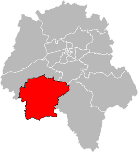 Location of the canton of Sainte-Maure-de-Touraine in the department of Indre-et-Loire | |
| Country | France |
| Region | Centre-Val de Loire |
| Department | Indre-et-Loire |
| No. of communes | 43 |
| Established | 1959 |
| Seat | Sainte-Maure-de-Touraine |
| Government | |
| • Representatives (2015-2021) | Nadège Arnault Etienne Martegoutte |
| Area | 746 km2 (288 sq mi) |
| Population (Jan. 2018)[1] | 26,949 |
| • Density | 36/km2 (90/sq mi) |
| INSEE code | 37 13 |
The canton of Sainte-Maure-de-Touraine is an administrative division of the Indre-et-Loire department, central France. Its borders were modified at the French canton reorganisation which came into effect in March 2015. Its seat is in Sainte-Maure-de-Touraine.[2]
Composition[]
Prior to 2015[]
The canton of Sainte-Maure-de-Touraine contained the 12 communes of:
| Nom | INSEE code | Intercommunality | Population
(last legal count) |
|---|---|---|---|
| Sainte-Maure-de-Touraine(Canton seat) | 37226 | 4 328 (2014) | |
| Antogny-le-Tillac | 37005 | 517 (2013) | |
| Maillé | 37142 | 582 (2014) | |
| Marcilly-sur-Vienne | 37147 | 544 (2014) | |
| Neuil | 37165 | 446 (2014) | |
| Nouâtre | 37174 | 825 (2014) | |
| Noyant-de-Touraine | 37176 | 1 179 (2014) | |
| Ports | 37187 | 354 (2014) | |
| Pouzay | 37188 | 840 (2014) | |
| Pussigny | 37190 | 175 (2014) | |
| Saint-Épain | 37216 | 1 569 (2014) | |
| Sainte-Catherine-de-Fierbois | 37212 | 728 (2014) |
Since 2015[]
It consists of the following communes:[2]
- Anché
- Antogny-le-Tillac
- Assay
- Avon-les-Roches
- Braslou
- Braye-sous-Faye
- Brizay
- Champigny-sur-Veude
- Chaveignes
- Chezelles
- Courcoué
- Cravant-les-Côteaux
- Crissay-sur-Manse
- Crouzilles
- Faye-la-Vineuse
- L'Île-Bouchard
- Jaulnay
- Lémeré
- Ligré
- Luzé
- Maillé
- Marcilly-sur-Vienne
- Marigny-Marmande
- Neuil
- Nouâtre
- Noyant-de-Touraine
- Panzoult
- Parçay-sur-Vienne
- Ports-sur-Vienne
- Pouzay
- Pussigny
- Razines
- Richelieu
- Rilly-sur-Vienne
- Sainte-Catherine-de-Fierbois
- Sainte-Maure-de-Touraine
- Saint-Épain
- Sazilly
- Tavant
- Theneuil
- La Tour-Saint-Gelin
- Trogues
- Verneuil-le-Château
References[]
| hide | |
|---|---|
|
Coordinates: 47°07′N 0°37′E / 47.11°N 0.62°E

This Indre-et-Loire geographical article is a stub. You can help Wikipedia by . |
Categories:
- Cantons of Indre-et-Loire
- Indre-et-Loire geography stubs