Cape Maisí
| Cabo Maisí | |
|---|---|
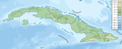 Location of Cape Maisí in Cuba | |
| Location | Guantanamo Province |
| Coordinates | 20°14′38.1″N 74°8′34.7″W / 20.243917°N 74.142972°WCoordinates: 20°14′38.1″N 74°8′34.7″W / 20.243917°N 74.142972°W |
| Offshore water bodies | Caribbean Sea, Atlantic Ocean |

Cape Maisí or Cape Maysí is a cape at the eastern extremity of Cuba, projecting into the Windward Passage.[1] It lies in the municipality of Maisí, Guantánamo Province.
See also[]
Notes[]
- ^ Merriam-Webster's Geographical Dictionary, Third Edition, p. 691.
References[]
- Merriam-Webster's Geographical Dictionary, Third Edition. Springfield, Massachusetts: Merriam-Webster, Incorporated, 1997.
This Cuban location article is a stub. You can help Wikipedia by . |
Categories:
- Headlands of Cuba
- Geography of Guantánamo Province
- Cuba geography stubs