Carl Township, Adams County, Iowa
Carl Township, Adams County | |
|---|---|
 | |
| Coordinates: 41°06′32″N 094°38′21″W / 41.10889°N 94.63917°WCoordinates: 41°06′32″N 094°38′21″W / 41.10889°N 94.63917°W | |
| Country | |
| State | |
| County | Adams |
| Area | |
| • Total | 35.79 sq mi (92.7 km2) |
| • Land | 35.61 sq mi (92.23 km2) |
| • Water | 0.18 sq mi (0.47 km2) |
| Elevation | 1,257 ft (383 m) |
| Population (2010) | |
| • Total | 149 |
| • Density | 4.2/sq mi (1.6/km2) |
| Time zone | UTC-6 (CST) |
| • Summer (DST) | UTC-5 (CDT) |
| FIPS code | 19-90471[2] |
| GNIS feature ID | 0467530 |

Carl Township is one of twelve townships in Adams County, Iowa, United States. At the 2010 census, its population was 149.[3]
Geography[]
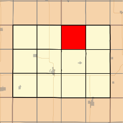
Carl Township covers an area of 35.79 square miles (92.7 km2) and contains no incorporated settlements. According to the USGS, it contains two cemeteries: Carl and Mount Zion.
References[]
- ^ "US Board on Geographic Names". United States Geological Survey. 2007-10-25. Retrieved 2008-01-31.
- ^ "U.S. Census website". United States Census Bureau. Retrieved 2008-01-31.
- ^ "IA - Carl township". United States Census Bureau. Archived from the original on April 9, 2013. Retrieved March 17, 2013.
External links[]
Municipalities and communities of Adams County, Iowa, United States | ||
|---|---|---|
| Cities | ||
| Townships | ||
| Unincorporated communities |
| |
| Ghost town | ||
| Footnotes | ‡This populated place also has portions in an adjacent county or counties | |
| ||
This article about the geography of Adams County, Iowa is a stub. You can help Wikipedia by . |
Categories:
- Townships in Adams County, Iowa
- Townships in Iowa
- South Iowa geography stubs