Catió
Catió | |
|---|---|
 Coat of arms | |
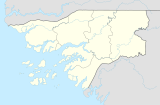 Catió Location in Guinea-Bissau | |
| Coordinates: 11°17′0″N 15°15′0″W / 11.28333°N 15.25000°WCoordinates: 11°17′0″N 15°15′0″W / 11.28333°N 15.25000°W | |
| Country | |
| Region | Tombali Region |
| Elevation | 1 m (3 ft) |
| Population (2008 est.) | |
| • Total | 9,217 |


Market, Catió

Cumbija river near Catió
Catió is a city in south eastern Guinea-Bissau. It is the capital of Tombali Region.
Population 9,217 (2008 est).[1]
Catio, along with Canjadude and other camps were besieged by the Portuguese in 1973.[2]
Notable people[]
- Abdulai Silá (1958-) -engineer and writer
Climate[]
Catió has a tropical monsoon climate (Köppen Am) featuring hot temperatures year-round, little to no rainfall from November to May and heavy to extremely heavy rainfall from June to October.
| Climate data for Catió | |||||||||||||
|---|---|---|---|---|---|---|---|---|---|---|---|---|---|
| Month | Jan | Feb | Mar | Apr | May | Jun | Jul | Aug | Sep | Oct | Nov | Dec | Year |
| Average high °C (°F) | 31.3 (88.3) |
32.4 (90.3) |
33.2 (91.8) |
33.6 (92.5) |
33.0 (91.4) |
31.1 (88.0) |
29.0 (84.2) |
28.2 (82.8) |
29.7 (85.5) |
30.9 (87.6) |
31.5 (88.7) |
30.5 (86.9) |
31.2 (88.2) |
| Daily mean °C (°F) | 25.4 (77.7) |
26.1 (79.0) |
27.2 (81.0) |
27.9 (82.2) |
27.9 (82.2) |
26.8 (80.2) |
25.8 (78.4) |
25.4 (77.7) |
26.3 (79.3) |
26.9 (80.4) |
27.3 (81.1) |
25.4 (77.7) |
26.5 (79.7) |
| Average low °C (°F) | 19.5 (67.1) |
19.9 (67.8) |
21.2 (70.2) |
22.2 (72.0) |
22.9 (73.2) |
22.6 (72.7) |
22.7 (72.9) |
22.6 (72.7) |
23.0 (73.4) |
22.9 (73.2) |
23.1 (73.6) |
20.4 (68.7) |
21.9 (71.5) |
| Average rainfall mm (inches) | 0 (0) |
1 (0.0) |
0 (0) |
1 (0.0) |
38 (1.5) |
252 (9.9) |
632 (24.9) |
798 (31.4) |
460 (18.1) |
267 (10.5) |
57 (2.2) |
5 (0.2) |
2,511 (98.7) |
| Source: Climate-Data.org[3] | |||||||||||||
References[]
- ^ World Gazetteer[dead link], Retrieved on June 16, 2008
- ^ Translations on Sub-Saharan Africa, Issues 1390-1397. United States. Joint Publications Research Service. 1973. p. 29.
- ^ "Climate: Catió". Climate-Data.org. Retrieved August 8, 2020.
This Guinea-Bissau location article is a stub. You can help Wikipedia by . |
Categories:
- Tombali Region
- Populated places in Guinea-Bissau
- Sectors of Guinea-Bissau
- Guinea-Bissau geography stubs