Cawarong
Cawarong
ཚ་བ་རོང་། Tsawarong | |
|---|---|
Town | |
| Cawarong | |
| Coordinates: 28°28′30″N 98°28′00″E / 28.47500°N 98.46667°ECoordinates: 28°28′30″N 98°28′00″E / 28.47500°N 98.46667°E | |
| Area | |
| • Total | 4,616.94 km2 (1,782.61 sq mi) |
| Elevation | 2,003 m (6,572 ft) |
| Population (2004) | |
| • Total | 6,788 |
| Time zone | UTC+8 |
| Area code(s) | +86 |

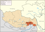
Cawarong or Tsawarong (Tibetan: ཚ་བ་རོང་།, Wylie: tsha ba rong, ZYPY: Cawarong; Chinese: 察瓦龙; pinyin: Cháwǎlóng) is a township in Zayü County, Tibet Autonomous Region of China.[1] It lies at an altitude of 2,003 metres (6,574 feet). Formerly known as Tsarung, it was traditionally a southern gateway and trade route into Tibet from Yunnan, forming part of the tea-horse road (茶马古道 Chá-Mǎ Gǔdào). It is a very arid area with little rainfall. An unsealed road cut into the cliffs above the Nu River links it to Bingzhongluo in Yunnan. Cawarong is a major step on the Khora of the Khawa Karpo.
Government[]
Its Chinese zoning code is 542626202.
Subdivisions[]
The town comprises 28 villages: Hongdong Village, Zharan Village, Gangzang Village, Zuobu Village, Qianzhongwa Village, Kangran Village, Songta Village, Abing Village, Zhan Village, Changxi Village, and Chuni Village , Kadi Village, Gerri Village, Laka Village, Buba Village, Babu Village, Gongka Village, Guoda Village, Muba Village, Mengzha Village, Shabu Village, LP Village, Zalang Village, Deng Xu Village , Xueba Village, Zhula Village, Wabu Village, and Gebu Village.
See also[]
- List of towns and villages in Tibet
Notes[]
- ^ (in Chinese) Wu Zhenhua (武振华), Xizang Diming (西藏地名; Place Names in Tibet), p.65, Chinese Zangxue Press (中国藏学出版社) 1996, ISBN 7-80057-284-6
External links and references[]
- Populated places in Nyingchi