Cayana Airstrip
Cayana Airstrip Kajana Airstrip | |||||||||||
|---|---|---|---|---|---|---|---|---|---|---|---|
 | |||||||||||
| Summary | |||||||||||
| Airport type | Public | ||||||||||
| Operator | Luchtvaartdienst Suriname | ||||||||||
| Location | Kajana, Suriname | ||||||||||
| Elevation AMSL | 360 ft / 110 m | ||||||||||
| Coordinates | 3°53′55″N 55°34′40″W / 3.89861°N 55.57778°WCoordinates: 3°53′55″N 55°34′40″W / 3.89861°N 55.57778°W | ||||||||||
| Map | |||||||||||
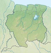 AAJ Location of airport in Suriname | |||||||||||
| Runways | |||||||||||
| |||||||||||

Cayana Airstrip (IATA: AAJ, ICAO: SMCA) is an airstrip serving the villages around Kajana in the Sipaliwini District of Suriname. The runway is just west of Kajana, across the Suriname River.
Airlines and destinations[]
Airlines serving this airport are:
| Airlines | Destinations |
|---|---|
| Blue Wing Airlines | Paramaribo, Zorg en Hoop Airport[3] |
| Gum Air | Paramaribo, Zorg en Hoop Airport[4] |
| Paramaribo, Zorg en Hoop Airport | |
| Suriname Air Force/ Surinaamse Luchtmacht | Paramaribo, Zorg en Hoop Airport |
| (UAS) | Paramaribo, Zorg en Hoop Airport |
| (VAS) | Paramaribo, Zorg en Hoop Airport |
Accidents and incidents[]
- On June 18, 1982, Cessna U206G (PZ-TAC) from Gonini Air Service was damaged at the Cayana airstrip. The pilot was Mr. Kuiper, who escaped serious injuries.[5]
See also[]
References[]
- ^ Airport information for AAJ at Great Circle Mapper.
- ^ Google Maps - Cayana Airstrip
- ^ Blue Wing schedule Archived 2013-05-22 at the Wayback Machine
- ^ Gum Air destinations
- ^ ASN 18 Jun 1982
External links[]
This article about an airport in Suriname is a stub. You can help Wikipedia by . |
Categories:
- Airports in Suriname
- Sipaliwini District
- South American airport stubs
- Suriname geography stubs