Central American Atlantic moist forests
| Central American Atlantic moist forests | |
|---|---|
 Cerro Chachahuate | |
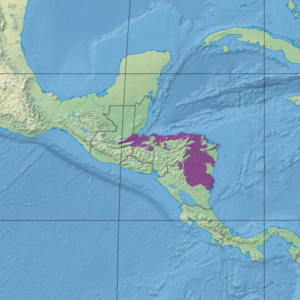 Ecoregion territory (in purple) | |
| Ecology | |
| Realm | Neotropic |
| Biome | Tropical and subtropical moist broadleaf forests |
| Geography | |
| Area | 89,979 km2 (34,741 sq mi) |
| Country | Honduras, Guatemala, Nicaragua |
| Coordinates | 13°45′N 84°45′W / 13.75°N 84.75°WCoordinates: 13°45′N 84°45′W / 13.75°N 84.75°W |

The Central American Atlantic moist forests ecoregion (WWF ID:NT0111) covers the lowland coastal forests of Honduras, southeast Guatemala, and the eastern forests of Nicaragua. Half of the ecoregion is closed-canopy tropical broadleaf evergreen forest, with tree heights reaching 50 meters.[1][2][3] This ecoregion has the largest single fragment of natural forest in Central America, with a size of 14,629 square kilometres (5,648 sq mi).[4] The total area is 89,979 square kilometres (34,741 sq mi).
Location and description[]
The ecoregion stretches for 700 km from the valley of Lake Izabal in southeastern Guatemala, across the northern coast of Honduras (in a 50 km wide strip), and down across most of the eastern half of Nicaragua. The mean elevation is 293 metres (961 ft), with a maximum of 2,270 metres (7,450 ft).
Climate[]
The climate of the ecoregion is Tropical monsoon climate (Köppen climate classification (Am)). This climate is characterized by relatively even temperatures throughout the year (all months being greater than 18 °C (64 °F) average temperature), and a pronounced dry season. The driest month has less than 60 mm of precipitation, but more than (100-(average/25) mm. This climate is mid-way between a tropical rainforest and a tropical savannah.[5][6] Average precipitation in the ecoregion is 2,333 mm/year.[4]
Flora and fauna[]
Half of the ecoregion is closed-canopy broadleaf evergreen rain forest, but with 30% of the territory converted agriculture. The remainder is open canopy evergreen forest or herbaceous wetland.[3] From 1990 to 2000, the ecoregion was experiencing deforestation at a rate of just under 1% per year. The ecoregion contains a number of large undisturbed fragments, which is important for larger species of animals. (The largest mammals require an estimated 100 km2 fragment to sustain viable populations).[4]
Protected areas[]
42% of the ecoregion is officially protected.[3] These protected areas include:
References[]
- ^ "Central American Atlantic moist forests". World Wildlife Federation. Retrieved March 21, 2020.
- ^ "Map of Ecoregions 2017". Resolve, using WWF data. Retrieved September 14, 2019.
- ^ a b c "Central American Atlantic moist forests". Digital Observatory for Protected Areas. Retrieved August 1, 2020.
- ^ a b c "An overview of forest biomes and ecoregions of Central America" (pdf). Routledge. Retrieved October 9, 2020.
- ^ Markus, Kottek; Grieser, Jürgen; Beck, Christoph; Rudolf, Bruno; Franz, Rubel (June 2006). "World Map of Koppen-Geiger Climate Classification Updated" (PDF). Gebrüder Borntraeger 2006. pp. 259–263. Retrieved September 14, 2019.
- ^ "Dataset - Koppen climate classifications". World Bank. Retrieved September 14, 2019.
- Neotropical tropical and subtropical moist broadleaf forests
- Ecoregions of Guatemala
- Ecoregions of Honduras
- Ecoregions of Nicaragua