Central Canada
Central Canada | |
|---|---|
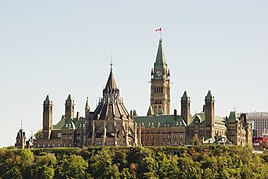    Clockwise from the top: Parliament Hill, Ottawa; Parliament Building, Quebec City; Montreal's Place d'Armes; Corner of Bay & King, Toronto | |
 Map of Central Canada, defined politically | |
| Composition |
|
| Largest city | Toronto |
| Largest metro | Greater Toronto Area |
| Area | |
| • Total | 2,265,154 km2 (874,581 sq mi) |
| Population (2016) | |
| • Total | 21,612,855 |
| • Density | 9.5/km2 (25/sq mi) |
Central Canada (French: Centre du Canada, sometimes the Central provinces) is a region consisting of Canada's two largest and most populous provinces: Ontario and Quebec.[1] Geographically, they are not at the centre of Canada but instead overlap with Eastern Canada toward the east. Because of their large populations, Ontario and Quebec have traditionally held a significant amount of political power in Canada, leading to some amount of resentment from other regions of the country. Before Confederation, the term "Canada" specifically referred to Central Canada. Today, the term "Central Canada" is less often used than the names of the individual provinces.
Geography[]
The longitudinal centre of Canada passes just east of Winnipeg, Manitoba; the geographic centre of Canada is located near Baker Lake, Nunavut.
Before Confederation, the region known as Canada was what is now called Central Canada. Southern Ontario was once called Upper Canada and later Canada West, and southern Quebec was called Lower Canada and later Canada East. Both were part of the United Province of Canada in 1841.[2]
Population[]
Combined, the two provinces have approximately 23 million inhabitants which represents 62% of Canada's population. They are represented in the House of Commons of Canada by 199 Members of Parliament Ontario: 121, Quebec: 78 out of a total of 338. The southern portions of the two provinces — particularly the Quebec City–Windsor Corridor — are the most urbanized and industrialized areas of Canada, containing the country's two largest cities, Toronto and Montreal and the national capital, Ottawa.
- Census Metropolitan Areas, 2016 Census[3]
- Toronto, ON: 5,928,040
- Montréal, QC: 4,098,927
- Ottawa, ON–Gatineau, QC: 1,323,783
- Québec, QC: 800,296
- Hamilton, ON: 747,545
- Kitchener, ON: 523,894
- London, ON: 494,069
- St. Catharines–Niagara, ON: 406,074
- Oshawa, ON: 379,848
- Windsor, ON: 329,144
- Sherbrooke, QC: 212,105
- Barrie, ON: 197,059
- Sudbury, ON: 164,689
- Kingston, ON: 161,175
- Saguenay, QC: 160,980
- Trois-Rivières, QC: 156,042
- Guelph, ON: 151,984
- Peterborough, ON: 121,721
- Brantford, ON: 134,203
- Thunder Bay, ON: 121,621
- Belleville, ON: 103,472
See also[]
| Look up Central Canada in Wiktionary, the free dictionary. |
- Central United States
- Great Lakes region
- List of regions of Canada
References[]
- ^ "National Post View: Couillard touts the force of Central Canada". National Post. 12 May 2015. Retrieved 8 November 2015.
- ^ Constitutional Act of 1791, Act of Union 1840, British North America Acts (1867)
- ^ Population and Dwelling Count Highlight Tables, 2016 Census
Canada | |||||
|---|---|---|---|---|---|
| History |
| ||||
| Provinces and territories |
| ||||
| Government |
| ||||
| Politics |
| ||||
| Geography |
| ||||
| Economy |
| ||||
| Society |
| ||||
| Demographics |
| ||||
| Culture |
| ||||
| Symbols |
| ||||
| Article overviews |
| ||||
| Research |
| ||||
| |||||
| |||||||||||||||||||||||||||||||||||||||||||||||||||||||||||||||||||||||
Coordinates: 50°N 79°W / 50°N 79°W

- Regions of Canada