Châteaubleau
Châteaubleau | |
|---|---|
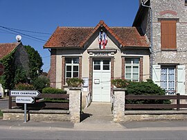 The town hall in Châteaubleau | |
show Location of Châteaubleau | |
 Châteaubleau | |
| Coordinates: 48°35′19″N 3°06′30″E / 48.5886°N 3.1083°ECoordinates: 48°35′19″N 3°06′30″E / 48.5886°N 3.1083°E | |
| Country | France |
| Region | Île-de-France |
| Department | Seine-et-Marne |
| Arrondissement | Provins |
| Canton | Nangis |
| Intercommunality | CC Brie Nangissienne |
| Government | |
| • Mayor (2020–2026) | Jean-Marc Desplats[1] |
| Area 1 | 3.4 km2 (1.3 sq mi) |
| Population (Jan. 2018)[2] | 361 |
| • Density | 110/km2 (270/sq mi) |
| Time zone | UTC+01:00 (CET) |
| • Summer (DST) | UTC+02:00 (CEST) |
| INSEE/Postal code | 77098 /77370 |
| Elevation | 120–150 m (390–490 ft) |
| 1 French Land Register data, which excludes lakes, ponds, glaciers > 1 km2 (0.386 sq mi or 247 acres) and river estuaries. | |


Châteaubleau is a commune in the Seine-et-Marne département in the Île-de-France région in north-central France.
It is located 16 km west of Provins and 9.5 km north east of Nangis. The inhabitants are called Castelblotins.
See also[]
- Communes of the Seine-et-Marne department
References[]
- ^ "Répertoire national des élus: les maires". data.gouv.fr, Plateforme ouverte des données publiques françaises (in French). 2 December 2020.
- ^ "Populations légales 2018". INSEE. 28 December 2020.
External links[]
| Wikimedia Commons has media related to Châteaubleau. |
- 1999 Land Use, from IAURIF (Institute for Urban Planning and Development of the Paris-Île-de-France région) (in English)
- Base Mérimée: Search for heritage in the commune, Ministère français de la Culture. (in French)
| show Communes of the Seine-et-Marne department |
|---|
| show Authority control |
|---|
This article related to a Seine-et-Marne location is a stub. You can help Wikipedia by . |
Categories:
- Communes of Seine-et-Marne
- Seine-et-Marne geography stubs