Chaltyr
Chaltyr
Чалтырь | |
|---|---|
Selo[1] | |
 Central part | |
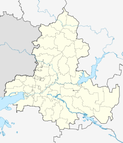
Location of Chaltyr  | |
 Chaltyr Location of Chaltyr | |
| Coordinates: 47°17′5.17″N 39°28′56.35″E / 47.2847694°N 39.4823194°ECoordinates: 47°17′5.17″N 39°28′56.35″E / 47.2847694°N 39.4823194°E | |
| Country | Russia |
| Federal subject | Rostov Oblast[1] |
| Administrative district | Myasnikovsky District[1] |
| Founded | 1779 |
| Population | |
| • Total | 15,334 |
| Time zone | UTC+3 (MSK |
| Postal code(s)[3] | 346800, 346801, 346802, 346803 |
| OKTMO ID | 60635452101 |

Chaltyr (Russian: Чалтырь, Armenian: Չալթր) is a rural locality (a selo) in Myasnikovsky District of Rostov Oblast, Russia. Population: 15,334 (2010 Census);[1] 14,711 (2002 Census).[4] It is also the administrative center of Myasnikovsky District and the largest settlement in the district.
Geography[]

Chaltyr is situated 11 km west of Rostov-on-Don. The village of Crimea (with 4,5 thousand inhabitants) directly adjoins Chaltyr from the north. Rivers Mokry Chaltyr and Khavaly flow through the settlement.
History[]
Chaltyr was founded in 1779 by Armenian settlers from the Crimea peninsula, whose real birthplace was the capital of medieval Armenia, the city of Ani. They speak the Nor-Nakhichevan (or Don, Crimean-Ani) dialect of Western Armenian language. Don Armenians still constitute a large part of the population of Chaltyr village and other settlements of Myasnikovsky District. The Church of the Ascension was founded in 1790.
In the years 1869 ― 1870, the railroad of Taganrog-Rostov line was being constructed through Mokry Chaltyr khutor. It was built and later maintained also by the local population.[5]
At the end of the XIX century, the peasants of Chaltyr village invented a new kind of strong, spring wheat that was called "Chaltyrka".[6]
Places of interest[]
- Church of the Ascension (Chaltyr), an Armenian Apostolic church built in the 19th century.
- Glory Memorial, a memorial to Soviet soldiers who died in World War II
- Museum of local history and ethnography[7]
- Chatal-Oba Mounds
References[]
- ^ a b c d e Russian Federal State Statistics Service (2011). Всероссийская перепись населения 2010 года. Том 1 [2010 All-Russian Population Census, vol. 1]. Всероссийская перепись населения 2010 года [2010 All-Russia Population Census] (in Russian). Federal State Statistics Service.
- ^ "Об исчислении времени". Официальный интернет-портал правовой информации (in Russian). 3 June 2011. Retrieved 19 January 2019.
- ^ Почта России. Информационно-вычислительный центр ОАСУ РПО. (Russian Post). Поиск объектов почтовой связи (Postal Objects Search) (in Russian)
- ^ Russian Federal State Statistics Service (21 May 2004). Численность населения России, субъектов Российской Федерации в составе федеральных округов, районов, городских поселений, сельских населённых пунктов – районных центров и сельских населённых пунктов с населением 3 тысячи и более человек [Population of Russia, Its Federal Districts, Federal Subjects, Districts, Urban Localities, Rural Localities—Administrative Centers, and Rural Localities with Population of Over 3,000] (XLS). Всероссийская перепись населения 2002 года [All-Russia Population Census of 2002] (in Russian).
- ^ История Чалтырского сельского поселения (in Russian). Retrieved 2017-02-16.
- ^ "ПЕРЕСЕЛЕНИЕ АРМЯН С КРЫМА НА ДОН". www.chaltlib.ru. Retrieved 2017-10-11.
- ^ Админ. "20 лет Чалтырьскому историко-этнографическому музею". www.voopiik-don.ru (in Russian). Retrieved 2017-11-08.
This Rostov Oblast location article is a stub. You can help Wikipedia by . |
- Rural localities in Rostov Oblast
- Rostov Oblast geography stubs