Changla Gali
Changla Gali | |
|---|---|
Town | |
 | |
 Changla Gali | |
| Coordinates: 33°59′18.63″N 73°23′17.91″E / 33.9885083°N 73.3883083°ECoordinates: 33°59′18.63″N 73°23′17.91″E / 33.9885083°N 73.3883083°E | |
| Country | |
| Province | Khyber-Pakhtunkhwa |
| District | Abbottabad District |
| Elevation | 2,804 m (9,199 ft) |
| Time zone | UTC+5 (PST) |

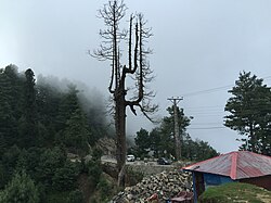
Changla Gali is one of the tourist mountain resort towns of the Galyat area of Pakistan. It has an elevation of 2804m.[1] During British rule it was the headquarters of the Northern Command School of Musketry.[2]
Location[]
Changla Gali is located in Seer Gharbi which is a Union Council of Abbottabad District, and is located 16 km north from the more famous Galyat town of Murree in Rawalpindi District.[1]
References[]
- ^ a b Changlagali - Government of the Punjab Archived 8 December 2007 at the Wayback Machine
- ^ Changlagali - Imperial Gazetteer of India 1908, v10, p173
| Wikimedia Commons has media related to Changla Gali. |
This Abbottabad District location article is a stub. You can help Wikipedia by . |
Categories:
- Hill stations in Pakistan
- Populated places in Abbottabad District
- Galyat of Pakistan
- Abbottabad District geography stubs