Chaurpati Rural Municipality
Chaurpati Rural Municipality
चौरपाटी गाउँपालिका | |
|---|---|
 Chaurpati Rural Municipality नेपालको नक्शामा चौरपाटी गाउँपालिका | |
| Coordinates: 29°10′54″N 81°07′44″E / 29.1818°N 81.1290°ECoordinates: 29°10′54″N 81°07′44″E / 29.1818°N 81.1290°E | |
| Country | |
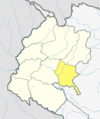
| Province | Sudurpashchim Province |
| District | Achham District |
| Government | |
| • Type | Local government |
| Area | |
| • Total | 182.16 km2 (70.33 sq mi) |
| Population | |
| • Total | 25,149 |
| • Density | 140/km2 (360/sq mi) |
| Time zone | UTC+05:45 (Nepal Standard Time) |
| Website | http://chaurpatimun.gov.np |

Chaurpati (Nepali: चौरपाटी ) is a Gaupalika(Nepali: गाउपालिका ; gaupalika) in Achham District in the Sudurpashchim Province of far-western Nepal.[1]
Chaurpati has a population of 25149.The land area is 182.16 km2.[2]
It was formed by merging Siudi, Sokot, Payal, Lunnga, Marku and Duni VDSs. Currently, it is divided into 7 administrative wards.[3]
References[]
- ^ "Ministry of Federal Affairs". Retrieved 6 July 2020.
- ^ "National Population and Housing Census 2011(National Report)" (PDF). Central Bureau of Statistics. Government of Nepal. 2012. Archived from the original (PDF) on 2013-04-18. Retrieved 2012-01-01.
- ^ http://chaurpatimun.gov.np/
Accham District | ||
|---|---|---|
Headquarters: Mangalsen | ||
| Urban municipalities |
|  |
| Rural municipalities |
| |
For former VDCs See here | ||
This article about a location in the Achham District of Nepal is a stub. You can help Wikipedia by . |
Categories:
- Rural municipalities in Achham District
- Rural municipalities of Nepal established in 2017
- Achham District geography stubs