Cheloor
Cheloor | |
|---|---|
village | |
| Coordinates: 10°33′0″N 76°19′0″E / 10.55000°N 76.31667°ECoordinates: 10°33′0″N 76°19′0″E / 10.55000°N 76.31667°E | |
| Country | |
| State | Kerala |
| District | Thrissur |
| Languages | |
| • Official | Malayalam, English |
| Time zone | UTC+5:30 (IST) |
| PIN | 680121 |
| Telephone code | 0480 |
| Vehicle registration | KL-45 |
| Nearest city | Thrissur |
| Lok Sabha constituency | Thrissur |
| Vidhan Sabha constituency | Irinjalakuda |

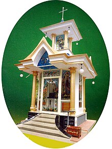
Chapel Americankettu
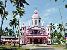
Cheloor Church

Cheloor Heights
Cheloor is a place in Irinjalakuda municipality, Thrissur district in the Indian state of Kerala. It is around 1 km from the famous Koodalmanikyam Temple.
Location[]
Cheloor is bordered by Edakulam on the south, Edathirinji on the west, Kanteshwaram on the north and Irinjalakuda town on the east.
Irinjalakuda and Moonupeedika are the nearest towns.
Transportation[]
Irinjalakuda Municipal Bus Stand and Irinjalakuda KSRTC Bus Stand are the nearest bus stands. Irinjalakuda Railway Station at Kalletumkara is the nearest railway station.
Places of worship[]
- Cheloor Kavu
- St. Mary's Church
- Mariyaman Kovil
- Vettathu Ambalam
- Panokkil Ambalam
Thamarath SreeRama Temple
Bank branches[]
•South Indian bank
References[]
This article related to a location in Thrissur district, Kerala, India is a stub. You can help Wikipedia by . |
Categories:
- Thrissur district geography stubs
- Villages in Thrissur district