Chepo River
| Chepo River | |
|---|---|
 | |
 Location of mouth | |
| Location | |
| Country | Panama |
| Physical characteristics | |
| Mouth | |
• coordinates | 8°59′53″N 79°06′49″W / 8.9980°N 79.1136°WCoordinates: 8°59′53″N 79°06′49″W / 8.9980°N 79.1136°W |
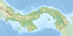
The Chepo River is a river of Panama in the Chepo District of Panama Province. It drains into the Pacific Ocean.
Course[]
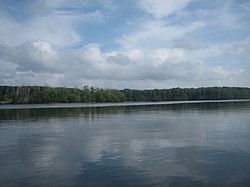
The uppermost reaches of the Chepo is alternately called the Bayano River after the construction of the Bayano Dam that resulted in the 350-square-kilometre (140 sq mi) lake reservoir.[1] The headwaters of the Chepo encompass watercourses running south from the San Blas Mountains near the Caribbean along with other rivers draining parts of the Majé and Darien Mountains.[2]
The Mamoni River is a major tributary farther down stream.
Measuring 206 kilometres (128 mi) in length, the Chepo-Bayano is the third longest river of Panama.[3]
, in the lower reaches, is the main riverine port.
See also[]
References[]
- ^ Panama Fishing and Catching
- ^ "In the rivers of Darien". Archived from the original on 2016-07-04. Retrieved 2012-04-17.
- ^ Bayano River Archived December 18, 2010, at the Wayback Machine
- Rand McNally, The New International Atlas, 1993.
- CIA map, 1995.
| hide Authority control | |
|---|---|
| General |
|
| National libraries | |
Categories:
- Rivers of Panama
- Gulf of Panama
- Geography of Panamá Province
- Drainage basins of the Pacific Ocean
- North America river stubs
- Panama geography stubs