Chetumal Province
Province of Chetumal u kuchkabal Chetumal (Yucatecan Mayan) | |||||||||||
|---|---|---|---|---|---|---|---|---|---|---|---|
| ca. 950–1544 | |||||||||||
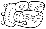 Emblem glyph of Lamanai
| |||||||||||
 Map of Yucatan showing Salamanca de Bacalar | |||||||||||
| Status | Dissolved | ||||||||||
| Capital | Chichen Itza; Mayapan; Chetumal | ||||||||||
| Common languages | Yucatecan Mayan | ||||||||||
| Religion | Mayan polytheism; Cult of Kukulkan | ||||||||||
| Government | Theocratic, absolute monarchy | ||||||||||
| King | |||||||||||
• ca. 1441-1446 | Ah Xiu Xupan (last) | ||||||||||
| Governor | |||||||||||
• ca. 1514–1544 | (last) | ||||||||||
| Historical era | Postclassic to Spanish conquest | ||||||||||
• Chichen Itza rule | ca. 950 | ||||||||||
| ca. 1250 | |||||||||||
| 1527–1544 | |||||||||||
| 4 March 1544 | |||||||||||
| |||||||||||
| Today part of | Belize; Mexico | ||||||||||
Chetumal, or the Province of Chetumal (/ˌtʃɛtʊˈmɑːl/ che-tuu-MAHL; Yucatec Maya: u kuchkabal Chetumal Mayan pronunciation: [u kutʃkaˈbal tʃetuˈmal]) was a Postclassic Mayan state in the Yucatan Peninsula.[1][2][note 1][note 2][note 3]
History[]
Pre-Columbian[]
Prior to Classic collapse[]
The first settlements in Chetumal were established by Palaeo-indians before 8000 BC, during the Lithic period of Mesoamerica.[note 4] The first permanent settlements in Chetumal are believed to have been established by Mayan farmers from the Guatemalan highlands by 2000 BC, during the Archaic period of Mesoamerica.[citation needed] The first state or province encompassing Mayan settlements in Chetumal is presumed to have been formed by 100 AD, during the Late Preclassic period of Mesoamerica.[citation needed]
Proximal to Classic collapse[]
The completion of the Classic Mayan collapse in Yucatan saw both the formation of Mayan provinces and the imperial expansion of Chichen Itza over these provinces, or their constituent cities.[3][4][5][6][note 5] The collapse does not seem to have been catastrophic in the (future) territory of Chetumal.[7][8] At least twenty-five settlements in the area are known to have survived, most likely by reorienting economic activity towards the Chichen Itza-driven coasting trade.[9][10][note 6] There is, nonetheless, evidence of limited social upheaval.[note 7]
Chichen Itza, established by Itza settlers in circa 750–800 AD, was the most powerful city-state in the Yucatan peninsula until circa 1050–1100 AD.[11][12][13][note 8][note 9] It appears to have started a sustained, and successful, programme of conquest in circa 900 AD, resulting in the formation of various provinces, possibly or likely including Chetumal.[5][3][6][note 10]
Posterior to Classic collapse[]

Mayapan succeeded Chichen Itza as the most powerful city-state in Yucatan during k'atun 8 ahaw, equivalent either to 1080–1104 AD, or to 1185–1204 AD. Its rule lasted thirteen k'atuno'ob, thereby ending either during 1392–1416 AD, or 1441–1461 AD.[14][note 11][note 12]
During circa 1450 to 1500 AD, Pachimalahix I, fifth ruler of the Acalan, led a military force to the Chetumal capital, and exacted tribute.[15][16][note 13] Further details on this event remain obscure, though given the reputed commercial pre-eminence of the provincial capital at the time, it has been suggested that Pachimalahix I rather raided the city to settle trade-related damages, rather than actually having exacted tribute.[17]
Columbian[]
First contacts with Spaniards[]
The first Spaniard known to have arrived in Chetumal was Gonzalo Guerrero, a sailor from Palos de la Frontera, Spain. In 1514, Guerrero entered the civil or military service in Chetumal. He was likely gifted to as a slave by a batab or mayor from the Ekab Province.[18][note 14] By 1519, Guerrero had fully assimilated to Mayan culture, having married Gov. Kan's daughter and fathered three children with her. Guerrero would thereafter devise or at least contribute to the military strategy of Chetumal and other Mayan states against at least three Spanish entradas.[19]
Three events pre-dating the 1514 arrival of Guerrero to Chetumal have been proposed as marking the first contact by residents of Chetumal with Spaniards:
- The 1511 arrival of Guerrero and his marooned shipmates to Cozumel[20][note 15]
- The 1508 voyage of Juan Díaz de Solís and Vicente Yáñez Pinzón to Lake Izabal[21][22][23]
- The 1502 voyage by Christopher Columbus to Guanaja
Mayan settlements near Cozumel, Lake Izabal, and Guanaja are known to have been part of the riverine and coastal trading networks of merchants in Chetumal. Any knowledge of non-Indian people obtained by the former is thus presumed to have been passed on to the latter. It has further been suggested that the Ekab Province may have been allied with Chetumal.[18]
Cuban expeditions to Yucatan[]
Hispano-Mayan hostilities commenced on 5 March 1517 in Cape Catoche, when an expeditionary force led by Francisco Hernández de Córdoba was ambushed by the military or militia of the Ekab Province, near that state's eponymous capital. The Hernández expedition were similarly received by neighbouring Mayan polities, thereby foiling the expedition's pecuniary aims. [24][note 16]
The expeditionaries' reports of grand Mayan cities would nonetheless spur further Cuban expeditions to Yucatan, including a 1518 trading and reconnoitering voyage by Juan de Grijalva and another in 1519 by Hernán Cortés, the latter of which quickly morphed into the 1519–1521 Spanish conquest of the Aztec Empire and the 1519–1521 smallpox epidemic.[25][note 17] The epidemic is presumed to have affected Chetumal severely. The reports likewise prompted the Governor of Cuba, who had commissioned the Hernández expedition, to petition and be granted letter patent authorising his conquest of the Mayan states on behalf of the Charles I of Spain. The newly-minted adelantado, however, did not proceed with the conquest of Yucatan.[26]
Montejo entrada, 1527–1528[]
On 8 December 1526, the Salamancan conquistador Francisco de Montejo, who had participated in the Grijalva and Cortés expeditions from Cuba, was granted letters patent for the conquest of Yucatan and Cozumel by Charles I of Spain. Unlike Gov. Velázquez, former holder of the patent, Montejo promptly undertook the called-for conquest.[27][28][note 18]
The adelantado named his close colleague, , likewise a participant in the Grijalva and Cortés expeditions from Cuba, the principal lieutenant for his entrada.[29] They engaged 4 ships and over 250 men in Seville, from where they embarked in late June 1527, landing in Cozumel in late September 1527.[30][31][note 19]
Northern campaign, autumn 1527 – summer 1528[]
They watered in Cozumel for a few days, upon their warm reception by residents and Naum Pat, an influential batab or mayor in Cozumel, and thereafter proceeded to the mainland.[32][note 20] They explored the immediate area, being well received by the nearby towns of Xelha and Zama, and founded a settlement, christened Salamanca, in October 1527.[33] Their substantial demands for foodstuffs soon grew irksome to locals, upon which Salamanca saw their supplies dwindle.[34] In late 1527 or early 1528, after a trying period of near-famine and disease, the Spanish moved northwards.[35] With Naum Pat’s intercession, they were well received throughout the Ekab Province.[36][note 21] They entered , capital of the Chikinchel Province, in spring of 1528.[37] A battle ensued, which Montejo won, thereby forcing Chikinchel to sue for peace.[38] They next headed to Ake, where the Battle of Ake was likewise won by Montejo, after which they headed back to Salamanca, reaching it mid- or late summer 1528.[39][note 22] Here, they were provisioned from Santo Domingo, whereupon they embarked on a combined entrada by land and sea southwards.[40]
Southern campaign, summer 1528[]
Montejo was to hug the coast with eight to ten men aboard the brigantine or caravel La Gavarra. Dávila was to take a parallel route by land, with the majority of the soldiers.[41][42] [note 23] The provincial capital of Chetumal, which had been set as the parties’ rendezvous point, was first reached by Montejo.[41][note 24] Unsure of the reception awaiting them, Montejo and his men kidnapped three or four residents under the cover of darkness to gather intelligence. Upon learning of Guerrero, now the nakom or commander-in-chief of the capital’s forces, Montejo dispatched one of the captives to the former, inviting the commander to break ranks and join the Spanish conquest. This being summarily spurned, the capital was prepared for battle.[43] The commander’s strategy was apparently to keep the Dávila and Montejo parties separated.[note 25] Guides were or had been sent, under pretence of alliance, to lead Dávila west of the capital, and thereafter inform him that the Montejo party had been lost. [44] The greater threat thus despatched, the capital turned towards Montejo. Feigning good will, residents ministered to Montejo and his men, and further informed the adelantado that the Dávila party had all perished. This bluff likewise worked, and the adelantado promptly set sail south towards Ulua River, and then back north towards Salamanca.[45][46] Montejo soon discovered the ruse, and determined to gather reinforcements at Veracruz for a renewed offensive on Chetumal.[note 26] He most likely set sail for that city in summer 1528.[47][note 27]
Davila entrada, 1531–1533[]
In early 1531, the adelantado, having brought the Chakan, Can Pech, and Ah Canul Provinces under Spanish authority, promptly set about planning a renewed campaign towards Chetumal.[48] Alonso Dávila was appointed to lead the expedition of circa fifty men.[49][50][note 28]
Waymil–Chetumal campaign, summer 1531[]
Dávila set out from the provincial capital of Can Pech in mid-1531.[51][50] They marched through the Mani and Cochuah Provinces unopposed, shortly thereafter reaching Chable, a town in the Waymil Province.[52] Pre-eminent individuals in town promptly offered assistance, and were despatched to the provincial capital of Bacalar to summon the batab or mayor.[note 29] The summons being rebuffed, Dávila marched on, leaving half of his men in Chable.[53][54][note 30][note 31] They next reached Maçanahau, a large town close to Lake Bacalar. Being well received, Dávila and his men stayed here for three weeks, during which time the diplomatic aid of leading individuals from various provincial towns seems to have convinced the batab or mayor of Bacalar to not oppose the entrada.[55][56][note 32] Consequently, the party continued their march to Bacalar unopposed. An overland march to Chetumal, Dávila soon found out, was not possible. Sea transport on several large canoes was thus arranged.[57][58] They disembarked at Chetumal unopposed, as the capital had been deserted. Nevertheless, per his instructions, Dávila decided to found a town in Chetumal. The rest of the party, who had been left in Chable, were called for, and the new settlement at Chetumal christened Villa Real.[57][59][note 33]
Settlement and siege of Villa Real, summer 1531 – autumn 1532[]
In the next two months, the Governor of Chetumal, Nachan Kan, rallied the provincial forces at Chequitaquil, a coastal town four leagues north of the capital. On learning this, Dávila ordered a pre-emptive strike. A unit of circa twenty-five soldiers took the encampment by surprise. The assault was a partial success, resulting in the death of many of the provinces men, imprisonment of over sixty, and dispersal of all others. The principal target, Gov. Kan, had nonetheless made his escape.[60][61][note 34]
Now safely ensconced at the Chetumal capital (now Villa Real), Dávila set out with twenty men on a survey of the newly-Spanish territory towards Maçanahau. Upon reaching Bacalar, Dávila, to his great surprise, was informed that residents of Maçanahau and other provincial towns of Waymil had resolved to oppose him. The towns and their access roads had been barricaded. The opposition, though, was soon routed.[62][63][note 35] In the meantime, the recently-conquered Cochuah Province had revolted. Dávila resupplied at Villa Real and set off with twenty-two men to suppress the revolt.[64][65][note 36] Unlike the limited rebellion in Waymil, the Cochuah revolt proved serious and widespread, forcing Dávila to retreat to Villa Real.[66][67] The Spanish settlement was now under heavy siege. With only some thirty men fit for combat, five horses, and depleting stores, their situation was precarious.[68][61][note 37]
Dávila soon learnt of a sizeable convoy preparing to set sail near Villa Real for trade towards the Ulua River. He had the merchants and their articles seized.[note 38] Since his prisoners included the son of the batab or mayor of Tapaen, a provincial town in Waymil, Dávila kept the son hostage and despatched two merchants to summon the mayor, who promptly called. The mayor was given a month to secure communication with the adelantado in the capital of the Can Pech Province, and promised his son in return. Believing his son would be released regardless, the mayor dallied. Upon learning of the mayor's ill faith, Dávila had him and his retinue tortured.[note 39] To prove "whether the son had more love for the father, than the father had for the son," Dávila now despatched the mayor's son to the adelantado in Can Pech, keeping the mayor hostage.[69] This arrangement also faltered.[70][note 40]
Retreat from Villa Real, autumn 1532 – spring 1533[]
The siege wore on for months, as it became increasingly clear to the men that the situation was untenable.[71] In autumn 1532, Dávila and the cabildo or town council resolved to retreat to Trujillo by sea.[72][73][note 41] They reached Puerto Caballos in spring 1533, after an arduous journey of seven months.[74][75][note 42]
Pacheco entrada, 1543–1544[]
In April 1543, the Adelantado commissioned Gaspar Pacheco to conquer Chetumal and Waymil. Pacheco enlisted twenty-five to thirty men in Merida, and named Melchor Pacheco his principal subordinate, and Alonso Pacheco third in command.[76][note 43] The expedition set out in late 1543 or early 1544.[77]
Pacheco and his men first reached the Spanish-controlled Cochuah Province. Their demands on the war-stricken residents here proved impossible to meet. The party nonetheless impressed men and women as servants, and seized so much food as to reduce the province to famine.[78] At this point, having fallen ill, Gaspar Pacheco tasked Melchor Pacheco, his second-in-command, with the conquest of Waymil and Chetumal.[78][79][note 44]
Marching onwards to Waymil and Chetumal, the Pachecos soon discovered that residents had burnt their crops and fled to the woods, determined on guerrilla warfare to oppose them.[80] Exasperated, the Pachecos now resorted to wanton acts of cruelty, including:
- clubbing captives to death,
- drowning captives,
- sicking dogs on unarmed civilians, and allowing the dogs to maul them to death, and
- mutilating captives.[81][note 45][note 46][note 47]
The Spanish thus avoided a war of attrition. By early 1544, local opposition was so inconsequential as to convince the Pachecos to establish a town, christened Salamanca, in the ruins of Bacalar.[81][note 48] The victory proved pyrrhic, as the entrada resulted in very significant depopulation of the Waymil and Chetumal Provinces, thereby ensuring the permanent poverty of Salamanca.[82][83]
Society[]
Religion[]

Chichen Itza is known to have (coercively) sponsored the pre-eminent worship of K'uk'ulkan.[84][note 49] The Cult of K'uk'ulkan is thought to have been the first state religion to transcend linguistic and ethnic differences in Mesoamerica.[85] The Cult is believed to have strengthened or been strengthened by the peninsular coasting trade.[86]
It has been suggested that the province was home to a cult of Itzamna which focussed on the god's connection to large ocean creatures.[87][note 50] He has featured prominently in material finds from Chetumal which, unusually, frequently depict him emerging from the jaws of sea creatures.[88][note 51]
Government[]
Pre-Columbian[]
Chichen Itza is believed to have been governed either by a multepal or council of lords, or by a king and a privy council.[89][12][note 52][note 53] It has been suggested that the city-state's realm was administered as a confederacy of provinces.[90]
Mayapan is commonly held to have been ruled by a multepal or council of lords, composed of members from the Canul, Chel, Cocom, Cupul, and Xiu ch'ibalo'ob or noble houses.[91][90][92][93][note 54] Its realm is believed to have been organised as a confederation of provinces, called the League of Mayapan, each of which was overseen by a kalwak or governor.[94][note 55][note 56]
Columbian[]

Chetumal's form of government as a sovereign province is presumed to have (i) remained significantly the same throughout its sovereign period, and (ii) not been significantly different from that of nearby provinces with a halach winik or governor, like Ceh Pech, Mani, and Sotuta.[95]
State offices[]
Chetumal's head of state and government was the halach winik or governor, who would also have been the batab or mayor of the province's eponymous capital.[95] His office and title (Ahaw or Lord) were hereditary, and his rule considered a divine right.[note 57] The office's powers and duties included—
- exacting tribute from cities, towns or hamlets,
- conscripting men for military service in times of war,
- conducting war,
- sitting as the highest tribunal for inter-municipal conflicts,
- officiating religious ceremonies of state.[95]
At least one of Chetumal's later governors is known to have held authority over at least part of a neighbouring province (Waymil).[note 58] This was likely effected through the threat of force, rather than diplomacy, as said authority was only reluctantly acceded to.[96][53]
Local offices[]
Immediately subject to the governor were the batabo'ob or mayors of the cities, towns and hamlets of the province.[note 59] This office was likewise hereditary.[note 60] The office's powers and duties included–
- having a town farm kept for his pecuniary benefit,
- keeping houses and farms in order,
- sitting as a tribunal of original civil and criminal jurisdiction,
- maintaining the military or militia in times of peace.[95]
The constitution of local government has not been fully elucidated. The following offices were nonetheless known to have been involved in at least some cities, towns or hamlets—
- nakomo'ob or commanders-in-chief, who exercised municipal military authority in the mayor's stead in times of war,
- kuch kabo'ob or aldermen, who severally exercised at least executive authority over kuchteelo'ob or wards, and who jointly, in court or council assembled, exercised veto power over at least some of the mayor's executive, judicial, or military decisions[note 61]
- kulelo'ob or town officers, who carried out the mayor's orders.[note 62]
Local government were also responsible for administering the commons, which included all municipal land, as private land ownership either did not exist or was forbidden.[note 63] It is not clear whether non-municipal land within the province was likewise held in common.[97]
Economy[]
Capital[]
At least since circa 1450, the provincial capital was a major port of call for the peninsular coasting trade from the Ulua River or the Bay Islands to the Ekab Province.[98][99] It was, at least towards the Columbian period, a large town of circa 2,000 houses, abutted by sapodilla and cacao orchards, maize fields, and apiaries of stingless bees.[100] Its merchant class fully occupied one-fourths of Nito, an out-of-province port of call on Dulce River.[101] It traded the province's cacao, honey, wax, and marine products for obsidian, jade, turquoise, copper, and gold.[99]
Provincial[]
The province was the only significant cacao-producer in Yucatan.[98] It provided the capital's merchants with cacao, honey, wax, and marine products.[99] Articles for local consumption are thought to have included–
- pottery from Lamanai and settlements on Honey Camp Lagoon,[102]
- salt and salted fish from settlements on the .[103][note 64]
Legacy[]
Scholarly[]


None of Chetumal's records are extant.[note 65] Consequently, all scholarship on the province has relied on later Hispano-Mayan records and modern archaeology.
Archaeological work in Chetumal was begun in early 1894 by Thomas Gann, a medical officer of colonial Belize, in the ruins of Santa Rita, Corozal.[104][105][106][107][note 66][note 67][note 68] His copious work spurred further explorations and excavations in Belize and Mexico by the University of Liverpool, British Museum, Carnegie Institution, Field Museum, Sir J. E. S. Thompson, and Sylvanus Morley.[108][109][110][111][note 69] He collaborated with Sir Thompson on Gann & Thompson 1931, the first panoptic survey of Mayan history for the general public.[112] His collections of Mayan artefacts remain in the British Museum, George Gustav Heye Center, National Museums Liverpool, and Middle American Research Institute, with the British Museum receiving the first known collection of Mayan jades.[113][114][115][note 70] It has been suggested that his work prompted the first legislative protections for antiquities in colonial Belize in 1894, and their subsequent strengthening in 1897, 1924, and 1927.[116][117][note 71]
After Dr. Gann, archaeological work in Chetumal languished until the 1964–1970 Altun Ha Expedition of the Royal Ontario Museum.[118][119][note 72][note 73] The project was pushed for by the Archaeological Commissioner of colonial Belize, , and led by David M. Pendergast.[120] The substantial corpus generated quickly prompted a renaissance of archaeological work in Chetumal, which has continued to the present day.[121]
Historical work on the Postclassic Mayan states was first published by the Merida-based polymath in 1896.[122][note 74] This was followed by the 1943 and 1957 publications of the Carnegie Mayanist, .[122][note 75] The latter of these has become the authoritative text on the subject, and is most commonly cited as the first of its kind, being significantly more rigorous and complete than preceding works.[123][124][note 76] Despite this progress, Chetumal remained one of the least elucidated provinces until a seminal 1989 publication by , then a Professor at Davidson College.[125][126]
Social[]
In Mexico[]

The modern city of Chetumal, established 5 May 1898 by Vice-Admiral Othón P. Blanco, was named in honour of the eponymous Postclassic capital of the Chetumal Province.[127]
The Guerrero–Kan family are widely believed to have been the first Mestizo family in the Americas.[128] Various public works of art depicting them have been installed in Yucatan and Quintana Roo. These include:
- an untitled sculpture by , installed in Akumal in January 1975[129]
- at least 25 replicas or near-replicas of the aforementioned Ayala Arellano sculpture, including one inaugurated on 16 November 1980 by the 58th President of Mexico, José López Portillo, in Merida[130]
- Nacimiento de la raza mestiza (lit. Birth of the Mestizo Race) by , a mural for the Palacio de Gobierno in Chetumal in 1979[131]
- Forma, color e historia de Quintana Roo (lit. Form, Colour and History of Quintana Roo) by , a mural inaugurated in Chetumal in 1981 by former Mexican President José López Portillo[132]
- Alegoría del mestizaje (lit. Allegory of Miscegenation) by , a sculpture inaugurated in Chetumal on 1 April 1981, by the 1st Governor of Quintana Roo, Jesús Martínez Ross[133]
- Cuna del mestizaje (lit. Trade of Miscegenation) by and , a sculpture inaugurated in Chetumal on 25 October 1996 by the 61st President of Mexico, Ernesto Zedillo[134]
- La cuna del mestizaje by , a mural installed 17 November 2007 in the Museum of Mayan Culture, Chetumal[132]
- Gonzalo Guerrero by Fernando Castro Pacheco, an oil painting for the Palacio de Gobierno in Merida[132]
Cancun's residents, upon the arrival of Juan Carlos I and Queen Sofía of Spain on 16 November 1978, gifted the monarchs a turtleshell statuette of Gonzalo Guerrero.[135][136] Quintana Roo's state anthem, introduced 14 January 1986, celebrates the Guerrero–Kan family.[137][138] Othon P. Blanco's highest civic honour, introduced 29 September 1997, was named after Guerrero.[139]
In Belize[]
On 20 December 2012, the and the Belize Tourism Industry Association held a public re-enactment of the Guerrero-Kan wedding at Santa Rita, Corozal.[140][141] Public re-enactments have been held on 22 March 2014, 5 February 2015, 20 February 2016, 6 July 2017, 19 May 2018, and 29 March 2019.[142][143][144]
Notes[]
- ^ The Yucatecan Mayan orthography in this article follows that of Barrera Vásquez et al. 1980, pp. 41a–44a. At least two other orthographic systems exist (Lehmann 2018, sec. 2.1, 3), neither of which is used in this article. Accordingly, kuchkabal, and Chetumal and its synonym Chakte'mal are preferred over several variations thereof, per Barrera Vásquez et al. 1980, pp. 91, 344.
- ^ Various dates for periods of the Mesoamerican chronology have been given. This article uses those provided by Sharer & Traxler 2006, p. 98—
- Lithic – 8000 BC and prior dates,
- Archaic – 8000 to 2000 BC,
- Preclassic – 2000 BC to 250 AD,
- Classic – 250 to 900 AD, and
- Postclassic – 900 AD and posterior dates.
- ^ The Chetumal Province has been called a chiefdom by some authors. A distinction has been made, however, between chiefdoms and states, the latter being characterised by more complex forms of sociopolitical organisation than the former (Sharer & Traxler 2006, p. 73, Rice 2004, pp. 4–7). Accordingly, the province is herein designated a state, and not a chiefdom.
- ^ As of 2016, evidence of Palaeo-indian presence in Chetumal include— (i) an undated, fishtail projectile point recovered near present-day Orange Walk (Stemp, Awe & Helmke 2016, pp. 71–72), (ii) an undated, lanceolate projectile point recovered from (Stemp, Awe & Helmke 2016, pp. 71–72).
- ^ It is not clear whether Chichen Itza's expansion across Yucatan came before, during, or after the formation of Postclassic Mayan provinces (Roys 1957, p. 3).
- ^ Namely–
- on New River – Cerros, Aventura, Lamanai, San Estevan, Chau Hiix, and one unnamed site (Aimers 2007, p. 343, Demarest, Rice & Rice 2004, pp. 378, 402),
- on Hondo River – Nohmul, Consejo, Chan Chen, San Antonio (Aimers 2007, p. 343),
- on Corozal Bay – Santa Rita (Aimers 2007, p. 343, Demarest, Rice & Rice 2004, p. 378),
- inland – Altun Ha, Colha, Honey Camp Lagoon / Laguna de On, Kichpanha (Aimers 2007, p. 343, Demarest, Rice & Rice 2004, p. 378),
- on Ambergris Caye – Marco Gonzalez, San Juan, Chac Balam (Aimers 2007, p. 343),
- on – Cabbage Ridge / Saktunja (Demarest, Rice & Rice 2004, p. 368),
- on – , and five unnamed sites (Demarest, Rice & Rice 2004, pp. 368–370).
- ^ Namely–
- Colha is thought to have been attacked and thereafter settled by northern polities, (patterns in its Postclassic material culture have been described as "totally different from those of the Classic period") (Aimers 2007, pp. 343–344, Demarest, Rice & Rice 2004, pp. 375, 378),
- Nohmul is thought to have been attacked and thereafter settled by northern polities (Aimers 2007, p. 344, Demarest, Rice & Rice 2004, p. 390),
- mass executions of the local aristocracy have been suggested (Aimers 2007, p. 344).
- ^ The city is known to have been conquered or sacked towards circa 1050–1100 AD (Sharer & Traxler 2006, pp. 591–592). Later Columbian-period accounts hold that Hunak Ke'el, ruler of Mayapan, conquered Chichen Itza, thereby cementing his city's rule over the latter's dominions (Sharer & Traxler 2006, p. 592, Barrera Vásquez et al. 1982, p. 247).
- ^ At least three other dates proximal to the 1050–1100 AD date have been suggested for the end of Chichen Itza's dominance over the Yucatan peninsula–
- 1000–1050 AD (Demarest, Rice & Rice 2004, p. 520),
- 1100–1200 AD (Demarest, Rice & Rice 2004, p. 520),
- 1200–1250 AD (Roys 1957, p. 3).
- ^ Said conquest most likely extended at least throughout central Yucatan (Sharer & Traxler 2006, p. 568). It has been further suggested that the city-state established direct rule, whether by conquest or the threat thereof, over key ports in the coasting trade which circumnavigated Yucatan, from the Chontalpa region to the Bay Islands (Sharer & Traxler 2006, pp. 567, 570). One of these may have been Nohmul in Chetumal, where a colonnaded courtyard building, apparently styled after those of Chichen Itza, has been excavated (Sharer & Traxler 2006, p. 579).
- ^ Various Columbian-period accounts detail Mayapan's history during these thirteen k'atuno'ob. However, two k'atuno'ob were in use then— (i) the Classical k'atun of 7,200 days (circa 19.713 tropical years), and (ii) a later ahaw k'atun of circa 24 tropical years. This has resulted in much uncertainty regarding Mayapan's chronology (Sharer & Traxler 2006, pp. 596–597).
- ^ It has been suggested the rise of Mayapan was preceded by a breakdown of the peninsular coasting trade (Demarest, Rice & Rice 2004, p. 375).
- ^ The Acalan were an ostracised group from Cozumel who settled the Tenosique valley on the Usumacinta River. This event is tentatively dated to during 1350 to 1375 by Scholes & Roys 1968, p. 79, upon the following calculus— (i) a six-generation pedigree of Acalan rulers ranging from the date of their expulsion from Cozumel to the death of their sixth ruler in circa 1526, (ii) a 30-year period-in-office per ruler (Scholes & Roys 1968, p. 89). This places the fifth ruler's time in office during circa 1465 to 1496.
- ^ The Ekab Province seems to have lacked a halach winik or governor, and was likely rather organised as a confederation of towns. It has been suggested that the Pat ch'ibal or noble house were the most influential in the province (Roys 1957, p. 143).
- ^ Jones 1989, p. 27 gives their arrival date as 1512.
- ^ Antón de Alamilla, chief pilot of the flotilla of 3 ships and over 100 men, seems to have convinced Hernández de Córdoba to sail directly westwards of Cuba, thereby taking them to the Ekab Province. (The expedition's initial destination was apparently either the Bahamas or the Bay Islands.) Alamilla had sailed with Christopher Columbus on his fourth voyage of 1502–1504 (Chamberlain 1948, p. 11).
- ^ The Grijalva expedition, of 4 ships and 250–300 men, and the Cortés one, of 10 ships and circa 400 men, were piloted by Antón de Alamilla, and included Pedro de Alvarado, Alonso Dávila, and Francisco de Montejo as principal subordinates. The former's survey of Laguna de Términos led to a mistaken belief that Yucatan was an island (Chamberlain 1948, pp. 13–15).
- ^ The petition was formally made on 16 November 1526, and supported Pánfilo de Narváez and . His letters patent required that the conquest begin within a year (Chamberlain 1948, pp. 19–20, 22).
- ^ The ships were— (i) the San Jerónimo, Miguel Ferrer master, (ii) Nicolasa, Ochoa master, (iii) La Gavarra, master not named, and (iv) a fourth unnamed ship, master likewise not named. The adelantado’s principal subordinates were Alonso Dávila, Antón Sánchez Calabrés, Pedro de los Ríos, Pedro de Añasco, Pedro de Lugones, Pedro González, Hernando Palomino, Pedro Gaitán, and possibly Andrés de Calleja and Roberto Alemán. Crown representatives Pedro de Luna and Hernando de Cueto accompanied the expedition, as did frays Juan Rodríguez de Caraveo, Pedro Fernández, and Gregorio de San Martín. The flotilla was thoroughly refitted at Santo Domingo (Chamberlain 1948, pp. 31–35).
- ^ It has been suggested that the Pat ch'ibal or noble house were the most influential house in the Ekab Province, which is thought to have encompassed Cozumel (Roys 1957, p. 143). At least two towns are known to have existed in Cozumel prior to the Spanish conquest. These were later known as San Miguel Xamancab and Santa María Oycib. A third town, possibly Tantun, has been suggested (Roys 1957, p. 155).
- ^ The Spanish chanced upon Naum Pat at , and readily accepted his offer of diplomatic aid (Chamberlain 1948, pp. 45–46). Good will was further maintained by the fluency in Yucatecan Mayan of some officers and friars, fine displays of horsemanship, and strict discipline. Note that horses inspired awe and terror in the locals, the latter being unaccustomed to the former (Chamberlain 1948, pp. 46–48).
- ^ Their traverse may have involved engagements with the military or militia of the Sotuta and Kupul Provinces (Chamberlain 1948, p. 58).
- ^ A small contingent of twenty men stayed at Salamanca, under Alonso de Luján. They were to build a small craft and follow Montejo post haste (Chamberlain 1948, p. 60). It is not immediately clear how many men constituted the Dávila party. The La Gavarra, which provisioned the men from Santo Domingo, is thought to have found seventy to seventy-five men at Salamanca, suggesting a party of fifty to fifty-five men accompanied Dávila southwards (Chamberlain 1948, pp. 59–60). On the other hand, Jones 1989, p. 26 gives the number as circa forty soldiers in the Dávila party.
- ^ The details of their crossing the barrier reef, and of their navigating its inner waters, are not clear, though this was apparently accomplished with their brig, the ‘’La Guevarra’’, rather than with a much smaller craft of lower draught (Chamberlain 1948, pp. 60–61, 63).
- ^ Chetumal seems to have known of the Dávila party in advance, though it is not clear that they similarly knew of the Montejo party until the adelantado’s note to Guerrero. Dávila was at present thirty leagues north of the capital (Chamberlain 1948, pp. 62–63).
- ^ Salamanca had been removed north towards Xamanha by Dávila and Lujan. The Chetumal capital seems to have been determined as the immediate target due to its exceedingly good harbour (Chamberlain 1948, pp. 64–65).
- ^ By December 1528, Montejo and his alférez mayor, Gonzalo Nieto, had engaged sufficient men, provisions, and two large vessels in Veracruz and Mexico City for a renewed campaign (Chamberlain 1948, pp. 69–70). These plans were abruptly upset, however, when the adelantado received the Real Audiencia of Mexico's authorisation to conquer the Tabasco and Acalan regions of New Spain (Chamberlain & 1948 1948, pp. 71–72).
- ^ Dávila's men included the adelantado's fifteen-year-old nephew, Francisco de Montejo, and thirteen cavalry. In addition, two Yucatecan Mayan interpreters, a mining expert (Francisco Vázquez), and possibly a friar accompanied them (Chamberlain 1948, p. 100).
- ^ It has been suggested that this assistance was compelled by force of arms, rather than freely proffered (Jones 1989, p. 30).
- ^ The batab or mayor of Bacalar was apparently under the authority of the Governor of Chetumal, Nachan Kan. (The Waymil Province seems to have lacked a halach winik or governor, and was likely rather organised as a confederation of towns, per Jones 1989, p. 40.) Notably, his reply to Dávila's summons declared that Waymil or Chetumal would give his men "[tribute of] fowls in the form of their [the locals'] lances and maize in the form of their arrows" (Chamberlain 1948, pp. 101–102). This reply is rather attributed to Gov. Kan by Jones 1989, pp. 30–31, who quotes the governor as stating that he would not come meet Dávila "but would rather declare war, giving [them] the chickens on spears and the maize on arrows."
- ^ Jones 1989, pp. 30–31 asserts that mediators from Chable were rather despatched to the capital of Chetumal, to summon Gov. Kan, and not the Waymil capital of Bacalar, since the former held authority over the latter, thereby making him the more suitable person for Dávila to deal with. The Chable messengers would have nonetheless passed Bacalar en route to Chetumal (Jones 1989, p. 31).
- ^ Leading residents of Chable, who had previously proffered assistance upon Dávila's arrival, had accompanied the reduced expedition to Maçanahau. Dávila had further received offers of mediation from respected residents of Maçanahau and Yuyumpeten, a nearby town (Chamberlain, p. 102).
- ^ The adelantado had instructed Dávila to establish a Spanish settlement wherever Dávila thought best. The new town would apparently serve to administer the Cochuah, Waymil and Chetumal Provinces, once these were all under Spanish rule. One of the founding regidores or councilmen of Villa Real was Montejo, the young nephew of the eponymous adelantado (Chamberlain 1948, p. 103). The alcaldes or mayors were Martín de Villarubia and Francisco Vázquez, and the remaining regidores were Cristóbal Cisneros, Blas Maldonado, and Alonso de Arévalo (Jones 1989, p. 38).
- ^ The assault yielded over sixty prisoners and loot worth circa 600 to 1,000 pesos. The capital's commander-in-chief, Gonzalo Guerrero, is presumed to have been with Gov. Kan at Chequitaquil, and to have likewise escaped. The captives, however, informed Dávila that Guerrero had previously died (Chamberlain 1948, pp. 104–105, Jones 1989, p. 33).
- ^ First at Maçanahau, then at Chable (Chamberlain 1948, pp. 105–106).
- ^ Leaving some twenty-odd men at Villa Real. At Bacalar, some 600 locals from the various towns of Waymil, including many provincial or municipal officers, accompanied Dávila to Cochuah (Chamberlain 1948, pp. 107–108). Some to most of the Waymil allies would later desert Dávila to join the Cochuah revolt (Chamberlain 1948, pp. 109–110). It has been suggested that the Governor of Chetumal, Nachan Kan, and his commander-in-chief, Gonzalo Guerrero, played a part in spreading the revolt (Chamberlain 1948, p. 116).
- ^ Eleven of the fifty-odd men who had set out from the Can Pech capital in mid-1531 had died, leaving some forty men at Villa Real, of whom ten were reportedly maimed (Chamberlain 1948, pp. 116–117).
- ^ By a small party, led by Martín de Villarubia (Chamberlain 1948, p. 117, Jones 1989, p. 38).
- ^ The mayor had been summoned to Villa Real upon the expiration of the month he had been given (Chamberlain 1948, p. 117).
- ^ The mayor's son had also been given a month to secure the adelantado's reply. When said time was up, Dávila had led a detachment to Tapaen, where he was informed by captives that the mayor's son had made no attempt to reach the Can Pech capital (Chamberlian 1948, p. 118).
- ^ Villa Real was to be re-established somewhere south of the Chetumal capital, if possible (Chamberlain 1948, pp. 119–120).
- ^ The retreat, aboard thirty-two canoes, was led by (captive) local merchants. Though swift and surreptitious, locals learnt of the retreat, and unsuccessfully pursued the Spanish for a day (Chamberlain 1948, pp. 120–121). Dávila and his men, despite the able guidance of their captive merchants, sailed only six to seven leagues each day, constantly fighting a treacherous sea. Raids on riverine settlements, and craft and goods seized from travelling merchants, supplemented the Spaniards' stores (Chamberlain 1948, pp. 122–124).
- ^ The date is given as 3 January 1543 in Jones 1989, p. 41.
- ^ Gaspar Pacheco returned to Merida to recuperate. Alonso Pacheco was now Melchor Pacheco's principal subordinate (Chamberlain 1948, p. 233).
- ^ It has been suggested that Melchor Pacheco's second-in-command, Alonso Pacheco, was the officer most responsible for these acts (Chamberlain 1948, p. 234). The lack of clergymen in the expedition has further been cited as a contributing factor (Chamberlain 1948, p. 234).
- ^ The Pacheco entrada is now commonly described as one of, if not the, bloodiest and cruelest campaigns in the Spanish conquest of Yucatan (Chamberlain 1948, p. 233, Jones 1989, p. 42). On 10 February 1548, Franciscan Fray Lorenzo de Bienvenida described it to Charles I of Spain thus–
(Fray Bienvenida established a mission in Bacalar in circa 1546, and may have stayed there for about a year (Jones 1989, pp. 42–43).) In circa 1566 in Relación de las cosas de Yucatán, Bishop Diego de Landa similarly reported–Nero was not more cruel than this man [Alonso Pacheco]. He passed forward [from the Cochuah Province] and reached a province called Chetumal, which was at peace. Even though the natives did not make war, he robbed the province and consumed the foodstuffs of the natives, who fled into the bush in fear of the Spaniards, since as soon as [A. Pacheco] captured any of them, he set the dogs on them. And the Indians fled from all this and did not sow their crops, and all died of hunger. I say all, because there were towns [in Chetumal] of five hundred and one thousand houses, and now [10 Feb. 1548] one which has one hundred is large. This province [of Chetumal] was also rich in cacao. This captain [A. Pacheco], with his own hands committed outrages: he killed many with the garrote, saying, "This is a good rod with which to punish these people," and, after he had killed them, he said, "Oh how well I finished them off." Tying them to stakes, he cut the breasts off many women, and hands, noses, and ears off the men, and he tied squashes to the feet of women and threw them in the lakes to drown merely to amuse himself. He committed other great cruelties which I shall not mention for lack of space. He destroyed the entire province. [Then the Spaniards] founded a town of eight vecinos, which is called Salamanca, a halting town which has neither a cleric nor a church, nor do the Spaniards there confess, since the town is sixty leagues from this city [of Merida]. If [the Chetumal Province] had not been destroyed it would have supported [a town of] thirty men [vecinos]. And for his cruelties they [the cabildo of Merida] returned this captain [A. Pacheco] to the province which he destroyed and gave him its best Indians, and in doing this they did not give him something which was of small value. Such is the justice rendered in this land. (Chamberlain 1948, p. 235).
The Indians of the provinces of Cochua and Chetuma revolted, the Spaniards pacified them in such a way, that these provinces which were formerly the thickest settled and the most populous, remained the most desolate of all the country; committing upon them unheard-of cruelties, cutting off noses, arms and legs, and the breasts of women; throwing them into deep lagoons with gourds tied to their feet; stabbing the little children because they did not walk as fast as their mothers; and if those whom they drove along, chained together around the neck, fell sick or did not move along as fast as the others they cut off their heads between the others, so as not to stop and untie them. With like inhuman treatment as this did they drag along in their train for their service a large number of male and female captives. And it is said the Don Francisco de Montejo did not commit any of these barbarities nor was he present at them. On the contrary they seemed very evil to him, but he could do nothing more. (Jones 1989, pp. 43, 301)
- ^ Criminal charges were brought against the Pachecos for cruelties committed during their entrada. The Spanish Crown further commissioned an enquiry (Chamberlain 1948, p. 236). The Adelantado, Francisco de Montejo, was ultimately held responsible for these and other alleged crimes (Jones 1989, p. 301, no. 23, García Bernal 2018, para. 24).
- ^ The date of the founding of Salamanca is broadly given as prior to the end of 1544 in Jones 1989, p. 43. Its founding alcaldes or mayors were Alonso and Melchor Pacheco. Its regidores or councilmen then were Pedro de Avila, Alonso Hernández, and Juan Farfán (Jones 1989, p. 44).
- ^ Though the god's introduction to the Mayan pantheon likely preceded the arrival of the Itza to Yucatan, via pre-existing trade links with the Aztec civilisation (Sharer & Traxler 2006, pp. 582–583).
- ^ Classical Mayan mythology is believed to have held that (i) Earth lay on the back of a large ocean creature, (ii) during the moment of creation, Itzamna set up one of three cosmic hearth stones (Nielsen & Andersen 2004, p. 90, fn. 7).
- ^ The material culture unearthed includes (i) late Postclassic polychrome murals formerly in Santa Rita (not extant, though reasonably complete reproductions survive in Powell 1900, pp. 655–692), (ii) at least eight effigy censers recovered from Santa Rita (Nielsen & Andersen 2004, pp. 91–92). Significantly, Santa Rita has variously been proposed as the likeliest location of the eponymous capital of the Chetumal Province (Nielsen & Andersen 2004, p. 86).
- ^ That is, the city-state was likely not ruled solely by a king. Despite this, one of Chichen Itza's known rulers, K'ak' u Pakal, may have been a divine king (Sharer & Traxler 2006, p. 581, Barrera Vásquez et al. 1980, p. 367). Furthermore, it has been proposed that K'uk'ulkan or Feathered Serpent was a title for Chichen Itza's (non-divine) kings (Sharer & Traxler 2006, p. 581, Barrera Vásquez et al. 1980, p. 420.
- ^ In the case of rule by a king and privy council, it has been further suggested that the balance of power lay with the council during the city's earlier history, and thereafter lay with the king (Sharer & Traxler 2006, p. 581).
- ^ It has been suggested that, of these five houses, the Xius were initially the pre-eminent one, followed sometime thereafter by the Cocoms (Sharer & Traxler 2006, p. 602). On the other hand, this Xiu–Cocom pre-eminence may have been at least a de facto monarchy (Milbrath & Peraza Lope 2003, pp. 31–32).
- ^ Governors, though, were apparently required to reside in Mayapan, so it is unclear who exactly delegated for them in provincial capitals (Sharer & Traxler 2006, p. 602).
- ^ Later Columbian-period accounts commonly hold the League of Mayapan to have been ruled jointly by Mayapan, Chichen Itza, and Uxmal. Archaeological evidence, however, indicates that the latter cities were virtually deserted during Mayapan's rule (Sharer & Traxler 2006, p. 602)
- ^ The office passed from father to first-born son (ie primogeniture). In cases when the office passed on to an infant, the former governor's brothers would exercise the office's powers in regency (Roys 1957, p. 6).
- ^ The Waymil Province is not known to have had a halach winik or governor. It may rather have been a confederation of towns, with Maçanahau, Yuyumpeten, and Bacalar being the largest known (Roys 1957, pp. 157–159, Jones 1989, pp. 32, 40).
- ^ In some neighbouring provinces, a hol pop (lit. "head of the mat") would sometimes be mayor, acting mayor, or mayor ad interim. This office is not well understood. Prof. Roys suggests the patriarch of the pre-eminent ch'ibal or noble house in town held the office. Its Columbian-period duties were purely social or ceremonial (Roys 1957, p. 7).
- ^ Inherited via primogeniture. Some mayors are known to have been appointed by the governor in neighbouring provinces, so this may have also been possible in Chetumal (Roys 1957, p. 7).
- ^ The court or council's full range of powers and duties, and its form of decision-making, are not understood. Its pre-Columbian Yucatecan Mayan name is not clear. A Spanish cabildo was called a molay, mulkan, tankab kabil or tan kah (Barrera Vásquez et al. 1980, p. 60). The Columbian-period term for aldermen was chun t'ano'ob, per Roys 1957, p. 7 and Barrera Vásquez et al. 1980, pp. 116–117.
- ^ Town officers ranked below aldermen, but it is not clear whether the officers also deputised for the aldermen.
- ^ Though lands were held in common, improvements thereon, like orchards and buildings, were not. It is not immediately clear whether or how administration of the commons was divided among local offices, though it is known that local government were responsible for apportioning it, and that the almeheno'ob or local aristocracy or upper class were preferred in such matters (Roys 1957, pp. 8–10).
- ^ This activity is known to have declined by circa 1000–1100 AD, likely due to being outcompeted by salt from the northern Yucatan coast (Demarest, Rice & Rice 2004, pp. 372, 381).
- ^ These are presumed to have been copious, given known pre-Columbian record-keeping practice in other Mayan states of the Yucatan peninsula. Most were likely burnt or otherwise destroyed during the Spanish conquest and ensuing proselytising efforts. Any which may have survived are presumed to have decayed past recognition, Chetumal's tropical climate being notoriously unforgiving to bark paper.
- ^ Dr. Gann's offices in colonial Belize included District Commissioner, District Medical Officer, Principal Medical Officer, JP, and MP (Hammond 2004, para. 1).
- ^ Notably, Dr. Gann uncovered very rare Postclassic polychrome stucco murals on Structure 1 (Str. 1) of Santa Rita. One of these included an extremely rare and substantial hieroglyphic inscription. With no tracing paper to be had in nearby Corozal, Dr. Gann was only able to reproduce half of said mural on oiled paper before locals repurposed its plaster for medicine. He managed to copy the remaining murals before they degraded. The surviving stencils were published in Powell 1900, pp. 655–692 (Thompson 1975, p. 743).
- ^ Dr. Matthias Levy, Danish consul to colonial Belize during 1860–1869, collected a number of Postclassic effigy censers from Santa Rita and Lamanai in 1860–1865. It is unclear how the censers came to be in his possession, though he is not known to have conducted archaeological work in the area. His collection was donated to National Museum of Denmark and an unspecified museum in Brussels (Nielsen & Andersen 2004, pp. 84–85). A flint implement, recovered by a Royal Navy officer some years prior to 1871, and then exhibited by Augustus Pitt Rivers for the Society of Antiquaries of London on 2 March 1872, may likewise have come from Chetumal (Society of Antiquaries of London 1870–1873, pp. 93–95), though Franks 1877 suggested otherwise.
- ^ Dr. Gann's work on Chetumal was published in Gann 1897, Powell 1900, pp. 655–692, Gann 1905, Gann 1912, Gann 1914–1916, Gann 1918, and Gann 1924, per Hammond 2004, para. 4, Thompson 1975, p. 743, Wallace 2011, p. 35.
- ^ The collection now housed in constituent museums of National Museums Liverpool, and formerly housed in the Public Museum of Liverpool, was damaged during the Liverpool Blitz in 1941. As of 2011, the extent of this damage had not been assessed (Wallace 2011, p. 26). Dr. Gann also donated artefacts to the former Wellcome Historical Medical Museum, which were subsequently dispersed upon the Museum's permanent closure. The number and destination of the Gann–Wellcome artefacts is not clear. At least one of them is now housed in Oxford's Pitt Rivers Museum (Wallace 2011, p. 32).
- ^ Dr. Gann's work, spanning his 1894–1936 career, has been described as "more destructive than protective of evidence from beginning to end" by Pendergast 1993, p. 4. However, it has also been pointed out that his work, if judged by archaeological standards of his time, rather than by modern ones, would not be so harshly judged—though it would still be found wanting (Wallace 2011, pp. 24–26).
- ^ Though brief, sporadic work occurred, including—
- Rev. Francis de Paula Castells briefly examined a Spanish mission church in Lamanai in September 1902. Rev. Castells unfortunately mistook the church for a pre-Columbian Mayan structure, thereby confounding archaeological work for nearly 80 years (Castells 1904, Pendergast 1993, p. 4).
- The Expedición Científica Mexicana de 1937 (lit. Mexican Scientific Expedition of 1937), led by Luis Rosado Vega, examined at least nine sites in Chetumal in June–December 1937 (Shaw & Mathews 2005, pp. 19, 185, González Vázquez 2018, pp. 1, 133, Escalona Ramos 1946).
- A. H. Anderson, then a government librarian in colonial Belize, conducted unpublished salvage work in 1937–1938 in Santana. In 1952, as First Assistant Secretary to the Governor of colonial Belize, he was given responsibility for archaeology, the first civil servant so charged. And in January 1957, he was appointed the country's first Commissioner of Archaeology (Pendergast 1968, pp. 90–91, Anderson 1963, p. 80).
- Dr. Wolfgang Haberland, of the Museum am Rothenbaum, and A. H. Anderson, briefly examined some artefacts and a structure at Louisville on 27 October 1954. They had been discovered by a local resident, Luis F. Ramirez, and were subsequently destroyed by Hurricane Janet on 27 September 1955 (Haberland 1958, pp. 128–129, Pendergast 1993, p. 7).
- William T. Sanders, then a PhD candidate at Harvard University, examined at least two sites in Chetumal in 1955 (Shaw & Mathews 2005, p. 185, Sanders 1960).
- Michel Peissel explored some coastal sites near Chetumal in 1961 (Peissel 1963, Shaw & Mathews 2005, p. 19).
- The Royal Ontario Museum, led by William R. Bullard, Jr., conducted excavations in San Estevan in 1962, as part of their broader archaeological project in colonial Belize (Bullard, Jr. 1965, Pendergast 1993, p. 8).
- ^ The project's work is detailed in Pendergast 1979, Pendergast 1982, Pendergast 1990, and in various journals (Pendergast 1993, pp. 8, 30–31).
- ^ As part of a survey of the history of Yucatan in Molina Solís 1896, pp. ix–lx, 175–337. The states' existence had been known to non-Mayans since Columbian times, but previous attempts at their exposition had been cursory (Andrews 1984, pp. 589–590).
- ^ Namely, Roys 1943 and Roys 1957. These were both preceded by a University of California, Berkeley PhD thesis, Jakeman 1938. The latter may have been preceded by a critical edition of the 1688 Historia de Yucathan in López de Cogolludo 1957, pt. 2, whose commentary by , a colleague of Prof. Roys, took up the topic of Postclassic Mayan states (Andrews 1984, p. 590).
- ^ Prof. Roys proposed sixteen geographically-delimited sovereign provinces, namely, the Provinces of Ah Canul, Chakan, Cehpech, Hocaba, Mani, Ah Kin Chel, Sotuta, Chikinchel, Tases, Cupul, Cochua, Ecab, Uaymil, Chetumal, Chanputun, Canpech (Roys 1957, p. iii), herein spelled Kanul, Chak'an, Kehpech, Hokaba', Mani, K'in Ch'el, Sotuta, Chik'in Che'el, Tases, Kupul, Koch Wah, Ekab, Waymil, Chetumal, Chanputun, Kanpech, per Barrera Vásquez et al. 1980, pp. 81, 84, 91, 99, 149, 220, 299, 309, 326, 354, 403, 497, 738, 917. Entries for "Tases" and "Kanpech" are missing in Barrera Vásquez et al. 1980, pp. 291–299, 777–778, but are elsewhere used and spelled as herein rendered, as in Barrera Vásquez et al. 1980, pp. 19, 84, 99, 231, 233, 708.
Citations[]
- ^ Oxford University Press 2021.
- ^ Barrera Vásquez et al. 1980, pp. 91, 344.
- ^ a b Roys 1957, p. 3.
- ^ Rice 2004, p. 24.
- ^ a b Demarest, Rice & Rice 2004, pp. 531–533, 537–542.
- ^ Aimers 2007, pp. 342–343.
- ^ Demarest, Rice & Rice 2004, pp. 367, 371–372.
- ^ Aimers 2007, p. 343.
- ^ Demarest, Rice & Rice 2004, pp. 371–372.
- ^ a b Aimers 2007, p. 339.
- ^ Demarest, Rice & Rice 2004, pp. 520–521, 561–562.
- ^ Roys 1957, p. 162.
- ^ Scholes & Roys 1968, pp. 79, 82, 85.
- ^ Scholes & Roys 1968, pp. 82, 85.
- ^ a b Jones 1989, p. 27.
- ^ González Hernández 2018, para. 1, 5–9.
- ^ González Hernández 2018, para. 4–5.
- ^ Varela Marcos 2018a, para. 8–16.
- ^ Varela Marcos 2018b, para. 33–41.
- ^ Arranz Márquez 2018, para. 12–20.
- ^ Chamberlain 1948, pp. 11–12.
- ^ Chamberlain 1948, pp. 13–15.
- ^ Chamberlain 1948, p. 16.
- ^ Chamberlain 1948, pp. 19.
- ^ García Bernal 2018, para. 13–14.
- ^ Chamberlain 1948, p. 30.
- ^ Chamberlain 1948, pp. 31–35.
- ^ García Bernal 2018, para. 15.
- ^ Chamberlain 1948, p. 35–36.
- ^ Chamberlain 1948, p. 36.
- ^ Chamberlain 1948, pp. 39–40.
- ^ Chamberlain 1948, pp. 40–41.
- ^ Chamberlain 1948, pp. 45–47.
- ^ Chamberlain 1948, pp. 49–51.
- ^ Chamberlain 1948, pp. 52–53.
- ^ Chamberlain 1948, pp. 54–58.
- ^ Chamberlain 1948, pp. 59–60.
- ^ a b Chamberlain 1948, p. 60.
- ^ Jones 1989, p. 26.
- ^ Chamberlain 1948, pp. 61–63.
- ^ Chamberlain 1948, pp. 63–64.
- ^ Chamberlain 1948, pp. 64–65.
- ^ Jones 1989, p. 28.
- ^ Chamberlain 1948, p. 65.
- ^ Chamberlain 1948, pp. 97–99.
- ^ Chamberlain 1948, p. 99.
- ^ a b Jones 1989, p. 30.
- ^ Chamberlain 1948, p. 100.
- ^ Chamberlain 1948, pp. 100–101.
- ^ a b Chamberlain 1948, pp. 101–102.
- ^ Jones 1989, pp. 30–31.
- ^ Chamberlain 1948, p. 102.
- ^ Jones 1989, p. 31.
- ^ a b Chamberlain 1948, p. 103.
- ^ Jones 1989, pp. 31–32.
- ^ Jones 1989, pp. 32–33.
- ^ Chamberlain 1948, p. 104.
- ^ a b Jones 1989, p. 33.
- ^ Chamberlain 1948, pp. 105–106.
- ^ Jones 1989, p. 34.
- ^ Chamberlain 1948, pp. 107–108.
- ^ Jones 1989, pp. 34–36.
- ^ Chamberlain 1948, pp. 112–113, 116.
- ^ Jones 1989, pp. 36–38.
- ^ Chamberlain 1948, pp. 116–117.
- ^ Chamberlain 1948, p. 117.
- ^ Chamberlain 1948, pp. 117–118.
- ^ Chamberlain 1948, p. 118.
- ^ Chamberlain 1948, pp. 119–120.
- ^ Jones 1989, pp. 38–39.
- ^ Chamberlain 1948, pp. 120–124.
- ^ Jones 1989, p. 39.
- ^ Chamberlain 1948, p. 232.
- ^ Chamberlain 1948, pp. 232–233.
- ^ a b Chamberlain 1948, p. 233.
- ^ Jones 1989, p. 42.
- ^ Chamberlain 1948, p. 233–234.
- ^ a b Chamberlain 1948, p. 234.
- ^ Chamberlain 1948, pp. 235–236.
- ^ Jones 1989, pp. 5–6, 45.
- ^ Aimers 2007, pp. 339–340.
- ^ Demarest, Rice & Rice 2004, p. 377.
- ^ Nielsen & Andersen 2004, pp. 84, 89–92.
- ^ Nielsen & Andersen 2004, pp. 89, 91.
- ^ a b Milbrath & Peraza Lope 2003, p. 31.
- ^ Barrera Vásquez et al. 1980, p. 540.
- ^ Aimers 2007, p. 338.
- ^ a b c d Roys 1957, pp. 6–7.
- ^ Roys 1957, p. 157.
- ^ Roys 1957, pp. 8–10.
- ^ a b Scholes & Roys 1968, p. 83.
- ^ a b c Nielsen & Andersen 2004, p. 86.
- ^ Roys 1957, pp. 161–162.
- ^ Scholes & Roys 1968, p. 86.
- ^ Demarest, Rice & Rice 2004, pp. 376, 412, 420–421.
- ^ Demarest, Rice & Rice 2004, pp. 372, 379.
- ^ Thompson 1975, p. 742.
- ^ Wallace 2011, p. 24.
- ^ Hammond 2004, para. 2.
- ^ Shaw & Mathews 2005, p. 184.
- ^ Pendergast 1993, pp. 4–6.
- ^ Hammond 2004, para. 3.
- ^ Wallace 2011, pp. 26–28.
- ^ Shaw & Mathews 2005, pp. 15–17.
- ^ Hammond 2004, para. 5.
- ^ Hammond 2004, para. 6.
- ^ Thompson 1975, p. 743.
- ^ Wallace 2011, pp. 26, 32.
- ^ Wallace 2011, p. 25.
- ^ Hammond 1983, p. 22.
- ^ Pendergast 1993, pp. 4, 8.
- ^ Shaw & Mathews 2005, p. 3.
- ^ Pendergast 1993, p. 8.
- ^ Pendergast 1993, pp. 9–10.
- ^ a b Andrews 1984, p. 590.
- ^ Graham 2011, p. 29.
- ^ Andrews 1984, pp. 589–590, 595.
- ^ Andrews 1984, p. 592.
- ^ Jones 1989.
- ^ Romero Mayo & Benítez López 2014, pp. 126–127.
- ^ González Hernández 2018, para. 6, 15.
- ^ García Cruzado 2011, pp. 174–175.
- ^ García Cruzado 2011, pp. 175–176.
- ^ García Cruzado 2011, pp. 177–178.
- ^ a b c García Cruzado 2011, p. 178.
- ^ García Cruzado 2011, pp. 176–177.
- ^ García Cruzado 2011, p. 177.
- ^ García Cruzado 2011, p. 158.
- ^ Sebastian 1978, para. 2.
- ^ García Cruzado 2011, p. 173, fn. 26.
- ^ XVI Congreso de Quintana Roo 2015, p. 4, stanza III.
- ^ García Cruzado 2011, pp. 172–174.
- ^ Nunez 2012a, para. 1.
- ^ Nunez 2012b.
- ^ Moody 2015, para. 1.
- ^ Moody 2016, para. 1, 3.
- ^ Wilson 2019, para. 2–7.
References[]
- Adams, Richard E. W.; Macleod, Murdo J., eds. (1998). Mesoamerica. The Cambridge history of the native peoples of the Americas. Vol. 2 (1 ed.). Cambridge: Cambridge University Press. ISBN 0521652057.
{{cite book}}:|first2=has generic name (help) - Aimers, James J. (17 August 2007). "What Maya Collapse? Terminal Classic Variation in the Maya Lowlands". Journal of Archaeological Research. 15 (4): 329–377. doi:10.1007/s10814-007-9015-x. S2CID 145053177.
- Anderson, A. H. (1963). Brief sketch of British Honduras. Belize: Printing Department.
- Andrews, Anthony P. (1984). "The Political Geography of the Sixteenth Century Yucatan Maya: Comments and Revisions". Journal of Anthropological Research. 40 (4): 589–596. doi:10.1086/jar.40.4.3629799. JSTOR 3629799. S2CID 163743879.
- Andrews, Anthony P.; Jones, Grant D. (2001). "Asentamientos coloniales en la costa de Quintana Roo". Temas Antropológicos. 23 (1). ISSN 1405-843X.
- Arranz Márquez, Luis (2018). "Pedro de Ledesma". Diccionario Biográfico electrónico. Real Academia de la Historia. Retrieved 3 August 2021.
- Barrera Vásquez, Alfredo; Bastarrachea Manzano, Juan Ramón; Brito Sansores, William; Vermont Salas, Refugio; Dzul Góngora, David; Dzul Poot, Domingo, eds. (1980). Diccionario maya Cordemex : maya-español, español-maya (1st ed.). Merida: Ediciones Cordemex.
{{cite book}}:|first6=has generic name (help) - Barrett, Jason W.; Scherer, Andrew K. (January 2005). "STONES, BONES, AND CROWDED PLAZAS: Evidence for Terminal Classic Maya warfare at Colha, Belize". Ancient Mesoamerica. 16 (1): 101–118. doi:10.1017/S0956536105050091. S2CID 162998916.
- Biar, Alexandra (27 November 2017). "Prehispanic Dugout Canoes in Mexico: A Typology Based on a Multidisciplinary Approach". Journal of Maritime Archaeology. 12 (3): 239–265. Bibcode:2017JMarA..12..239B. doi:10.1007/s11457-017-9188-5. S2CID 165221743.
- Bullard, Jr., William R. (1965). Stratigraphic Excavations at San Estevan, Northern British Honduras. Royal Ontario Museum Art and Archaeology Division Occasional Paper. Vol. 9. Toronto: University of Toronto Press. OCLC 02687476.
- Castells, F. de P. (1904). "The Ruins of Indian Church in British Honduras". American Antiquarian and Oriental Journal. 26 (1): 32–37.
- Cioffi-Revilla, Claudio; Landman, Todd (December 1999). "Evolution of Maya Polities in the Ancient Mesoamerican System". International Studies Quarterly. 43 (4): 559–598. doi:10.1111/0020-8833.00137. JSTOR 3014022.
- Chamberlain, Robert Stoner (1948). The conquest and colonization of Yucatan, 1517–1550. Carnegie Institution of Washington Publication. Vol. 582 (1st ed.). Washington, DC: Carnegie Institution of Washington. hdl:2027/txu.059173008409431.
- Chase, Arlen F.; Rice, Prudence M., eds. (1985). The Lowland Maya Postclassic (1st ed.). Austin, TX: University of Texas Press. ISBN 0292746431.
{{cite book}}:|first2=has generic name (help) - Chase, Diane Z.; Chase, Arlen F. (August 1988). A postclassic perspective : excavations at the Maya site of Santa Rita Corozal, Belize. Monograph. Vol. 4. San Francisco, CA: Pre-Columbian Art Research Institute. OCLC 1097265592.
- Cockrell, Bryan R.; Simmons, Scott E. (March–June 2017). "Recycling and Reconfiguring: Metalwork of Maya Communities at Lamanai and Tipu, Belize". Ancient Mesoamerica. 28 (1): 157–181. doi:10.1017/S0956536116000365. S2CID 164472012.
- Demarest, Arthur A.; Rice, Prudence M.; Rice, Don S., eds. (2004). The Terminal Classic in the Maya Lowlands: Collapse, Transition and Transformation. Boulder, CO: University Press of Colorado. ISBN 0870817396.
{{cite book}}:|first3=has generic name (help) - Escalona Ramos, Alberto (1946). "Algunas ruinas prehispánicas en Quintana Roo". Boletín de la Sociedad Mexicana de Geografía y Estadística. 61 (3): 513–628. ISSN 0373-6148.
- Farris, Nancy M. (1984). Maya society under colonial rule : the collective enterprise of survival (1st ed.). Princeton, NJ: Princeton University Press. ISBN 0691076685.
- Franks, A. W. (1877). "Remarks on Stone Implements from Honduras". Journal of the Anthropological Institute of Great Britain and Ireland. 6: 37–40. doi:10.2307/2841243. hdl:2027/hvd.32044042253526. JSTOR 2841243.
- Gann, Thomas W. F. (25 February 1897). "On the contents of some ancient mounds in Central America". Proceedings of the Society of Antiquaries of London. 2. 17: 308–317. hdl:2027/njp.32101077284147.
- Gann, Thomas W. F. (January–June 1905). "The Ancient Monuments of Northern Honduras and the Adjacent Parts of Yucatan and Guatemala, the Former Civilisation in These Parts, and the Chief Characteristics of the Races Now Inhabiting Them; with an Account of a Visit to the Rio Grande Ruins". Journal of the Anthropological Institute of Great Britain and Ireland. 35: 103–112. doi:10.2307/2843120. JSTOR 2843120.
- Gann, Thomas W. F. (1912). "Exploration Carried on in British Honduras during 1908–9". Annals of Archaeology and Anthropology. 4: 72–87. hdl:2027/coo.31924082052816.
- Gann, Thomas W. F. (1914–1916). "Report on Some Excavations in British Honduras". Annals of Archaeology and Anthropology. 7: 28–42. hdl:2027/umn.319510007364852.
- Gann, Thomas W. F. (1918). The Maya Indians of southern Yucatan and northern British Honduras. Smithsonian Institution Bureau of American Ethnology Bulletin. Vol. 64 (1st ed.). Washington, DC: Government Printing Office. OL 6621217M.
- Gann, Thomas W. F. (1924). In an Unknown Land (1st ed.). London: Duckworth & Co. OCLC 771316288.
- Gann, Thomas W. F.; Thompson, J. E. S. (1931). The history of the Maya : from the earliest times to the present day (1st ed.). London: Charles Scribner's Sons. OCLC 911759759.
- García Bernal, Manuela Cristina (2018). "Francisco de Montejo". Diccionario Biográfico electrónico. Real Academia de la Historia. Retrieved 10 August 2021.
- García Cruzado, Eduardo, ed. (2011). Jornadas IV, V y VI (2008, 2009 y 2010). Actas de las Jornadas de Historia sobre el Descubrimiento de América. Vol. 2 (1st ed.). Palos de la Frontera: Universidad Internacional de Andalucía : Ayuntamiento de Palos de la Frontera. ISBN 9788479932114.
{{cite book}}:|first1=has generic name (help) - Gerhard, Peter (1979). The southeast frontier of New Spain (1st ed.). Princeton, NJ: Princeton University Press. ISBN 0691052735.
- González Hernández, Cristina (2018). "Gonzalo Guerrero". Diccionario Biográfico electrónico. Real Academia de la Historia. Retrieved 3 August 2021.
- González Ochoa, José María (2018). "Alonso González Dávila". Diccionario Biográfico electrónico. Real Academia de la Historia. Retrieved 10 August 2021.
- González Vázquez, David Anuar (November 2018). LA EXPEDICIÓN CIENTÍFICA MEXICANA AL TERRITORIO DE QUINTANA ROO (1936-1938): PRÁCTICAS CIENTÍFICAS Y RELACIONES POLÍTICAS EN LA FORMACIÓN DEL ESTADO-NACIÓN (MA). Mexico City: Centro de Investigaciones y Estudios Superiores en Antropología Social.
- Graham, Elizabeth A. (2011). Maya Christians and Their Churches in Sixteenth-Century Belize. Maya Studies (1st ed.). Gainesville, FL: University Press of Florida. ISBN 978-0813041834.
- Guderjan, Thomas H. (March–June 1995). "Maya Settlement and Trade on Ambergris Caye, Belize". Ancient Mesoamerica. 6: 147–159. doi:10.1017/S0956536100002157.
- Haberland, Wolfgang (August 1958). "An Early Mound at Luisville, British Honduras". Man. 58: 128–129. doi:10.2307/2796273. JSTOR 2796273.
- Hammond, Norman (March 1983). "The development of Belizean archaeology". Antiquities. 57 (219): 19–27. doi:10.1017/S0003598X00054946.
- Hammond, Norman (23 September 2004). "Gann, Thomas William Francis". Oxford Dictionary of National Biography (online ed.). Oxford University Press. doi:10.1093/ref:odnb/33319. (Subscription or UK public library membership required.)
- Helmke, Christophe (September–December 2020). "Under the Lordly Monarchs of the North: The Epigraphy of Northern Belize". Ancient Mesoamerica. 31 (2): 261–286. doi:10.1017/S0956536119000348. S2CID 213203582.
- Jakeman, M. Wells (May 1938). The Maya states of Yucatan, 1441-1545 (PhD). Berkeley, CA: University of California. OCLC 14464076.
- Jones, Grant D. (1989). Maya resistance to Spanish rule : time and history on a colonial frontier (1st ed.). Albuquerque, NM: University of New Mexico Press. ISBN 082631161X.
- Kelly, Thomas C. (September 1993). "Preceramic Projectile-Point Typology in Belize". Ancient Mesoamerica. 4 (2): 205–227. doi:10.1017/S0956536100000900.
- Lehmann, Christian (16 December 2018). "Ortografía". La lengua maya de Yucatán. Christian Lehmann. Retrieved 5 August 2021.
- López de Cogolludo, Diego (1957). Rubio Mañé, Jorge I. (ed.). Historia de Yucatán. Colección de grandes crónicas mexicanas. Vol. 3 (5th ed.). Mexico City: Editorial Academia Literaria. OCLC 9367712.
- Masson, Marilyn A. (January 1999). "Postclassic Maya Ritual at Laguna de on Island, Belize". Ancient Mesoamerica. 10 (1): 51–68. doi:10.1017/S0956536199101068.
- Masson, Marilyn A. (2000). In the realm of Nachan Kan : Postclassic Maya archaeology at Laguna de On, Belize. Mesoamerican Worlds. Boulder, CO: University Press of Colorado. ISBN 0870815679.
- Meissner, Nathan J. (September–December 2020). "THE POROUS BOUNDARY: COMPARING LATE POSTCLASSIC–EARLY COLONIAL MAYA PROJECTILE TECHNOLOGIES ACROSS PETEN AND BELIZE". Ancient Mesoamerica. 31 (3): 526–542. doi:10.1017/S0956536120000140. S2CID 229332603.
- Milbrath, Susan; Peraza Lope, Carlos (January 2003). "REVISITING MAYAPAN: Mexico's last Maya capital". Ancient Mesoamerica. 14 (1): 1–46. doi:10.1017/S0956536103132178. S2CID 154673143.
- Molina Solís, Juan Francisco (1896). Historia del descubrimiento y conquista de Yucatán, con una reseña de la historia antigua de esta península (1st ed.). Mérida de Yucatán: Impr. y lit. R. Caballero. OCLC 6955452. OL 23361775M.
- Moody, Duane (6 February 2015). "Traditional Maya Wedding at Santa Rita". News 5. Great Belize Productions. Retrieved 6 August 2021.
- Moody, Duane (23 February 2016). "Traditional Mayan Culture Kept Alive in the North". News 5. Great Belize Productions. Retrieved 6 August 2021.
- Nielsen, Jasper; Andersen, Bente Jul (2004). "Collecting in Corozal : late Postclassic Maya Effigy Censers from Belize in the Danish National Museum (1860-1865)". Mayab. 17. ISSN 1130-6157.
- Nunez, Dorian (21 December 2012a). "The Re-Enactment Of The Mayan Royal Wedding At Santa Rita". Ambergris Today. Retrieved 6 August 2021.
- Nunez, Dorian (27 December 2012b). Royal Maya Wedding Reenactment at Santa Rita Site Belize (Videotape). Ambergris Today. Retrieved 6 August 2021.
- Okashi Harada, Tsubasa; Izquierdo, Ana L.; Williams-Beck, Lorraine A., eds. (2006). Nuevas perspectivas sobre la geografía política de los mayas (1st ed.). Mexico City: Universidad Nacional Autónoma de México : Universidad Autónoma de Campeche : Foundation for the Advancement of Mesoamerican Studies. ISBN 9703232086.
{{cite book}}:|first3=has generic name (help) - Oxford University Press (2021). "Chetumal". UK English Dictionary. Lexico.com. Retrieved 5 August 2021.
- Peissel, Michel (1963). The Lost World of Quintana Roo (1st ed.). New York: E. P. Dutton & Co. OCLC 871738735.
- Pendergast, David M. (January 1968). "A. H. Anderson, 1901-1967". American Antiquity. 33 (1): 90–92. doi:10.1017/S0002731600090466. JSTOR 277776.
- Pendergast, David M. (1979). Excavations at Altun Ha, Belize, 1964–1970. Vol. 1. Toronto: Royal Ontario Museum. ISBN 0888542194.
- Pendergast, David M. (1982). Excavations at Altun Ha, Belize, 1964–1970. Vol. 2. Toronto: Royal Ontario Museum. ISBN 0888542909.
- Pendergast, David M. (1990). Excavations at Altun Ha, Belize, 1964–1970. Vol. 3. Toronto: Royal Ontario Museum. ISBN 0888543557.
- Pendergast, David M. (March 1993). "The Center and the Edge: Archaeology in Belize, 1809–1992". Journal of World Prehistory. 7 (1): 1–33. doi:10.1007/BF00978219. JSTOR 25800626. S2CID 161362847.
- Powell, J. W. (1900). Nineteenth Annual Report of the Bureau of American Ethnology to the Secretary of the Smithsonian Institution 1897–98 in Two Parts—Part 2 (Report). Washington, DC: Government Printing Office.
- Quezada, Sergio (1993). Pueblos y caciques yucatecos, 1550-1580 (1st ed.). Mexico City: Colegio de México. ISBN 968120395X.
- Reichert, Rafal (1 June 2017). "El golfo de Honduras: estrategias geopolíticas y militares de una frontera imperial, siglos XVI-XVIII". Tzintzun. 65. ISSN 2007-963X.
- Restall, Matthew (1997). The Maya world : Yucatec culture and society, 1550–1850 (1st ed.). Stanford, CA: Stanford University Press. ISBN 0804736588.
- Rice, Prudence M. (2004). Maya Political Science : Time, Astrology, and the Cosmos. Linda Schele Series in Maya and Pre-Columbian Studies (1st ed.). Austin, TX: University of Texas Press. ISBN 0292702612.
- Romero Mayo, Rafael I.; Benítez López, Jazmín (2014). "El proceso histórico de conformación de la antigua Payo Obispo (Hoy Chetumal) como espacio urbano fronterizo durante la etapa de Quintana Roo como territorio federal". Península. 9 (1). ISSN 1870-5766.
- Rosenswig, Robert M.; Masson, Marilyn A. (2002). "Transformation of the Terminal Classic to Postclassic Architectural Landscape at Caye Coco, Belize". Ancient Mesoamerica. 13 (2): 213–235. doi:10.1017/S0956536102132123. JSTOR 26308205. S2CID 14142695.
- Roys, Ralph L. (1943). The Indian background of colonial Yucatan. Carnegie Institution of Washington Publication. Vol. 548 (1st ed.). Washington, DC: Carnegie Institution of Washington. OCLC 26104478.
- Roys, Ralph L. (1957). The Political Geography of the Yucatan Maya. Carnegie Institution of Washington Publication. Vol. 613 (1st ed.). Washington, DC: Carnegie Institution of Washington.
- Sanders, William T. (1960). Prehistoric Ceramics and Settlement Patterns in Quintana Roo, Mexico : Contributions to American Anthropology and History No. 60. Carnegie Institution of Washington Publication. Vol. 606 (1st ed.). Washington, DC: Carnegie Institution of Washington. hdl:2027/uc1.31210024890640.
- Scholes, France V.; Roys, Ralph L. (1968). The Maya Chontal Indians of Acalan-Tixchel: A Contribution to the History and Ethnography of the Yucatan Peninsula (2nd ed.). Norman, OK: University of Oklahoma Press. OL 22086001M.
- Sebastian, Pablo (17 November 1978). "Los Reyes llegaron a Cancún (México)". El País. Retrieved 6 August 2021.
- Sharer, Robert J.; Traxler, Loa P., eds. (2006). The ancient Maya (6th ed.). Stanford, CA: Stanford University Press. ISBN 0804748160.
{{cite book}}:|first2=has generic name (help) - Shaw, Justine M.; Mathews, Jennifer P., eds. (2005). Quintana Roo archaeology. Tucson, AZ: University of Arizona Press. ISBN 0816524416.
{{cite book}}:|first2=has generic name (help) - Smith, Michael E.; Berdan, Frances F., eds. (2003). The postclassic Mesoamerican world (1st ed.). Salt Lake City, UT: University of Utah Press. ISBN 0874807344.
{{cite book}}:|first2=has generic name (help) - Smith, Michael E. (1 May 2005). "City Size in Late Postclassic Mesoamerica". Journal of Urban History. 31 (4): 403–434. doi:10.1177/0096144204274396. S2CID 145452272.
- Society of Antiquaries of London (November 1873 – April 1873). "Thursday, March 2nd, 1871". Proceedings of the Society of Antiquaries of London. 2. 5: 92–101. doi:10.1017/S0950797300011616. hdl:2027/hvd.hw2a3c.
- Stemp, W. James; Awe, Jaime J.; Helmke, Christophe G. B. (7 April 2016). "A Possible Paleoindian/Early Archaic Point from Ladyville, Belize, Central America" (PDF). PaleoAmerica. 2 (1): 70–73. doi:10.1179/2055557115Y.0000000009. S2CID 130966757.
- Thompson, J. E. S. (28 June 1975). "Thomas Gann in the Maya ruins". British Medical Journal. 2 (5973): 741–743. doi:10.1136/bmj.2.5973.741. PMC 1673974. PMID 1095123.
- Varela Marcos, Jesús (2018a). "Juan Díaz de Solís". Diccionario Biográfico electrónico. Real Academia de la Historia. Retrieved 3 August 2021.
- Varela Marcos, Jesús (2018b). "Vicente Yáñez Pinzón". Diccionario Biográfico electrónico. Real Academia de la Historia. Retrieved 3 August 2021.
- Vazquez Barke, Gabriela (August 2012). BACALAR EN EL SIGLO XVII: colonización y resistencia (MA). Mexico City: Centro de Investigaciones y Estudios Superiores en Antropología Social.
- Walker, Debra S., ed. (2016). Perspectives on the ancient Maya of Chetumal Bay. Maya Studies. Gainesville, FL: University Press of Florida. ISBN 9780813062792.
- Wallace, Colin (May 2011). "Reconnecting Thomas Gann with British Interest in the Archaeology of Mesoamerica: An Aspect of the Development of Archaeology as a University Subject". Bulletin of the History of Archaeology. 21 (1): 23. doi:10.5334/bha.2113.
- Wilson, Jan R. (2019). "Maya Weddings". Chactemal.com. Retrieved 6 August 2021.
- XVI Congreso de Quintana Roo (30 December 2015). LEY SOBRE LAS CARACTERÍSTICAS, DIFUSIÓN Y EJECUCIÓN DEL HIMNO A QUINTANA ROO (Report). Retrieved 6 August 2021.
- Mayan chiefdoms of the Yucatán Peninsula