Chicago Ridge station
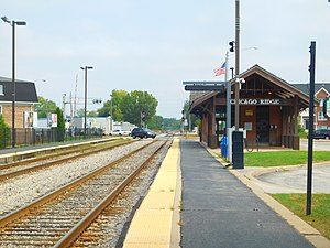 Chicago Ridge station in September 2016. | |||||||||||
| Location | 103rd Street & Ridgeland Chicago Ridge, Illinois | ||||||||||
| Coordinates | 41°42′12″N 87°46′49″W / 41.7034°N 87.7803°WCoordinates: 41°42′12″N 87°46′49″W / 41.7034°N 87.7803°W | ||||||||||
| Owned by | Metra | ||||||||||
| Platforms | 2 side platforms | ||||||||||
| Tracks | 2 | ||||||||||
| Connections | Pace Buses | ||||||||||
| Construction | |||||||||||
| Disabled access | Yes | ||||||||||
| Other information | |||||||||||
| Fare zone | D | ||||||||||
| History | |||||||||||
| Opened | 1991[citation needed] | ||||||||||
| Passengers | |||||||||||
| 2018 | 372 (average weekday)[1] | ||||||||||
| Rank | 127 out of 236[1] | ||||||||||
| Services | |||||||||||
| |||||||||||
| |||||||||||

Chicago Ridge is a station on Metra's SouthWest Service in Chicago Ridge, Illinois. The station is 16.6 miles (26.7 km) away from Union Station, the northern terminus of the line.[2] In Metra's zone-based fare system, Chicago Ridge is in zone D. As of 2018, Chicago Ridge is the 127th busiest of Metra's 236 non-downtown stations, with an average of 372 weekday boardings.[1]
The station is located just north of the Village Hall and Police Station on Ridgeland Avenue between Washington Avenue and 105th Street, and west of the B&OCT/IHB Railroad's crossing at grade and the Stony Creek Golf Course. Parking is available not only at the station, but behind the Police Station, along Birmingham Street, Oxford Avenue, and north of the tracks at the corner of Ridgeland Avenue and 103rd Street.
Bus connections[]
"Route 384 – Narragansett - Ridgeland". PaceBus.com. Chicago: Pace Suburban Bus Service.
References[]
- ^ Jump up to: a b c "Commuter Rail System Station Boarding/Alighting Count: Summary Results Fall 2018" (PDF). Metra. April 2019. Archived from the original (PDF) on 26 May 2019.
- ^ Metra Railfan Tips - SouthWest Service
External links[]
This Illinois train station-related article is a stub. You can help Wikipedia by . |
- Metra templates
- Metra stations in Illinois
- Railway stations in Cook County, Illinois
- Railway stations in the United States opened in 1991
- Former Wabash Railroad stations
- Illinois railway station stubs