Chilas Airfield
Chilas Airfield چلاس ہوائی اڈا | |||||||||||
|---|---|---|---|---|---|---|---|---|---|---|---|
| Summary | |||||||||||
| Airport type | Public | ||||||||||
| Operator | Pakistan Civil Aviation Authority | ||||||||||
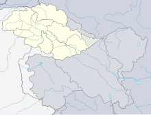
| Serves | Chilas, Gilgit–Baltistan, Pakistan | ||||||||||
| Elevation AMSL | 4,150 ft / 1,265 m | ||||||||||
| Coordinates | 35°25′37″N 074°05′06″E / 35.42694°N 74.08500°E | ||||||||||
| Map | |||||||||||
 CHB | |||||||||||
| Runways | |||||||||||
| |||||||||||
Chilas Airfield (IATA: CHB, ICAO: OPCL) is an airfield located at Chilas, a town in Gilgit–Baltistan, Pakistan.[1]
History[]
It was built during British Raj in 1927.[1] After independence, Frontier Works Organisation (FWO) further developed it to support the construction of Karakoram Highway.[1]
The airfield was also used by Pakistan Air Force in 1960s and 1970s and flew C-130 planes from there.[1]
See also[]
References[]
- ^ a b c d Nagri, Jamil (October 3, 2018). "CAA team arrives in Gilgit to start work on Chilas airfield". DAWN.COM.
External links[]
- Airport information for OPCL at Great Circle Mapper. Source: DAFIF (effective October 2006).
- Accident history for CHB at Aviation Safety Network
Categories:
- Airports in Gilgit-Baltistan
- Pakistani airport stubs

