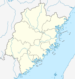
Chishui, Dehua County
Chishui
赤水镇 Ch'ih-shui, Chishui zhen, Chi shui, Chi shui zhen[2] | |
|---|---|
Town [1] | |
 Chishui Location in China | |
| Coordinates: 25°38′30″N 118°8′14″E / 25.64167°N 118.13722°ECoordinates: 25°38′30″N 118°8′14″E / 25.64167°N 118.13722°E | |
| Country | China |
| Province | Fujian |
| Prefecture-level city | Quanzhou |
| County | Dehua County |
| Area | |
| • Total | 90.95 km2 (35.12 sq mi) |
| Elevation | 970 m (3,180 ft) |
| Population (2010)[1] | |
| • Total | 4,063 |
| • Density | 42.65/km2 (110.5/sq mi) |
| Population gender ratio | |
| • Male | 2,109 |
| • Female | 1,954 |
| Population age ratio | |
| • 0-14 | 291 |
| • 15-64 | 2,844 |
| • 65+ | 928 |
| Postal code [4] | 362500 |
Chishui (Chinese: 赤水; pinyin: Chìshuĭ) is a mountainous town and one of eleven fourth-order administrative divisions under the jurisdiction of northwest Dehua County, Quanzhou, Fujian, China, located 33 kilometres from the county seat and home to a species of Apanteles ().[5][6]
Chishui has in its administrative town boundaries.[7] (also known as Yingxue Mountain) is another mountain in Daiyun, a village administered under Chishui. Daiyun Mountain is 1856 metres tall, takes up 35 km2, and is heavily vegetated, protected and trailed. It is known as 'the ridge of Mid-Fujian' and overlooks Alishan mountain ranges in Taiwan. Huangshan pine trees are scattered over the mountain. Chishui also has a ceramics museum and a location on the .[8]
The town has a humid-subtropical climate (Cfb) on the Köppen climate classification.[6]
The town's county had a local bridge and road construction company in Suling Village.
The construction company, the town's economic and social affairs center and the town's agricultural center were cancelled by the county government on February 4, 2021.[9]
The town has 12,038 mu (8.03 km2) of arable land and at least 18 more attractions other than the two mountains mentioned above.[10] As of 2020, it administers Chishui Residential Community and the following fourteen villages:[11]
- Daiyun Village (戴云村)
- Dongli Village (东里村)
- Suban Village (苏坂村)
- Menghu Village (猛虎村)
- Huling Village (湖岭村)
- Lingbian Village (岭边村)
- Fuquan Village (福全村)
- Jiling Village (吉岭村)
- Yongjia Village (永嘉村)
- Suling Village (苏岭村)
- Xiyang Village (西洋村)
- Jinyang Village (锦洋村)
- Xiaoming Village (小铭村)
- Ming'ai Village (铭爱村)
References[]
- ^ Jump up to: a b c d "赤水镇 (德化县, 泉州市, 中國) - 人口统计,图表,地图,位置,天气和网络信息". www.citypopulation.de.
- ^ "Mindat.org". www.mindat.org.
- ^ Jump up to: a b "赤水镇卫星地图 - 福建省泉州市德化县赤水镇、村地图浏览". www.meet99.com.
- ^ "Jiuxian Mountain (Dehua County) - 2021 All You Need to Know Before You Go (with Photos) - Dehua County, China". Tripadvisor.
- ^ Liu, Zhen; He, Jun-Hua; Chen, Xue-Xin; Gupta, Ankita (2020-06-30). "Apanteles opacus Ashmead 1905". Cite journal requires
|journal=(help) - ^ Jump up to: a b "Mindat.org". www.mindat.org. Retrieved 2021-02-08.
- ^ "Jiuxian Mountain (Dehua County) - 2021 All You Need to Know Before You Go (with Photos) - Dehua County, China". Tripadvisor. Retrieved 2021-02-08.
- ^ "Daiyun Mountain travel guidebook –must visit attractions in Dehua – Daiyun Mountain nearby recommendation". TRIP.COM. Retrieved 2021-02-08.
- ^ "德化县人民政府". www.dehua.gov.cn. Retrieved 2021-02-08.
- ^ "赤水镇卫星地图 - 福建省泉州市德化县赤水镇、村地图浏览". www.meet99.com. Retrieved 2021-02-08.
- ^ 2020年统计用区划代码和城乡划分代码:赤水镇 (in Chinese). National Bureau of Statistics of the People's Republic of China. Retrieved 8 April 2021.
- Township-level divisions of Fujian
- Dehua County
- Fujian geography stubs


