Chkhalta
This article needs additional citations for verification. (May 2014) |
Chkhalta
| |
|---|---|
 The House of the Government of Abkhazian Autonomous Republic, Azhara, Upper Abkhazia | |
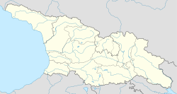
 Chkhalta Location of Chkhalta in Abkhazia | |
| Coordinates: 43°05′48″N 41°40′24″E / 43.09667°N 41.67333°ECoordinates: 43°05′48″N 41°40′24″E / 43.09667°N 41.67333°E | |
| Country | Georgia |
| Partially recognized state | Abkhazia[1] |
| District | Tkvarcheli |
| Time zone | UTC+4 (MSK) |
| • Summer (DST) | UTC+5 |

Chkhalta (Georgian: ჩხალთა; Abkhazian: Чҳалҭа; Russian: Чхалта) is a village in the upper part of the Kodori Valley, situated in Gulripshi District, Abkhazia, a breakaway republic from Georgia.
History[]
Prior to August 2008, Chkhalta was part of 'Upper Abkhazia', the only part of Abkhazia controlled by the Georgian government. During the August 2008 war in South Ossetia, Abkhazian forces gained control of Chkhalta and the rest of Upper Abkhazia. [1] Most of Chkalta's inhabitants fled the advancing troops and have yet to return.
See also[]
References[]
- ^ Abkhazia is the subject of a territorial dispute between the Republic of Abkhazia and Georgia. The Republic of Abkhazia unilaterally declared independence on 23 July 1992, but Georgia continues to claim it as part of its own sovereign territory and designates it as a territory occupied by Russia. Abkhazia has received formal recognition as an independent state from 7 out of 193 United Nations member states, 1 of which has subsequently withdrawn its recognition.
| Districts | |
|---|---|
| Cities | |
| Towns | |
| Other settlements | |
This Abkhazia location article is a stub. You can help Wikipedia by . |
This Georgia location article is a stub. You can help Wikipedia by . |
Categories:
- Upper Abkhazia
- Populated places in Gulripshi District
- Abkhazia stubs
- Georgia (country) geography stubs