Chongwu
Chongwu
崇武镇 | |
|---|---|
Town | |
 Chongwu walled city | |
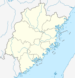 Chongwu Location in Fujian | |
| Coordinates: 24°53′00″N 118°56′00″E / 24.88333°N 118.93333°ECoordinates: 24°53′00″N 118°56′00″E / 24.88333°N 118.93333°E | |
| Country | People's Republic of China |
| Province | Fujian |
| Prefecture-level city | Quanzhou |
| County | Hui'an |
| Time zone | UTC+8 (China Standard) |

Chongwu Town (Chinese: 崇武镇) is a township-level division of Hui'an County, Quanzhou Prefecture-level city, Fujian Province, China.[1]
Chongwu Town is in the southeastern part of Hui'an County, on a peninsula jutting into Taiwan Strait. The town's historical center, the Old Chongwu Fortress (Chinese: 崇武古城, Chongwu Gu Cheng) is a walled city dating to the late 14th century (Hongwu Emperor's reign; the conventional date is 1384).[2] The traditional Hui'an County vernacular architecture, making heavy use of the local granite, is largely preserved within the walled city. A large sculpture park is located on the narrow strip south of the fortress, between the city wall and the beach.
A memorial hall and a small temple (解放军庙) on the beach just west of town commemorate an engagement between the PLA infantry and the Nationalist air force that took place here in 1949.[3]
A significant amount of hospitality establishment, from luxury to budget hotels, are located outside the walled city.
Chongwu's eastern peninsula, extending east of central Chongwu into Taiwan Strait, contains a number of fishing and farming villages. Toward the east, the peninsula is split in two by the scenic Ben Ji An Bay (畚箕垵澳). A Neolithic archeological site, Dazuoshan (大岞山新石器时代遗址), is found on the "north fork" of the peninsula.
Climate[]
| showClimate data for Chongwu (1981−2010) |
|---|
See also[]
References[]
| Wikimedia Commons has media related to Chongwu Town. |
| Wikivoyage has a travel guide for Chongwu. |
- ^ "福建省" (in Chinese). xzqh.org. Archived from the original on 2012-03-07. Retrieved 11 September 2021.
- ^ Walled City of Chongwu (崇武古城) Archived 2011-09-05 at the Wayback Machine. Adapted from Magic Fujian© 2007 by Dr. Bill Brown
- ^ Lary, Diana (2015), China's Civil War: A Social History, 1945–1949, Cambridge University Press, p. 264, ISBN 1316240304
| show Authority control |
|---|
This Fujian location article is a stub. You can help Wikipedia by . |
- Township-level divisions of Fujian
- Fujian geography stubs