Clachaig
Clachaig
| |
|---|---|
 Clachaig Village | |
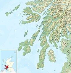 Clachaig Location within Argyll and Bute | |
| OS grid reference | NS 12100 81400 |
| Council area |
|
| Lieutenancy area |
|
| Country | Scotland |
| Sovereign state | United Kingdom |
| Post town | DUNOON, ARGYLL |
| Postcode district | PA23 |
| Dialling code | 01369 |
| UK Parliament |
|
| Scottish Parliament |
|

Clachaig; (Scottish Gaelic: Clachaig) is a small settlement, on the Cowal peninsula in Argyll and Bute, Scotland.[1][2] It is located on the B836 road between the Holy Loch and Loch Striven, the hamlet is just over a mile long.[3] Clachaig is a Gaelic word meaning 'stone place'.[4]
The Hamlet consists of twenty-two houses and was built for accommodation for the workers of the powder mill. The mill manufactured gunpowder.[5]
The river at the bottom of the glen is the that joins the , then joining the River Eachaig and flowing into the Holy Loch.
Gallery[]
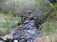
Blackcraig Burn, Clachaig.

References[]
- ^ name=OS63>Ordnance Survey: Landranger map sheet 63 Firth of Clyde (Greenock & Rothesay) (Map). Ordnance Survey. 2014. ISBN 9780319229699.
- ^ "Ordnance Survey: 1:50,000 Scale Gazetteer" (csv (download)). www.ordnancesurvey.co.uk. Ordnance Survey. 1 January 2016. Retrieved 18 February 2016.
- ^ "B836 - Roader's Digest: The SABRE Wiki". Sabre-roads.org.uk. 18 November 2016. Retrieved 15 December 2016.
- ^ Gaelic place names of Scotland
- ^ http://www.scotlandsplaces.gov.uk/record/rcahms/40783/clachaig-glenlean-blackpowder-works/rcahms |title=Clachaig, Glenlean Blackpowder Works |publisher=ScotlandsPlaces |date= |accessdate=2016-12-14
External links[]
- Map sources for Clachaig
| Wikimedia Commons has media related to Clachaig. |
This Argyll and Bute location article is a stub. You can help Wikipedia by . |
Categories:
- Villages in Cowal
- Highlands and Islands of Scotland
- Argyll and Bute geography stubs