| Alberni-Clayoquot RD |
- Clayoquot Arm
- Clayoquot Plateau
- Dawley Passage
- Epper Passage
- Flores Island
- Fossli
- Gibson Marine
- Hesquiat Lake
- Hesquiat Peninsula
- Hitchie Creek
- Kennedy Lake
- Kennedy River Bog
- Maquinna
- Nitinat River
- Sproat Lake
- Stamp River
- Strathcona
- Sulphur Passage
- Sydney Inlet
- Taylor Arm
- Tranquil Creek
- Vargas Island
|
|---|
| Bulkley-Nechako RD | |
|---|
| Capital RD |
- Bellhouse
- Bodega Ridge
- Burgoyne Bay
- Collinson Point
- Dionisio Point
- Discovery Island Marine
- French Beach
- Goldstream
- Gowland Tod
- ȽÁU,WELṈEW̱/John Dean
- Juan de Fuca
- Montague Harbour
- Mount Maxwell
- Ruckle
- Sooke Mountain
- Sooke Potholes
- Wallace Island
|
|---|
| Cariboo RD | |
|---|
| Central Coast RD |
- Codville Lagoon Marine
- Oliver Cove Marine
- Penrose Island Marine
- Sir Alexander Mackenzie
- Tweedsmuir South
|
|---|
| Central Kootenay RD | |
|---|
| Central Okanagan RD |
- Bear Creek
- Browne Lake
- Fintry
- Graystokes
- Myra-Bellevue
- Okanagan Mountain
- Trepanier
- Wrinkly Face
|
|---|
| Columbia-Shuswap RD | |
|---|
| Comox Valley RD |
- Boyle Point
- Fillongley
- Helliwell
- Kin Beach
- Kitty Coleman
- Miracle Beach
- Mount Geoffrey Escarpment
- Rosewall Creek
- Strathcona
- Tribune Bay
|
|---|
| Cowichan Valley RD | |
|---|
| East Kootenay RD |
- Akamina-Kishinena
- Bugaboo
- Columbia Lake
- Crowsnest
- Dry Gulch
- Elk Lakes
- Elk Valley
- Gilnockie
- Height of the Rockies
- James Chabot
- Jimsmith Lake
- Kikomun Creek
- Morrissey
- Mount Assiniboine
- Mount Fernie
- Moyie Lake
- Norbury Lake
- Purcell Wilderness Conservancy
- Premier Lake
- Ryan
- St. Mary's Alpine
- Thunder Hill
- Top of the World
- Wardner
- Wasa Lake
- Whiteswan Lake
- Windermere Lake
|
|---|
| Fraser-Fort George RD | |
|---|
| Fraser Valley RD |
- Alexandra Bridge
- Bridal Veil Falls
- Chilliwack River
- Coquihalla Canyon
- Coquihalla River
- Cultus Lake
- Davis Lake
- E.C. Manning
- Emory Creek
- F.H. Barber
- Ferry Island
- Garibaldi
- Golden Ears
- Kilby
- Mehatl Creek
- Nicolum River
- Rolley Lake
- Sasquatch
- Silver Lake
- Skagit Valley
- Sx̱ótsaqel/Chilliwack Lake
|
|---|
| Kitimat-Stikine RD | |
|---|
| Kootenay Boundary RD | |
|---|
| Metro Vancouver RD | |
|---|
| Mount Waddington RD | |
|---|
| Nanaimo RD | |
|---|
| North Coast RD |
- Diana Lake
- Khutzeymateen
- Kitson Island Marine
- Klewnuggit Inlet Marine
- Lower Skeena River
- Naikoon
- Prudhomme Lake
- Pure Lake
|
|---|
| North Okanagan RD |
- Echo Lake
- Ellison
- Granby
- Graystokes
- Kalamalka Lake
- Kekuli Bay
- Kingfisher Creek
- Mabel Lake
- Mara
- Monashee
- Mount Griffin
- Shuswap River Islands
- Silver Star
- Skookumchuck Rapids
- Upper Violet Creek
|
|---|
| Northern Rockies RM | |
|---|
| Okanagan-Similkameen RD | |
|---|
| Peace River RD | |
|---|
| qathet RD | |
|---|
| Squamish-Lillooet RD |
- Alice Lake
- Birkenhead Lake
- Blackcomb Glacier
- Brackendale Eagles
- Brandywine Falls
- Bridge River Delta
- Callaghan Lake
- Clendinning
- Duffey Lake
- Edge Hills
- Fred Antoine
- Garibaldi
- Gwyneth Lake
- Joffre Lakes
- Marble Canyon
- Murrin
- Nairn Falls
- Porteau Cove
- Seton Portage Historic
- Shannon Falls
- South Chilcotin Mountains
- Stawamus Chief
- Tantalus
- Upper Lillooet
- Yalakom
|
|---|
| Stikine Region | |
|---|
| Strathcona RD | |
|---|
| Sunshine Coast RD | |
|---|
| Thompson-Nicola RD | |
|---|

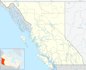
 49°10′40″N 125°34′00″W / 49.17778°N 125.56667°W / 49.17778; -125.56667Coordinates:
  49°10′40″N 125°34′00″W / 49.17778°N 125.56667°W / 49.17778; -125.56667