Cleadon
This article needs additional citations for verification. (September 2009) |
| Cleadon | |
|---|---|
 | |
 Cleadon Location within Tyne and Wear | |
| Population | 8,427 (2011. South Tyneside ward of Cleadon and East Boldon) |
| OS grid reference | NZ384624 |
| Metropolitan borough | |
| Metropolitan county | |
| Region | |
| Country | England |
| Sovereign state | United Kingdom |
| Post town | SUNDERLAND |
| Postcode district | SR6 |
| Dialling code | 0191 |
| Police | Northumbria |
| Fire | Tyne and Wear |
| Ambulance | North East |
| UK Parliament | |

Cleadon is a suburban village in South Tyneside, North East England in the county of Tyne and Wear, and the historic County Durham. In 2001 the population of Cleadon was 4,795,[1] increasing for the South Tyneside ward of Cleadon and Boldon at the 2011 Census to 8,457.[2] Nearby villages or population centres include East Boldon, Whitburn, and Jarrow. The village is around 5 miles from the city of Sunderland and 10 miles from the city of Newcastle.
History[]
Prehistoric[]
The earliest evidence of human occupation in the area around Cleadon dates back to the Mesolithic period (8,000-4,500BC). Although there is no direct evidence of Mesolithic habitation in Cleadon itself, flint scatters have been identified in surrounding sites including St Peter's Church, Monkwearmouth, suggesting hunting parties travelled through the area.[3]: 78–70 It is likely that Neolithic (4,500-2,400BC) farmers were active in Cleadon, evidenced by further discoveries of flint, but exact the locations of any settlements remain unknown.[3]: 82–83
Middle Ages[]
Cleadon was first recorded as Clyuedon in the Boldon Book (1183), sharing an entry with Whiteberne, or modern-day Whitburn. The name Clyduedon roughly translates to hill (dun) of the cliffs (clifta). It is likely this name refers to the surrounding landscape.[3]: 90 Cleadon and Whitburn's entry in the Boldon Book refers to land ownership, dues, and services, suggesting that a complex administrative system had been in place a number of years before 1183. An estimation of the population of the township at this time is around 172.[3]: 95–96
Around 200 years after the Boldon Book, Thomas Hatfield - Bishop of Durham from 1345-1381, commissioned the Hatfield survey. This was a more comprehensive population survey which again combined Cleadon and Whitburn as a single parish. The survey reveals changes in land ownership, including the introduction of copyhold tenure and bondsmen. Between the 12th and 14th centuries, the region suffered from the plague which first broke out in 1230s and culminated in the Black Death. It also faced threats of invasion from Scotland and a radical change in the climate in the early 1300s.[3]: 108–109
16th-17th Centuries[]

The first representation of Cleadon on a map is in the Dunelmensis Episcopatus, published in 1576 by Christopher Saxton. The village, called Cleydon, is represented by a single building. In the late 16th century, a further survey was conducted of the area, this time distinguishing between Cleadon (listed as Clevedon) and Whitburn.[3]: 112
In 1644 during the English Civil War, Cleadon was caught between the Royalist forces of Newcastle and the Parliamentarians of Sunderland, leading to the Battle of Boldon Hill. It was reported that Briar Cottage in Cleadon may have served as a hospital during the war.[3]: 119–121
By the end of the 17th century, enclosure agreements grew throughout the Durham area, whereby copyhold tenants ensured properties were combined into more manageable fields. The Cleadon enclosure agreement is recorded as being in April 1676.[3]: 123
18th Century[]

More detailed maps of Cleadon and the surrounding area were produced towards the end of the 18th century. Map of the County Palatine of Durham, published by Andrew Armstrong in 1754, depicts Cleadon Mill and features some of the key landowners of the village. It does not, however, include key features of the area at the time, such as Cleadon Farm and Boldon Lane.[3]: 142–145
Cleadon House was built by John Dagnia, an influential glass manufacturer, in 1738. It is a two-storey brick 'double pile' building – a relatively new building technique in the 1730s.[3]: 131–132 A 15-acre pleasure garden was also constructed, featuring terraced lawns, a fruit wall, an ornamental lake and a grotto. Today, little of the 18th century garden survives. Only a section of the original estate wall, evidence of water features, and the Grade II listed grotto remain in modern-day Coulthard Park. The grotto's design is typical of Picturesque architecture popular in the mid-18th century.[4]
Cleadon Old Hall was another large house constructed in Cleadon in the 18th century, most likely around the time John Dagnia was building Cleadon House. Similarly to Cleadon House, Cleadon Old Hall featured gardens and a pond. It was demolished in the 1960s, but earlier photographs show a grand building stylistic of the Georgian era.[3]: 139–140
19th Century[]
In the 1800s, Cleadon still remained part of the wider Whitburn Parish. The population of the parish grew throughout the 1800s from 675 in 1801 to 3,292 in 1901.[5] In a contemporary survey publication, Cleadon was reported to have "a small Methodist chapel, four farmholds, two public houses, and a ladies' boarding school."[6]: 64 Cleadon Parochial School opened in 1830 and was later reopened as Cleadon Church School in 1872.[7][8]: 10 In 1891, Walter Scott wrote about Cleadon in The Monthly Chronicle of North-Country Lore and Legend. He describes Cleadon House as "a quaint, picturesque residence ... partly secluded by trees". As for the village itself, Scott remarks that "Cleadon does not materially differ from the ordinary country village." His account includes descriptions of Cleadon Towers (erected in 1890), the three pubs of the village, the village green, the pond, the parish church, and the village school.[9]

Although agriculture remained a key part of the local economy during the 19th century, brick production, tile production, and limestone quarrying became increasingly important industries in Cleadon.[3]: 148 In 1855, there was one brickworks active in the village – The Cleadon Brick and Tile Works. By the end of the century there were four, demonstrating the widespread demand for brick during that time. Today, the former clay pits of Cleadon Brick and Tile Works have been flooded and form the Tilesheds Local Nature Reserve, which opened in 1997.[3]: 150–154
By the end of the 1800s, there were a variety of tradespeople in Cleadon, including a nurse, a solicitor, a violin-string manufacturer, a hay dealer, a laundress, and numerous labourers.[3]: 197
The first train station in the village area – Cleadon Lane Station – opened in the 1800s. It was renamed to East Boldon Station in 1898 and survives today as East Boldon Metro station.[3]: 155–156
Charles Dickens reportedly stayed for a time in Cleadon House on Front Street. A story he was told by resident George Cooper Abbs was a possible inspiration for the character Miss Havisham in Great Expectations.[10]
20th Century[]
The most significant change to the layout of the village occurred with the development of the first housing estate in the 20th century – the Cleadon Plantation Housing Estate. It consisted of villa properties which extended across the three main roads to the west of Cleadon House, occupied by affluent citizens such as surgeons and managers.[3]: 216–218
In 1903, the village school moved to a new premises which today is known as The Old Schoolroom.[8]: 20 In 1908, the Cleadon National School for children aged 7 to 13 was opened.[8]: 29 A new building was provided in 1909 on Cleadon Lane to accommodate the teaching of children under the care of the Local Authority. This school closed in 1962.[7]
First World War[]
Cleadon played an important part during the First World War. The village was well-positioned between Sunderland and the River Tyne to be a transitional training centre for troops. It also played a role in second line coastal defence. Cleadon Hill Farm served as a landing ground for the 36 Squadron Royal Flying Corp which was in use from April 1916 until December 1917. Cleadon did not suffer any enemy bomb damage during the First World War. However, there was a case of friendly fire when the Tynemouth Battery fired a shell which ricocheted off the water and landed in the garden of Briar Cottage.[3]: 223–226
A 1918 War Office document shows that there were troop accommodation facilities in Cleadon, including in Cleadon Meadow, a Hutment Camp in Cottage Homes, and at Wesley Hall.[3]: 230 Throughout Tyne and Wear there were several examples of practice trenches which display a zigzag pattern. Only those at Cleadon Hills are still visible on the ground today.[11]
The Cleadon War Memorial was unveiled on November 1920, commemorating the 22 men from Cleadon who died during the war.[3]: 231
After the First World War, housing development grew in Cleadon consisting of more villas and smaller semi-detached buildings. Transport to the surrounding local areas also became easier with new bus services to South Shields.[3]: 233–234
Second World War[]
Cleadon was at risk of being a German target during the Second World War due to its proximity to both the River Tyne and River Wear. War defences were built along the east coast of England as early of 1938, which included pillboxes, gun emplacements, and minefields. A Heavy Anti-Aircraft Battery was located in Cleadon between February 1940 and January 1946. A searchlight battery was also recorded to be in Cleadon.[3]: 236–237 The Ship Inn pub served as the headquarters of the local home guard.[3]: 174
On 15 August 1940, 15 German bombers targeted the Tyneside shipyards. The bombs landed in Cleadon but nobody was killed or badly injured. Cleadon was caught up in a series of bombing raids which followed from 1940-1943, some of which resulted in fatalities.[3]: 240–242
Post-1945[]
The village expanded quickly in the post-war period with construction on Laburnum Grove and south of Whitburn Road. Cleadon Park Estate also expanded with the grounds of Cleadon Park House purchased by the council and opened as Cleadon Park. Sand and gravel extraction in the grounds of Cleadon House destroyed much evidence of the earlier gardens. The pleasure grounds were purchased by the council, and survive today as Coulthard Park.[3]: 243–244
The demolition of some cottages and other houses in the village in the 1960-70s gave rise to some controversy. Three of the large houses of the village – Cleadon Park, Cleadon Meadows and Cleadon Old Hall – were demolished. In order to accommodate the changes to Sunderland Road and Shields Road, the Ship Inn pub was destroyed and the village pond was reduced in size.[3]: 246–247
In 1963, a new Junior School opened on Boldon Lane.[7]
Cleadon Hills[]
Cleadon Hills is a ridge of high ground standing between the village and the coast. Around 260 million years ago the hills were, together with others in the area, a group of small low islands in a tropical lagoon referred to as the Zechstein Sea.[citation needed]
Cleadon Windmill[]

The ruined windmill on the hills was constructed in the 1820s.[12] The mill is built on the highest part of Cleadon Hills on a slight artificial mound. The building incorporates a stone , a feature that was unique to windmills in the area.
The mill was severely damaged in a storm at some time during the 1870s, and then suffered the indignity of being a target for gunnery practice during the First World War. A photograph dating from the 1920s shows the rotating cap and the windshaft more or less intact but without the sails, which were presumably destroyed during the storm that put the mill out of business. Nowadays the entrances to the mill are barred and locked, the remains of internal machinery that were visible in the mill during the 1970s are now gone, although broken fragments of a millstone remain.
A local legend relates the story of Elizabeth Gibbon, a heartbroken woman who threw herself from the top of the mill tower and whose ghost apparently haunts the ruin of the mill to this day. The windmill was operated by the Gibbon family at the time the storm took place, which lends some weight to the tale of Elizabeth's suicide.[citation needed]
Cleadon Water Tower[]

Also on Cleadon Hills is a former water pumping station, which once provided water to the South Shields area. The site is dominated by the landmark Cleadon Water Tower, in fact a chimney for the former steam-powered pumps, which is visible for miles around, as far south as the Headland in Hartlepool. It is Grade II listed.[13]
The works were built for the Sunderland and South Shields Water Company to a design by Thomas Hawksley from 1860 to 1862.[14] The facility was typical of the grand Victorian waterworks style of the day, and resembles its sister station at Ryhope Engines Museum which was built a few years later.
It was one of a chain of wells that stretched from Cleadon in the north to Hesledon in the south, which were constructed to exploit the reserves of clean fresh water that lay trapped in the permeable limestone. Little is known about the engine that drove the pumps, it was described as a 'high class' beam engine of 130 hp, driving a pump that drew water from a well 258 feet deep and 12 feet in diameter, the water standing 18 feet deep at the bottom. The works were electrified in 1930 and the steam plant removed.
The chimney itself is 100 feet tall and the balcony is 82 feet above ground level; a square spiral staircase of 141 steps winds around the central flue.[15] It was designed to resemble the well-known Italian campanile bell towers, and was placed above the works on the highest part of the hill to facilitate boiler draughting and the dispersal of smoke and steam. While the other buildings have since been converted into homes, the chimney has been threatened with demolition at least once, notwithstanding the fact that it now houses a number of radio aerials, and presumably generates revenue in the form of rent.[citation needed]
It was also, together with the Paper Mill chimneys at Grangetown, south of Sunderland, used as a navigation landmark by Luftflotte (Air Fleet) 5 of the Luftwaffe, operating from Stavanger in Norway and Ålborg in Denmark during the Second World War, while engaged in attacks against Belfast and Liverpool[citation needed].
The reservoir was later covered with a large concrete dome, then believed to the biggest of its type ever constructed, which is still in place today.
Wartime Defences[]
Two pill boxes were constructed on Cleadon Hills to allow placement of machine gun positions overlooking the fields leading from Whitburn to Cleadon. Only one of these remains today, largely obstructed by overgrown foliage.[3]: 238 The undisturbed remains of several concrete machine gun nests can still be found in the undergrowth on the side of Cleadon Hills.[citation needed]
Cleadon white horse[]
A small painted hill figure of a white horse, 6 feet tall and 9 feet long, appears on a low cliff on the hill. Before houses were built after the Second World War it could be seen from South Shields and can still be seen from Herd Groyne lighthouse. It has often been defaced by graffiti but it was restored in 2012 and in 2013 by a team of volunteers with a repainted black background and is now a white horse on a natural limestone rock face. It has recently (Sept 2014) been restored by the council.
Its origins are unclear—there are at least five different stories that explain why it was painted, possibly as early as the 1840s. One story is shown on information boards nearby and tells a story of a man who rode the white horse off Marsden cliffs.[16][17]
Amenities[]
Pubs[]
There are three pubs in Cleadon: the Britannia Inn (part of the Toby Carvery chain), the Cottage Tavern, and The Stables. The Britannia Inn is located on Front Street.[18] It was built in 1894 on the site of the house of the Matthews, a wealthy family who resided in Cleadon. Today, a stone fireplace from the old Matthew house, dated 1675, can be found in the side room of the pub.[3]: 114–115 The Cottage Tavern is located on North Street. It was built in the latter half of the 19th century, most likely as a beerhouse.[19]: 27 A new establishment, The Stables microbrewery, was opened in April 2021 on Front Street by three friends.[20][21]
Coulthard Park[]

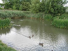
Coulthard Park in central Cleadon was formerly the grounds of Cleadon House. Today it contains a bowling green, play area, tennis courts, and a pavilion.[22] The historic grotto also still stands today today.[19]: 21 It is commemorated by a blue plaque which reads "An 18th Century garden ornament overlooking a formal pond originally in the grounds of Cleadon House. Repointed by the Borough of South Tyneside as a contribution to the Cleadon 800 festival in 1983."[23]
Another pond outside of the park, situated on the corner of North Street and Sunniside Lane, was filled in during the 1970s. Its location now identifiable by a fenced area of grass.[3]: 172
Shops[]
There are a few shops including Bon Appetit Deli, Boutique Bijoux, Happy Organic, Romanos Italian restaurant, chemist, papershop, garage and a Post Office (now closed). The nearest Post Office is now in East Boldon.
School[]
Cleadon Church of England Academy is the village primary school. It is the result of an amalgamation of the village Infant and Junior Schools in the early 2000s. A new school building was completed in 2007 to accommodate all pupils. The school gained academy status in 2014 and a nursery was added to the site in 2017.[7]
Churches[]
All Saints Church[]
All Saints is a C of E church located on Sunderland Road. Until the 19th century, the closest church to Cleadon was in Whitburn. All Saints was built due to a desire from villagers to have a place of worship more close by. Permission was granted by the Bishop of Durham to build the church, and construction was completed in 1869.[24] The building contains three chancel windows completed in 1912 which depict the various miracles of Jesus. It also contains a War Memorial window unveiled in 1948, and a colourful window depicting the Good Shepherd.[25]
Cleadon Methodist Church[]
Cleadon Methodist Church is located on Sunderland Road. Before a specific church was constructed, Wesleyan Methodist services were held in Cleadon in a farm cottage owned by John Burdon. Burdon was a friend of John Wesley, who had visited Cleadon in 1743. However, in the 19th century residents of the village wanted a designated Methodist church and a foundation stone was laid in May 1899.[19]: 25 [26]
Transport[]
Cleadon is close to the East Boldon Metro station.
Politics[]
Cleadon is part of the Jarrow constituency, represented by Labour MP Kate Osborne since 2019. It is in the council ward of Cleadon and East Boldon. This ward is represented by Joan Atkinson and Margaret Melling of the Labour Party and Conservative councillor Jeff Milburn. Margaret Melling won a by-election in 2013 after the death of David Potts.[citation needed]
Famous residents[]
Famous people who have lived within Cleadon include footballers such as the former Sunderland A.F.C. player Michael Gray. Carlo Little, original drummer of the Rolling Stones and member of Screaming Lord Sutch and the Savages, lived in Cleadon for many years. Actor Bill Travers also resided in the village at 17, Underhill Road, sometime after WW2.
Don Revie, former Sunderland AFC player, Leeds United and England manager, lived in Cleadon as did former Sunderland AFC Manager Alan Brown who lived in Whitburn Road. Ernie Taylor, famed for being part of Blackpool's 1953 FA Cup win against Bolton Wanderers, also lived in Whitburn Road.
Before 1945, James Humble of the Humble family owned Cleadon Hall in County Durham; it was called "Humble" Hall. The Humble family owned coal mines and farms in County Durham.[27]
References[]
- ^ Office for National Statistics : Census 2001 : Urban Areas : Table KS01 : Usual Resident Population Archived 8 February 2007 at the Wayback Machine Retrieved 26 August 2009
- ^ "South Tyneside Ward population 2011". Retrieved 30 January 2016.
- ^ Jump up to: a b c d e f g h i j k l m n o p q r s t u v w x y z aa ab Brian Young, Penny Middleton, Ivan Dunn (29 May 2015). The Cleadon Village Atlas (PDF) (Report). Northern Archaeological Associates Ltd. Retrieved 28 August 2021.CS1 maint: uses authors parameter (link)
- ^ "Coulthard Park, Cleadon". Northern Archaeological Associates. Retrieved 29 August 2021.
- ^ "Whitburn AP/CP through time | Population Statistics | Total Population, A Vision of Britain through Time". Vision of Britain. University of Portsmouth GB Historical Jisc. Retrieved 29 August 2021.
- ^ Mackenzie, Eneas; Ross, Marvin (1834). An Historical, Topographical, and Descriptive View of the County Palatine of Durham. Newcastle upon Tyne: Mackenzie and Dent – via Google Books.
- ^ Jump up to: a b c d "Education - an enduring concern". Cleadon All Saints. Retrieved 4 September 2021.
- ^ Jump up to: a b c Robinson, Kathleen (1 June 2015). Glimpses into school: early days in Cleadon Village (PDF) (Report). Retrieved 4 September 2021.
- ^ Scott, Walter (1891). "The Monthly Chronicle of North-Country Lore and Legend". Newcastle Weekly Chronicle. pp. 392–393. Retrieved 30 August 2021 – via Google Books.
- ^ http://www.shieldsgazette.com/what-s-on/historian-claims-s-tyne-link-to-dickens-classic-1-4171652[bare URL]
- ^ Whaley, R; Morrison, J; Heslop, D (2008). Archaeology of the Twentieth Century Defence Sites of Tyne and Wear: An Illustrated Guide (PDF) (Report). Newcastle City Council, Tyne & Wear Specialist Conservation Team. p. 16. Retrieved 20 August 2021.
- ^ http://www.twsitelines.info/smr/1587[bare URL]
- ^ http://www.southtyneside.gov.uk/applications/2/listedbuildings/buildingdetail.aspx?id=0331000032000&street=sunniside%20lane&area=cleadon&building=COMBINED%20ENGINE%20AND%20BOILER%20HOUSES.%20ADJACENT%20COAL%20STORE.%20DETATCHED%20CHIMNEY.%20ENGINEMAN'S%20HOUSE%20AND%20COTTAGE%20AT%20CLEADON%20PUMPING%20STATION[permanent dead link]
- ^ http://www.southtyneside.gov.uk/applications/2/listedbuildings/buildingdetail.aspx?id=0331000032000&street=sunniside%20lane&area=cleadon&building=COMBINED%20ENGINE%20AND%20BOILER%20HOUSES.%20ADJACENT%20COAL%20STORE.%20DETATCHED%20CHIMNEY.%20ENGINEMAN'S%20HOUSE%20AND%20COTTAGE%20AT%20CLEADON%20PUMPING%20STATION[permanent dead link]
- ^ "Detached chimney at Cleadon Pumping Station, non Civil Parish - 1416041 | Historic England".
- ^ Hows, Mark. "Cleadon Hills White Horse". The Hillfigure Homepage. Retrieved 16 October 2011.
- ^ "Other non-Wiltshire white horses". Wiltshire White Horses. Retrieved 16 October 2011.
- ^ "Welcome to Toby Carvery Cleadon Village". Toby Carvery. Retrieved 2 September 2021.
- ^ Jump up to: a b c The Cleadon Village Atlas Mini (PDF) (Report). Northern Archaeological Associates Ltd. April 2015. Retrieved 2 September 2021.
- ^ "Stables". WhatPub. 13 June 2021. Retrieved 2 September 2021.
- ^ Brownson, Sophie (23 April 2021). "Inside the 'exciting' new micro bar and brewery opened by three friends in a former Cleadon florists". The Shields Gazette. Retrieved 2 September 2021.
- ^ "Coulthard Park". South Tyneside Council. Retrieved 31 August 2021.
- ^ "Cleadon Grotto". Open Plaques. Retrieved 4 September 2021.
- ^ "History". Cleadon All Saints. Retrieved 31 August 2021.
- ^ "Art and Artists". Cleadon All Saints. Retrieved 31 August 2021.
- ^ "Cleadon Methodist Church". The National Archives. Retrieved 31 August 2021.
- ^ Humble Family History tree
External links[]
![]() Media related to Cleadon at Wikimedia Commons
Media related to Cleadon at Wikimedia Commons
- Villages in Tyne and Wear
- White horses in England
- Water towers in the United Kingdom