Cloverleaf Colony, South Dakota
Cloverleaf Colony, South Dakota | |
|---|---|
 Cloverleaf Colony  Cloverleaf Colony | |
| Coordinates: 44°11′0″N 97°32′13″W / 44.18333°N 97.53694°WCoordinates: 44°11′0″N 97°32′13″W / 44.18333°N 97.53694°W | |
| Country | United States |
| State | South Dakota |
| County | Miner |
| Area | |
| • Total | 0.09 sq mi (0.24 km2) |
| • Land | 0.09 sq mi (0.24 km2) |
| • Water | 0.0 sq mi (0.0 km2) |
| Elevation | 1,640 ft (500 m) |
| Population (2020) | 16 |
| Time zone | UTC-6 (Central (CST)) |
| • Summer (DST) | UTC-5 (CDT) |
| ZIP Code | 57349 (Howard) |
| Area code(s) | 605 |
| FIPS code | 46-13010 |
| GNIS feature ID | 2813053[2] |
Cloverleaf Colony is a census-designated place (CDP) and former Hutterite colony[3] in Miner County, South Dakota, United States. It was first listed as a CDP prior to the 2020 census.[2] The population of the CDP was 16 at the 2020 census.[4]
It is near the northern edge of the county, 12 miles (19 km) north of Howard, the county seat, and 15 miles (24 km) south of De Smet.
References[]
- ^ "2020 U.S. Gazetteer Files – South Dakota". United States Census Bureau. Retrieved September 20, 2021.
- ^ a b "Cloverleaf Colony Census Designated Place". Geographic Names Information System. United States Geological Survey.
- ^ Friesen, Bert (May 2021). "Cloverleaf Hutterite Colony (Cloverleaf, South Dakota, USA)". Global Anabaptist Mennonite Encyclopedia Online. Retrieved September 20, 2021.
- ^ "U.S. Census Bureau: Cloverleaf Colony CDP, South Dakota". www.census.gov. United States Census Bureau. Retrieved 16 January 2022.
Municipalities and communities of Miner County, South Dakota, United States | ||
|---|---|---|
| Cities | 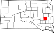 | |
| Towns | ||
| Township | ||
| CDPs | ||
| Ghost town |
| |
| ||
This South Dakota state location article is a stub. You can help Wikipedia by . |
Categories:
- Census-designated places in Miner County, South Dakota
- Census-designated places in South Dakota
- Hutterite communities
- South Dakota geography stubs