Cocokyun Township
Cocokyun Township
ကိုကိုးကျွန်း မြို့နယ် | |
|---|---|
Township of Yangon | |
 Cocokyun Township | |
| Coordinates: 14°22′30″N 93°28′30″E / 14.37500°N 93.47500°ECoordinates: 14°22′30″N 93°28′30″E / 14.37500°N 93.47500°E | |
| Country | Myanmar |
| Division | Yangon |
| City | Yangon |
| Township | Cocokyun |
| Area | |
| • Total | 28.5 km2 (11.0 sq mi) |
| Elevation | 112 m (367 ft) |
| Population | |
| • Total | 1,940 [1] |
| Time zone | UTC6:30 (MMT) |
| Postal codes | 112xx |
| Area code(s) | 1 (mobile: 80, 99) |
| YCDC[2] | |

Cocokyun Township (or Cocogyun) (Burmese: ကိုကိုးကျွန်း မြို့နယ်) is located on the islands of Coco and Preparis, in Myanmar. The township, made up of two wards, is rural and underdeveloped because of its distance from the mainland. Preparis Ward is the smaller ward, having a population of only 50 residents. Cocos Ward is the larger ward, having all the local government infrastructure, and around 1,900 villagers.
Cocokyun has two schools.
References[]
- ^ Census data
- ^ a b "Cocokyun Township". Yangon City Development Committee. Retrieved 21 March 2009.[dead link]
Capital: Yangon | ||
| East Yangon District |  | |
| North Yangon District | ||
| South Yangon District | ||
| West Yangon District (Downtown) | ||
1 - part of South Yangon City; 2 - part of North Yangon City | ||
Capital: Yangon | ||
| East Yangon District |  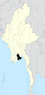 | |
| North Yangon District | ||
| South Yangon District | ||
| West Yangon District (Downtown) | ||
| Main cities and towns | ||
1 - part of South Yangon City; 2 - part of North Yangon City | ||
| States | ||
|---|---|---|
| Regions | ||
| Self-Administered Zones | ||
| Self-Administered Divisions | ||
| Union Territories | ||
This Yangon Region location article is a stub. You can help Wikipedia by . |
Categories:
- Populated places in Yangon Region
- Townships of Yangon Region
- Myanmar geography stubs