Col d'Ares
| Col d'Ares / Coll d'Ares | |
|---|---|
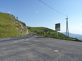 French side of the Col d'Ares | |
| Elevation | 1,513 m (4,964 ft) |
| Location | Pyrénées-Orientales, France Catalonia, Spain |
| Range | Pyrenees |
| Coordinates | 42°22′2″N 2°27′24″E / 42.36722°N 2.45667°ECoordinates: 42°22′2″N 2°27′24″E / 42.36722°N 2.45667°E |
 Location in the Pyrenees | |

Col d'Ares (French: [kɔldaʁ]) or Coll d'Ares (Catalan: [ˈkɔʎ ˈdaɾəs]) (el. 1513 m) is a mountain pass in the Pyrenees on the border between France and Spain.
It connects Prats-de-Mollo in France with Molló in Catalonia, Spain.
History[]
In 1691, during the Nine Years' War, the Spanish passed through the Col d'Ares to try taking Prats-de-Mollo, without success.
This pass also used during the during the Spanish Civil War by fleeing Spaniards supporting the Republican cause.
See also[]
- List of highest paved roads in Europe
- List of mountain passes
References[]
This Occitania geographical article is a stub. You can help Wikipedia by . |
This Province of Girona location article is a stub. You can help Wikipedia by . |
Categories:
- Mountain passes of Spain
- Mountain passes of the Pyrenees
- France–Spain border crossings
- Landforms of Catalonia
- Mountain passes of Occitanie
- Occitania geography stubs
- Province of Girona geography stubs