Col de la Ramaz
| Col de la Ramaz | |
|---|---|
 | |
| Elevation | 1,559 m (5,115 ft) |
| Location | Haute-Savoie, France |
| Range | Alps |
| Coordinates | 46°9′48″N 6°34′29″E / 46.16333°N 6.57472°ECoordinates: 46°9′48″N 6°34′29″E / 46.16333°N 6.57472°E |

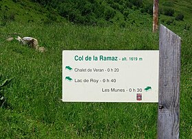
Col de la Ramaz (elevation 1559 m.) is a high mountain pass in the Alps in the department of Haute-Savoie in France through which the Tour de France passed during 2003, 2010, and 2016.[1][2] The road through the pass culminates slightly higher, at 1619m (5312 feet).
See also[]
- List of highest paved roads in Europe
- List of mountain passes
References[]
- ^ Will (9 July 2010). "Tour de France preview cycling Col de la Ramaz". Cycling Challenge. Retrieved 19 July 2015.
- ^ "Archived copy". Archived from the original on 2016-07-01. Retrieved 2016-10-21.
{{cite web}}: CS1 maint: archived copy as title (link)
This Auvergne-Rhône-Alpes geographical article is a stub. You can help Wikipedia by . |
Categories:
- Mountain passes of Auvergne-Rhône-Alpes
- Mountain passes of the Alps
- Auvergne-Rhône-Alpes geography stubs