Colmar-Berg
Colmar-Berg
Colmer-Bierg | |
|---|---|
Commune | |
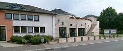 Town hall | |
 Coat of arms | |
 Map of Luxembourg with Colmar-Berg highlighted in orange, and the canton in dark red | |
| Coordinates: 49°48′40″N 6°05′50″E / 49.8111°N 6.0972°ECoordinates: 49°48′40″N 6°05′50″E / 49.8111°N 6.0972°E | |
| Country | |
| Canton | Mersch |
| Area | |
| • Total | 12.31 km2 (4.75 sq mi) |
| Area rank | 88th of 102 |
| Highest elevation | 372 m (1,220 ft) |
| • Rank | 73rd of 102 |
| Lowest elevation | 201 m (659 ft) |
| • Rank | 26th of 102 |
| Population (2018) | |
| • Total | 2,218 |
| • Rank | 65th of 102 |
| • Density | 180/km2 (470/sq mi) |
| • Density rank | 44th of 102 |
| Time zone | UTC+1 (CET) |
| • Summer (DST) | UTC+2 (CEST) |
| LU0000401 | |
| Website | colmar-berg.lu |

Colmar-Berg (Luxembourgish: Colmer-Bierg, German: Colmar-Berg) is a commune and town in central Luxembourg, in the canton of Mersch. It is situated at the confluence of the rivers Attert and Alzette.
As of 2005, the town of Colmar-Berg, which lies in the east of the commune, has a population of 1,711. Colmar-Berg is the site of the Grand Duke of Luxembourg's principal residence, Berg Castle. It is also the site of a Goodyear tyre factory.
The commune was known as simply "Berg" until 25 March 1991.[1]
The "Centre de Formation pour Conducteurs" (French for "Drivers' Training Centre") is also in Colmar-Berg. Every person has to make an "Obligatory Course" after they got their driving license in order for it to become a definitive license. This has to be done in the timespan after three months and before two years after the person passed their practical driving test.

References[]
- ^ "Mémorial A, 1991, No. 25" (PDF) (in French). Service central de législation. Retrieved 2006-07-18.[permanent dead link]
External links[]
 Media related to Colmar-Berg at Wikimedia Commons
| show Places adjacent to Colmar-Berg |
|---|

| Authority control |
|---|
This article related to the geography of Mersch canton is a stub. You can help Wikipedia by . |
- Colmar-Berg
- Towns in Luxembourg
- Communes in Mersch (canton)
- Alzette
- Luxembourg geography stubs