Comoro River
This article may be expanded with text translated from the corresponding article in German. (May 2012) Click [show] for important translation instructions.
|
| Comoro River | |
|---|---|
 The river in during the dry season | |
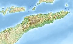 Location of river mouth | |
| Native name |
|
| Location | |
| Country | East Timor |
| Municipality | Dili |
| Physical characteristics | |
| Mouth | Ombai Strait |
• location | |
• coordinates | 8°32′17″S 125°32′4″E / 8.53806°S 125.53444°ECoordinates: 8°32′17″S 125°32′4″E / 8.53806°S 125.53444°E |
| Basin features | |
| Waterfalls | Berloi |
| Bridges | |

The Comoro River (Portuguese: Ribeira de Comoro, Tetum: Mota Komoro) is a river in East Timor. It flows north into the Ombai Strait, reaching the sea in the western suburbs of the capital, Dili.
References[]
- Wheeler, T. (2004) East Timor. Footscray, VIC; Lonely Planet.
External links[]
- "Preparatory Survey Report on the Project for the Construction of Upriver Comoro Bridge in the Democratic Republic of Timor-Leste" (PDF). Japan International Cooperation Agency. February 2014. Retrieved 11 July 2021.
Categories:
- Dili Municipality
- Rivers of East Timor
- Asia river stubs
- East Timor geography stubs