Comrie, Fife
| Comrie | |
|---|---|
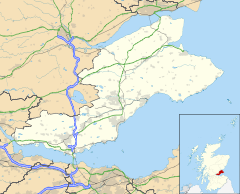 Comrie Location within Fife | |
| Area | 0.199 km2 (0.077 sq mi) |
| Population | 810 (2019 estimate) |
| • Density | 4,070/km2 (10,500/sq mi) |
| OS grid reference | NT0188 |
| Council area | |
| Shire county | |
| Country | Scotland |
| Sovereign state | United Kingdom |
| Police | Scotland |
| Fire | Scottish |
| Ambulance | Scottish |
| UK Parliament | |
| Scottish Parliament | |

Comrie (/ˈkʌmri/ locally or /ˈkɒmri/ (![]() listen));[1] is a village in Fife, Scotland, located immediately west of the neighbouring village of Oakley, 6.2 miles (9.98 km) west of Dunfermline on the A907.[2] In 2019 it had an estimated population of 810.[3]
listen));[1] is a village in Fife, Scotland, located immediately west of the neighbouring village of Oakley, 6.2 miles (9.98 km) west of Dunfermline on the A907.[2] In 2019 it had an estimated population of 810.[3]
Description[]
The village primarily consists of modern housing schemes. There is also a community centre, one bakery and one pub. Services including a health centre are located in Oakley. The Comrie Burn runs through the south of the village, and the Blair Burn to the east separates Comrie from Oakley.
Education[]
Children in Comrie are within the catchment area of Inzievar (non-denominational) and Holy Name (Catholic) primary schools, both located in one building in Oakley. High school pupils attend Queen Anne (non-denominational) or St Columba's, both located in Dunfermline.
Transport[]
The 4, 6 and 28 bus services run from Comrie through to Dunfermline.
References[]
- ^ "Fife Place-name Data :: Comrie". fife-placenames.glasgow.ac.uk.
- ^ "Comrie". Gazetteer for Scotland. Retrieved 5 October 2020.
- ^ "Comrie". City Population De. Retrieved 5 October 2020.
- Villages in Fife
- Mining communities in Fife