Conestoga, Pennsylvania
Conestoga, Pennsylvania | |
|---|---|
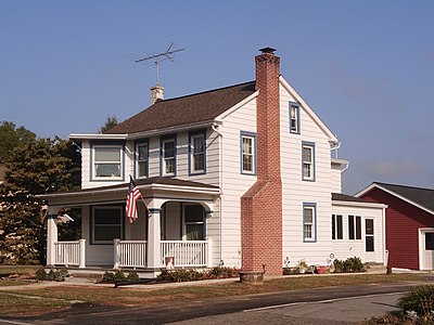
 Hess House, built 1811 | |
 Conestoga Location in Pennsylvania | |
| Coordinates: 39°56′26″N 76°20′46″W / 39.94056°N 76.34611°WCoordinates: 39°56′26″N 76°20′46″W / 39.94056°N 76.34611°W | |
| Country | United States |
| State | Pennsylvania |
| County | Lancaster |
| Township | Conestoga |
| Area | |
| • Total | 2.08 sq mi (5.39 km2) |
| • Land | 2.08 sq mi (5.38 km2) |
| • Water | 0.004 sq mi (0.01 km2) |
| Elevation | 500 ft (200 m) |
| Population | |
| • Total | 1,258 |
| • Density | 606/sq mi (233.9/km2) |
| Time zone | UTC-5 (Eastern (EST)) |
| • Summer (DST) | UTC-4 (EDT) |
| ZIP code | 17516 |
| FIPS code | 42-15584 |
| GNIS feature ID | 1172302[3] |


Conestoga is an unincorporated community and census-designated place (CDP) in Conestoga Township, Lancaster County, Pennsylvania, in the United States. At the 2010 census the population was 1,258.[2] The Conestoga post office serves ZIP code 17516.
The headquarters of Turkey Hill Dairy, a food company specializing in iced teas and dairy products, has a Conestoga mailing address and is 7 miles (11 km) west of Conestoga in Manor Township.
History[]
Conestoga was first called "Conestoga Manor" by William Penn.[4] The name came from the Conestoga (Susquehannock) people,[5] a peaceful Christian tribe, whose principal village was located nearby. A number of the Conestoga were massacred by the Paxton Boys in 1763, with the survivors fleeing the area. The town of Conestoga was laid out by John Kendig, Harry Breneman, Edward Charles, and John Folkman in 1797.[4]
The area was in the national news in 2001 when President George W. Bush held a photo opportunity at the Safe Harbor power station[6] 4 miles (6 km) southwest of Conestoga.
Geography[]
Conestoga is in southwest Lancaster County, in the eastern part of Conestoga Township. It is situated between the Conestoga River to the northwest and Pequea Creek to the southeast. It is 7 miles (11 km) south-southwest of Lancaster, the county seat, and 3 miles (5 km) northeast of the Susquehanna River.
According to the U.S. Census Bureau, the Conestoga CDP has a total area of 2.1 square miles (5.4 km2), of which 0.004 square miles (0.01 km2), or 0.22%, are water.[1]
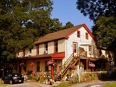
Photo gallery[]
References[]
- ^ a b "2019 U.S. Gazetteer Files: Places: Pennsylvania". United States Census Bureau. Retrieved September 22, 2020.
- ^ a b "Total Population: 2010 Census DEC Summary File 1 (P1), Conestoga CDP, Pennsylvania". data.census.gov. U.S. Census Bureau. Retrieved September 22, 2020.
- ^ U.S. Geological Survey Geographic Names Information System: Conestoga
- ^ a b Conestoga, PA Archived September 11, 2006, at the Wayback Machine
- ^ "Early history". Reading Eagle. June 9, 1896. p. 25. Retrieved 18 October 2015.
- ^ Remarks at the Safe Harbor Water Power Corporation in Conestoga, Pennsylvania - Transcript

This Lancaster County, Pennsylvania state location article is a stub. You can help Wikipedia by . |
- Census-designated places in Lancaster County, Pennsylvania
- Census-designated places in Pennsylvania
- Lancaster County, Pennsylvania geography stubs