Coulter Glacier
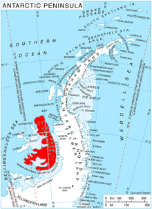
Coulter Glacier ( WikiMiniAtlas69°20′S 71°47′W / 69.333°S 71.783°W / -69.333; -71.783) is a steeply inclined glacier, 5 nautical miles (9 km) long, flowing south from the Havre Mountains, northern Alexander Island, into Kolokita Cove in Lazarev Bay, Antarctica. The glacier was photographed from the air by the Ronne Antarctic Research Expedition in 1947 and mapped from the photographs by the Falkland Islands Dependencies Survey in 1960. It was named by the Advisory Committee on Antarctic Names for , Master of USNS Alatna during U.S. Navy Operation Deepfreeze, 1969.[1]
See also[]
- List of glaciers in the Antarctic
- Yozola Glacier
- Sullivan Glacier
References[]
- ^ "Coulter Glacier". Geographic Names Information System. United States Geological Survey. Retrieved 2011-11-29.
![]() This article incorporates public domain material from the United States Geological Survey document: "Coulter Glacier". (content from the Geographic Names Information System)
This article incorporates public domain material from the United States Geological Survey document: "Coulter Glacier". (content from the Geographic Names Information System)
Glaciers in the Antarctic | |
|---|---|
|
Glaciers of Palmer Land | |
|---|---|
| Antarctic Peninsula |
|
| Alexander Island |
|
This article about a glacier in Alexander Island is a stub. You can help Wikipedia by . |
- v
- t
- Glaciers of Alexander Island
- Palmer Land glacier stubs
- Alexander Island geography stubs
- Coordinates on Wikidata
- Wikipedia articles incorporating text from the USGS Geographic Names Information System
- All stub articles