County Route 8 (Nassau County, New York)
| County Route 8 | |
|---|---|
 CR 8 highlighted in red | |
| Route information | |
| Maintained by Nassau County Department of Public Works | |
| Length | 5.00 mi (8.05 km) |
| Highway system | |
Nassau County Route 8 is an unsigned county road in Nassau County, New York. It travels between Old Country Road (CR 25) and Rockaway Avenue (CR E06) in Garden City and Northern Boulevard (NY 25A) in Manhasset.
Nassau County Route 8 travels along Herricks Road and Shelter Rock Road, is roughly five miles (8.0 km) in length, and is maintained by the Nassau County Department of Public Works.[1][2]
Route description[]

Southern segment (Herricks Road)[]
The route starts as Herricks Road at the intersection of Old Country Road (CR 25) and Rockaway Avenue (CR E06) in the Incorporated Village of Garden City (located within the Town of Hempstead).[1][2][4][5] From there, it continues north underneath the Main Line of the Long Island Rail Road, entering into the Town of North Hempstead.[1][2][4][5] From the railroad tracks, it continues north to Jericho Turnpike (NY 25), forming the boundary between the unincorporated hamlet of Garden City Park to the west and the Incorporated Village of Mineola to the east.[1][2][4][5] Continuing north from Jericho Turnpike, County Route 8 continues north to Hillside Avenue (NY 25B), still as Herricks Road and forming the border between the two communities.[1][2][4][5] North of Hillside Avenue, Herricks Road enters into the unincorporated hamlet of Herricks, and continues north through the hamlet to its intersection with Searingtown Road (CR 101) and Shelter Rock Road, where Herricks Road ends.[1][2][4][5] At this intersection, the alignment of County Route 8 turns west onto Shelter Rock Road.[1][2][4][5]
Northern segment (Shelter Rock Road)[]

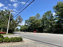
From the intersection with Herricks Road, Searingtown Road (CR 101), and Shelter Rock Road, Nassau County Route 8 follows Shelter Rock Road west and north through Herricks, passing Herricks High School and forming the border between Herricks and unincorporated Manhasset Hills, as well as some of the Herricks–North Hills village border.[1][2][4][5] It continues north to I.U. Willets Road, entering completely into the Incorporated Village of North Hills. Continuing north, Shelter Rock Road crosses over the Northern State Parkway and then the Long Island Expressway (Interstate 495).[1][2][4][5] It then continues north through North Hills and then straddling the North Hills–Manhasset border, passing the historic Shelter Rock (for which the road is named), and ending just over the North Hills–Manhasset border at Northern Boulevard (NY 25A).[1][2][4][5][6][7]
In the early 1960s, Shelter Rock Road's alignment was straightened and modernized through its northern stretch; remaining portions of the old alignment are now known as Old Shelter Rock Road.[4][6][8]
Major intersections[]
| Location | mi[9] | km | Destinations | Notes | |
|---|---|---|---|---|---|
| Garden City–Mineola line | 0.0 | 0.0 | Rockaway Avenue | Roadway continues as Old Country Road | |
| Garden City Park–Mineola line | 0.6 | 0.97 | |||
| Garden City Park–Herricks– Williston–Mineola quadripoint | 1.2 | 1.9 | |||
| North Hills | 3.1 | 5.0 | |||
| 3.2 | 5.1 | ||||
| Manhasset | 5.0 | 8.0 | |||
| 1.000 mi = 1.609 km; 1.000 km = 0.621 mi | |||||
See also[]
References[]
- ^ a b c d e f g h i j "Nassau County Road Jurisdiction Viewer" (Map). nassau-county.maps.arcgis.com. Retrieved August 22, 2021.
{{cite map}}: CS1 maint: url-status (link) - ^ a b c d e f g h i j New York State Department of Transportation (July 1, 2020). County Roads Listing – Nassau County (PDF) (Report). Retrieved August 22, 2021.
- ^ "Nassau-Suffolk County Road History". NYC Roads. Archived from the original on January 3, 2009. Retrieved August 22, 2021.
- ^ a b c d e f g h i j "Long Island Index: Interactive Map". www.longislandindexmaps.org. Retrieved 2021-08-22.
- ^ a b c d e f g h i "Nassau County Route 8 - Shelter Rock Road". East Coast Roads. Retrieved 2021-08-22.
- ^ a b Rather, John (1999-02-28). "Shelter Rock Facing an Uncertain Future". The New York Times. ISSN 0362-4331. Retrieved 2021-08-22.
- ^ Mosco, Steve (2015-09-20). "What is Shelter Rock?". Manhasset Press. Retrieved 2021-08-22.
- ^ "County OKs $12 Million For '61 Road Program". Newsday. January 31, 1961. p. 15 – via ProQuest.
- ^ Google (September 3, 2021). "County Route 8 (Nassau County, New York)" (Map). Google Maps. Google. Retrieved September 3, 2021.
- County routes in Nassau County, New York