Coyote Point Recreation Area
| Coyote Point Recreation Area | |
|---|---|
 Coyote Point from the air. Peninsula Avenue retreats into the center background after crossing the Bayshore Freeway (US 101), which runs from left to right in the upper portion of the picture. The marina, at lower left, runs almost directly north-south. Beyond the trees, in the upper left, is the adjoining Poplar Creek Golf Course. | |
 | |
| Type | Parkland, woodland, museum & zoo |
| Location | San Mateo County, California, USA |
| Coordinates | 37°35′22″N 122°19′34″W / 37.5893796°N 122.3260810°WCoordinates: 37°35′22″N 122°19′34″W / 37.5893796°N 122.3260810°W |
| Area | 670 acres (270 ha)[1] |
| Created | 1962 |
| Operated by | San Mateo County, California |
| Open | All year |
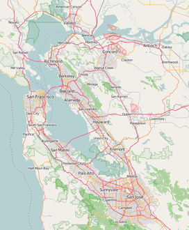

Coyote Point Recreation Area is a 670-acre (270 ha) park in San Mateo County, California, United States. Located on San Francisco Bay, it is south of San Francisco International Airport on the border of Burlingame and San Mateo.
The distinctive point, covered by a grove of eucalyptus trees, can be seen from airplanes approaching San Francisco International Airport and is a good location for aircraft spotting and birdwatching.[1][2][3]
History[]

Precolumbian[]
Coyote Point was originally an island in San Francisco Bay with a marsh connecting it to the mainland. Because it has no fresh water, it is doubtful that Native Americans lived here, but shell mounds on the point indicate that it was at least occasionally used, possibly for special ceremonies or feasts.[4]
Spanish settlement[]
Coyote Point was part of the Presidio and Mission lands until it passed to Mexico. The Governor of Mexico then granted the land to Coyetano Arenas, to which the name can probably be traced. The Arenas family sold it to the firm of Mellus and Howard, and Howard purchased it from the firm in 1850. The land remained in the Howard family until it was sold to the county and the federal government in 1942.[4]
In the late 19th century, the Howard family built a pier at Coyote Point for lumber loading. They also reclaimed the marsh between the island and the mainland (now a golf course) to create dairy pasture. They built a bathhouse and pool on the beach in 1880, and had Eucalyptus, Cypress and Pine trees planted on the knoll.[4]
Pacific City Amusement Park[]
In July 1922, a group of promoters opened the "Pacific City Amusement Park" on about 90 acres (36 ha) of land along the beach leased from the Howard family.[5] Dubbed the "Coney Island of the West", the park included a beach (with trucked-in sand), boardwalk, children's playground, scenic railway, merry-go-round, Ferris wheel, dancing pavilion, and several food concessions. Although it was reputed to have had one million visitors in the first season, a fire during the second season destroyed about one quarter of the development, and it never opened for a third season. The reasons given for the closure were strong afternoon winds and sewage contamination in the bay.[4] The carousel which operated there, as well as the "little puffer" miniature train ride, can still be enjoyed at the San Francisco Zoo.[6]
Educational use[]
In 1942, the federal government purchased 10 acres (4.0 ha) of land on Coyote Point for one of three Merchant Marine Cadet Basic schools, the Pacific Coast Cadet Corps (the other two were for the Atlantic Coast Cadet Corps at Kings Point, New York and the Gulf Coast Cadet Corps at Pass Christian, Mississippi).[7] The merchant marine training program had been shortened from 48 to 18 months, in three stages:[8]
- Basic School (lasting 3 months, serving as Fourth Class Cadet-Midshipmen at Kings Point, San Mateo, or Pass Christian)
- Shipboard experience (6 months, Third Class aboard merchant vessels)
- Academy (9 months, Second and First Class at Kings Point)
The Pacific Coast Merchant Marine Cadet Basic School had started aboard the ex-riverboat Delta Queen[citation needed] on 1 July 1941; enrollment quickly outgrew the ship, and the school moved to land-based facilities on Treasure Island. With the outbreak of war, enrollment exceeded the capacity of facilities on Treasure Island and US$450,000 (equivalent to $7,128,000 in 2020) was appropriated to enlarge the school in May 1942. Plans were swiftly drawn up by Cdr. Ralph M. Sheaf, and construction began on the facilities at Coyote Point on June 25, 1942.[9] The Basic School opened on August 15, 1942 and was officially dedicated on August 21, 1943 with a capacity of 528 cadets.[7]
In 1946, the buildings were purchased by the College of San Mateo, and this became the college campus until the land was acquired by San Mateo County in 1962.[4]
Facilities[]
The park contains many trails for walking and bicycling, and includes sections of the San Francisco Bay Trail. The Tour de Peninsula bicycle race starts and ends within the park.[10] In addition, there are many small picnic areas throughout the park, eight larger picnic areas available by registration, the Captains House Conference Facility, the Coyote Point Pistol and Rifle Range, CuriOdyssey, the Magic Mountain Playground and the Coyote Point Marina.[11][12]
CuriOdyssey[]
CuriOdyssey, formerly the Coyote Point Museum for Environmental Education is a hands-on science museum and native animal zoo located in the park at 1651 Coyote Point Drive in San Mateo, California, United States.
- The Main Concourse Science Exhibits offer a variety of hands-on science exhibits that allow children and families to experience natural phenomena up-close.
- The Wildlife Habitats consist of 25 naturalistic habitats that house over 50 non-releasable animals native to California, including a bobcat, river otter, snakes, golden eagles, Channel Island fox, banana slugs, turtles, owls, snowy egret, tarantula, Western toads, herons, turkey vultures, raccoons, and others.
- The Aviary is a 4,000-square-foot (370 m2) walk-through facility that houses over a dozen non-releasable, native California birds.[13]
- The Invertebrate Corner houses a variety of native invertebrates including a California blond tarantula, black widow spider, dermestid beetles and others.
- The Gardens cover about 1.3 acres (0.53 ha) and consist of a variety of plants, some native. They include a hummingbird garden, butterfly habitat, and the Nature's Marketplace Garden which features native plants used by Native Californians.
Gallery[]

Coyote Point is covered in eucalyptus trees

Fisherman at Coyote Point

View from Coyote Point facing Burlingame

Steady breezes and open space facilitate kite flying (San Bruno Mountain in background)

Slips at Coyote Point Marina

Beach at Coyote Point; piers from Pacific City are still embedded in the sand
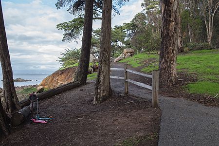
The Bluff Trail along the Bay shoreline

Merchant Marine Memorial

The Bay Trail runs along the interior perimeter

Coyote Point looking toward San Francisco city


Notes[]
- ^ Jump up to: a b "Coyote Point Park". baytrail.abag.ca.gov. Ronald Horii. Archived from the original on 6 June 2011. Retrieved 12 June 2011.
- ^ "Coyote Point Recreation Area". www.smcgov.org. San Mateo County. Retrieved 21 April 2014.
- ^ "eBird Hotspot: Coyote Point County Park". ebird.org. eBird. Retrieved 23 February 2016.
- ^ Jump up to: a b c d e "Coyote Point Recreation Area:History". www.smcgov.org. San Mateo County. Retrieved 21 April 2014.
- ^ Van Niekerken, Bill (2019-09-04). "When Peninsula's 'Coney Island of the West' was snuffed out by a stench". SFChronicle.com. Retrieved 2019-09-04.
- ^ "Coney Island of the West" (PDF). Latitude 38. Vol. 368. February 2008. p. 88.
- ^ Jump up to: a b Donovan, Lt. Richard (July 1944). "U.S. Merchant Marine Training Program". The Log. 39 (8): 230–236. Retrieved 22 September 2016.
- ^ Ryan, George J. (2012). "The Training Programs". Kings Pointers in World War II. Retrieved 22 September 2016.
With the outbreak of war, the training program was reduced from four years to 22, and then 18, months. By December 1942 the Fourth Classmen basic prelim instruction period at San Mateo, Pass Christian, and Kings Point was just 12 weeks long. This was followed by a minimum of six months as Third Classmen on merchant vessels. Finally, Second and First Class Cadet-Midshipmen were to spend 36 weeks of instruction at Kings Point.
- ^ "U.S. Merchant Marine Cadet Basic School Celebrates Second Year". The Log. 39 (11): 110. October 1944. Retrieved 22 September 2016.
- ^ Seipal, Tracy (3 August 2014). "Tour de Peninsula attracts happy, healthy crowd". The Mercury News. Retrieved 16 June 2020.
- ^ "Coyote Point Recreation Area:Facilities". www.smcgov.org. San Mateo County. Retrieved 21 April 2014.
- ^ "Coyote Point Recreation Area" (PDF). San Mateo County Parks. November 2015. Retrieved 30 September 2016.
- ^ "Our Animals". coyoteptmuseum.org. Coyote Point Museum. Archived from the original on 18 April 2010. Retrieved 11 April 2010.
External links[]
| Wikimedia Commons has media related to Coyote Point Recreation Area. |

- 1962 establishments in California
- Burlingame, California
- Parks in San Mateo County, California
- Regional parks in California
- San Francisco Bay Trail
- San Francisco Bay
- San Mateo, California