Crampton's Gap
| Crampton's Gap | |
|---|---|
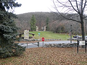 Crampton's Gap looking from the south side (Gathland State Park) to the north | |
| Elevation | 928 feet (283 m)[1] |
| Traversed by | Gapland Road |
| Location | Frederick County and Washington County, Maryland, United States |
| Range | South Mountain Blue Ridge Mountains |
| Coordinates | 39°25′N 77°38′W / 39.41°N 77.64°WCoordinates: 39°25′N 77°38′W / 39.41°N 77.64°W[2] |
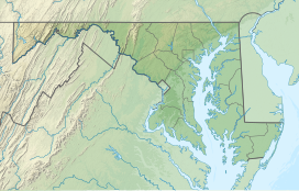 Location of the gap in Maryland | |

Crampton's Gap, also known as Crampton Gap, is a wind gap on South Mountain in Maryland.
The 928 feet (283 m) gap connects Burkittsville in the Middletown Valley to the east with Gapland and Rohrersville in the Pleasant Valley to the west.
The gap is the location of Gathland State Park and was the site of the Battle of Crampton's Gap on September 14, 1862, during the Maryland Campaign of the American Civil War.
References[]
External links[]
| Authority control: National libraries |
|---|
Categories:
- Wind gaps of the United States
- Landforms of Frederick County, Maryland
- Landforms of Washington County, Maryland
- South Mountain Range (Maryland−Pennsylvania)
- Journey Through Hallowed Ground National Heritage Area
- Valleys of Maryland